
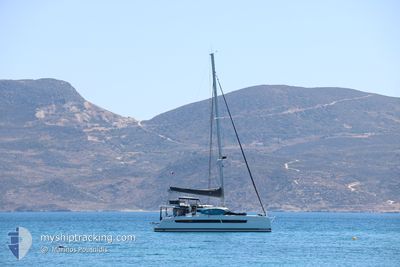
REMAKE
Sailing
Current Trip
Unknown
Destination Port
ETA*
---
| Time Travelled | 5 days |
|---|---|
| Remaining Time | --- |
| Distance Travelled | 72.38 nm |
| Remaining Distance | --- |
| AVG Speed | 5.9 Knots |
| MAX Speed | 8.7 Knots |
| AVG Wind | 12 knots |
| MAX Wind | 17.3 knots |
| MIN Temp | 24.9°C / 76.82°F |
| MAX Temp | 26.3°C / 79.34°F |
| Draught | --- |
| Position Received | 2 m ago |
Current Position
| Longitude | --- |
|---|---|
| Latitude | --- |
| Status | Default |
| Speed | 0.1 Knots |
| Course | --- |
| Area | Caribbean Sea |
| Station | T-AIS |
| Position Received | 2 m ago |
Info
info
Information
The current position of REMAKE is in Caribbean Sea with coordinates 18.34677° / -64.59702° as reported on 2026-03-24 06:00 by AIS to our vessel tracker app. The vessel's current speed is 0.1 Knots
The vessel REMAKE (MMSI: 228263340) is a Sailing It's sailing under the flag of [FR] France.
In this page you can find informations about the vessels current position, last detected port calls, and current voyage information. If the vessels is not in coverage by AIS you will find the latest position.
The current position of REMAKE is detected by our AIS receivers and we are not responsible for the reliability of the data. The last position was recorded while the vessel was in Coverage by the Ais receivers of our vessel tracking app.
Weather
| Temperature | 25.8°C / 78.44°F |
|---|---|
| Wind Speed | 9 knots |
| Direction | 69° ENE |
| Pressure | 1014 hPa |
| Humidity | 72.2 % |
| Cloud Coverage | 10 % |
Featured Company
Limited time offer - Install a base station receiver to your area and list your company on MyShipTracking Free forever!
Last Port Calls
| Port | Arrival | Departure | Time In Port |
|---|---|---|---|
| 2026-03-18 13:18 | 2026-03-18 16:42 | 3 h | |
| 2026-03-07 16:10 | 2026-03-07 16:30 | 20 m | |
| 2026-03-07 13:38 | 2026-03-07 15:51 | 2 h | |
| 2026-02-05 17:32 | 2026-02-06 07:13 | 13 h |
Most Visited Ports (Last year)
| Port | Arrivals | |
|---|---|---|
| 4 | ||
| 2 | ||
| 2 | ||
| 2 | ||
| 2 | ||
| 1 |
Last Trips
| Origin | Departure | Destination | Arrival | Distance | |
|---|---|---|---|---|---|
| 2026-03-07 16:30 | 2026-03-18 13:18 | 245.60 nm | |||
| 2026-03-07 15:51 | 2026-03-07 16:10 | 2.04 nm | |||
| 2026-02-06 07:13 | 2026-03-07 13:38 | 477.51 nm | |||
| 2025-11-10 14:42 | 2026-02-05 17:32 | 449.77 nm |
Events
| Time | Event | Details | Position / Dest | Info |
|---|---|---|---|---|
| 2026-03-23 15:52 | STOP Moving | --- |
18.34655 / -64.59769
|
Speed: 0.2 kn Course: 511° |
| 2026-03-23 15:19 | Change Sea Area | British Virgin Islands part of the Caribbean Sea Puerto Rican part of the Caribbean Sea |
18.34804 / -64.63969
Caribbean Sea
|
Speed: 5.9 kn Course: 118° |
| 2026-03-23 15:04 | Change Sea Area | Puerto Rican part of the Caribbean Sea British Virgin Islands part of the Caribbean Sea |
18.36229 / -64.66166
Caribbean Sea
|
Speed: 6.1 kn Course: 133.5° |
| 2026-03-23 14:49 | Change Sea Area | British Virgin Islands part of the Caribbean Sea Puerto Rican part of the Caribbean Sea |
18.37146 / -64.67560
Caribbean Sea
|
Speed: 5.8 kn Course: 12.7° |
| 2026-03-23 14:22 | Change Sea Area | Puerto Rican part of the Caribbean Sea British Virgin Islands part of the Caribbean Sea |
18.37090 / -64.69215
Caribbean Sea
|
Speed: 2.7 kn Course: 145° |
| 2026-03-23 13:06 | START Moving | --- |
18.44961 / -64.71478
|
Speed: 3.1 kn Course: 184.5° |
| 2026-03-23 12:54 | IN Coverage |
18.45196 / -64.71592
Caribbean Sea
|
Speed: 0.1 kn Course: 215.1° |
|
| 2026-03-22 20:42 | OUT of Coverage |
18.45220 / -64.71593
Caribbean Sea
|
Speed: 0.1 kn Course: 57.8° |
|
| 2026-03-22 20:42 | STOP Moving | --- |
18.45220 / -64.71593
|
Speed: 0.1 kn Course: 511° |
| 2026-03-22 20:00 | START Moving | --- |
18.43967 / -64.76054
|
Speed: 5.7 kn Course: 171° |