

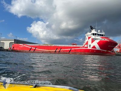
REM COMMANDER
Offshore Supply Ship

Current Trip
FJORDBASE
| Time Travelled | 2 days |
|---|---|
| Remaining Time | --- |
| Distance Travelled | 133.06 nm |
| Remaining Distance | --- |
| AVG Speed | 8.1 Knots |
| MAX Speed | 11.3 Knots |
| AVG Wind | 16.4 knots |
| MAX Wind | 27 knots |
| MIN Temp | 5.1°C / 41.18°F |
| MAX Temp | 8.3°C / 46.94°F |
| Draught | 5.6 m |
| Position Received | 4 m ago |
Current Position
| Longitude | --- |
|---|---|
| Latitude | --- |
| Status | Moored |
| Speed | |
| Course | 75° |
| Area | Norwegian Sea |
| Station | T-AIS |
| Position Received | 4 m ago |
Information
The current position of REM COMMANDER is in Norwegian Sea with coordinates 61.60966° / 5.06765° as reported on 2025-03-28 07:03 by AIS to our vessel tracker app. The vessel's current speed is 0 Knots
The vessel REM COMMANDER (IMO: 9482354, MMSI: 257638000) is a Offshore Supply Ship that was built in 2010 ( 15 years old ). It's sailing under the flag of [NO] Norway.
In this page you can find informations about the vessels current position, last detected port calls, and current voyage information. If the vessels is not in coverage by AIS you will find the latest position.
The current position of REM COMMANDER is detected by our AIS receivers and we are not responsible for the reliability of the data. The last position was recorded while the vessel was in Coverage by the Ais receivers of our vessel tracking app.
The current draught of REM COMMANDER as reported by AIS is 5.6 meters
Weather
| Temperature | 6.3°C / 43.34°F |
|---|---|
| Wind Speed | 19 knots |
| Direction | 191° S |
| Pressure | 992.8 hPa |
| Humidity | 91.5 % |
| Cloud Coverage | 100 % |


Featured Company
Last Port Calls
| Port | Arrival | Departure | Time In Port |
|---|---|---|---|
| 2025-03-25 16:32 | 2025-03-25 18:57 | 2 h | |
| 2025-01-30 15:50 | 2025-01-30 18:23 | 2 h | |
| 2025-01-22 13:23 | 2025-01-23 23:17 | 1 d | |
| 2025-01-14 23:25 | 2025-01-18 23:52 | 4 d | |
| 2025-01-10 09:48 | 2025-01-11 02:53 | 17 h | |
| 2025-01-07 02:51 | 2025-01-07 16:12 | 13 h |
Last Trips
| Origin | Departure | Destination | Arrival | Distance | |
|---|---|---|---|---|---|
| 2025-01-30 19:23 | 2025-03-25 17:32 | 2282.04 nm | |||
| 2025-01-24 00:17 | 2025-01-30 16:50 | 307.12 nm | |||
| 2025-01-19 00:52 | 2025-01-22 14:23 | 166.63 nm | |||
| 2025-01-11 03:53 | 2025-01-15 00:25 | 171.08 nm | |||
| 2025-01-07 17:12 | 2025-01-10 10:48 | 160.45 nm | |||
| 2024-12-30 19:02 | 2025-01-07 03:51 | 235.99 nm |
Events
| Time | Event | Details | Position / Dest | Info |
|---|---|---|---|---|
| 2025-03-27 18:41 | Status Changed | Moored Under way using engine |
61.60968 / 5.06772
FJORDBASE
|
Speed: Course: 76° |
| 2025-03-27 18:17 | Status Changed | Under way using engine Moored |
61.61196 / 5.06997
FJORDBASE
|
Speed: Course: 206° |
| 2025-03-27 14:36 | STOP Moving | 1.29 nm, North East of FLORO |
61.61197 / 5.06998
FJORDBASE
|
Speed: 0.1 kn Course: 205° |
| 2025-03-27 14:30 | Status Changed | Moored Under way using engine |
61.61257 / 5.06973
FJORDBASE
|
Speed: 1.7 kn Course: 193° |
| 2025-03-27 08:26 | ETA Changed | 2025/03/27 16:00 2025/03/26 02:00 |
61.08658 / 3.29691
FJORDBASE
|
Speed: 9.9 kn Course: 55.8° |
| 2025-03-27 08:20 | Status Changed | Under way using engine Restricted manoeuverability |
61.08020 / 3.27715
FJORDBASE
|
Speed: 4.5 kn Course: 64° |
| 2025-03-27 08:19 | Destination Changed | FJORDBASE DEEPSEA YANTAI |
61.07800 / 3.27015
FJORDBASE
|
Speed: 4.5 kn Course: 64° |
| 2025-03-27 08:16 | START Moving |
61.07582 / 3.26669
DEEPSEA YANTAI
|
Speed: 6.2 kn Course: 348.2° |
|
| 2025-03-27 07:49 | STOP Moving |
61.07247 / 3.27298
DEEPSEA YANTAI
|
Speed: 0.3 kn Course: 280° |
|
| 2025-03-27 07:34 | START Moving |
61.07047 / 3.28228
DEEPSEA YANTAI
|
Speed: 6.1 kn Course: 315.4° |