
RASHA
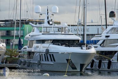
Pleasure Craft
Current Trip
Current Position
| Longitude | 7.28433° |
|---|---|
| Latitude | 43.69732° |
| Status | Moored |
| Speed | |
| Course | 96° |
| Area | Mediterranean Sea - Western Basin |
| Station | T-AIS |
| Position Received | 2 m ago |
Info
Information
The current position of RASHA is in Mediterranean Sea - Western Basin with coordinates 43.69732° / 7.28433° as reported on 2024-05-20 23:58 by AIS to our vessel tracker app. The vessel's current speed is 0 Knots and is currently inside the port of NICE.
The vessel RASHA (IMO: 9786853, MMSI: 518101009) is a Pleasure Craft It's sailing under the flag of [CK] Cook Is.
In this page you can find informations about the vessels current position, last detected port calls, and current voyage information. If the vessels is not in coverage by AIS you will find the latest position.
The current position of RASHA is detected by our AIS receivers and we are not responsible for the reliability of the data. The last position was recorded while the vessel was in Coverage by the Ais receivers of our vessel tracking app.
Weather
| Temperature | 15.3°C / 59.54°F |
|---|---|
| Wind Speed | 2 knots |
| Direction | 333° NNW |
| Pressure | 1008.4 hPa |
| Humidity | 84.8 % |
| Cloud Coverage | 100 % |
Featured Company
Most Visited Ports (Last year)
| Port | Arrivals | |
|---|---|---|
| 4 | ||
| 4 | ||
| 2 | ||
| 2 | ||
| 2 | ||
| 1 |
Last Trips
| Origin | Departure | Destination | Arrival | Distance | |
|---|---|---|---|---|---|
| 2024-05-15 15:22 | 2024-05-15 16:09 | 9.26 nm | |||
| 2024-05-15 11:00 | 2024-05-15 13:18 | 10.32 nm | |||
| 2024-04-17 17:01 | 2024-04-17 17:49 | 9.18 nm | |||
| 2024-04-17 11:07 | 2024-04-17 15:19 | 11.30 nm | |||
| 2024-03-29 10:05 | 2024-03-29 10:28 | 3.27 nm |
Events
| Time | Event | Details | Position / Dest | Info |
|---|---|---|---|---|
| 2024-05-15 14:17 | STOP Moving |
43.69715 / 7.28504
[FR] NICE
|
Speed: 0.3 kn Course: 32° |
|
| 2024-05-15 14:09 | PORT ARRIVAL |
|
43.68979 / 7.28945
[FR] NICE
|
Speed: 6 kn Course: 23.7° |
| 2024-05-15 13:22 | PORT DEPARTURE |
|
43.59218 / 7.13179
NICE
|
Speed: 9.2 kn Course: 27° |
| 2024-05-15 13:16 | START Moving |
43.58665 / 7.12550
[FR] ANTIBES
|
Speed: 3.7 kn Course: 114° |
|
| 2024-05-15 11:35 | STOP Moving |
43.58758 / 7.12310
[FR] ANTIBES
|
Speed: Course: 179° |
|
| 2024-05-15 11:18 | PORT ARRIVAL |
|
43.59077 / 7.13124
[FR] ANTIBES
|
Speed: 5.4 kn Course: 183.7° |
| 2024-05-15 11:12 | START Moving | 0.49 nm, East of ANTIBES |
43.58641 / 7.13903
NICE
|
Speed: 7.9 kn Course: 37.6° |
| 2024-05-15 09:53 | STOP Moving | 0.39 nm, East of ANTIBES |
43.58580 / 7.13664
NICE
|
Speed: Course: 158° |
| 2024-05-15 09:00 | PORT DEPARTURE |
|
43.68785 / 7.28893
NICE
|
Speed: 7.8 kn Course: 191° |
| 2024-05-15 08:54 | START Moving |
43.69537 / 7.28450
[FR] NICE
|
Speed: 3.3 kn Course: 184° |