

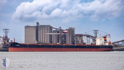
QUEENA
Cargo

Current Trip
DEV POINT
| Time Travelled | 21 h, 45 mins |
|---|---|
| Remaining Time | --- |
| Distance Travelled | 253.94 nm |
| Remaining Distance | --- |
| AVG Speed | 11.1 Knots |
| MAX Speed | 13.3 Knots |
| AVG Wind | 6.5 knots |
| MAX Wind | 12.8 knots |
| MIN Temp | 7.9°C / 46.22°F |
| MAX Temp | 9.8°C / 49.64°F |
| Draught | 8 m |
| Position Received | 1 m ago |
Current Position
| Longitude | --- |
|---|---|
| Latitude | --- |
| Status | Under way using engine |
| Speed | 11.7 Knots |
| Course | 256.3° |
| Area | English Channel |
| Station | T-AIS |
| Position Received | 1 m ago |
Information
The current position of QUEENA is in English Channel with coordinates 50.38593° / -0.61935° as reported on 2025-03-24 02:09 by AIS to our vessel tracker app. The vessel's current speed is 11.7 Knots
The vessel QUEENA (IMO: 9736286, MMSI: 477454600) is a Cargo It's sailing under the flag of [HK] Hong Kong.
In this page you can find informations about the vessels current position, last detected port calls, and current voyage information. If the vessels is not in coverage by AIS you will find the latest position.
The current position of QUEENA is detected by our AIS receivers and we are not responsible for the reliability of the data. The last position was recorded while the vessel was in Coverage by the Ais receivers of our vessel tracking app.
The current draught of QUEENA as reported by AIS is 8 meters
Weather
| Temperature | 9°C / 48.2°F |
|---|---|
| Wind Speed | 13 knots |
| Direction | 18° NNE |
| Pressure | 1010.7 hPa |
| Humidity | 93.8 % |
| Cloud Coverage | 100 % |


Featured Company
Last Port Calls
| Port | Arrival | Departure | Time In Port |
|---|---|---|---|
| 2025-03-19 06:55 | 2025-03-23 05:25 | 3 d | |
| 2025-03-19 04:38 | 2025-03-19 05:23 | 44 m | |
| 2025-02-18 19:20 | 2025-02-26 14:27 | 7 d | |
| 2025-01-17 17:25 | 2025-01-28 17:14 | 10 d |
Most Visited Ports (Last year)
| Port | Arrivals | |
|---|---|---|
| 2 | ||
| 2 | ||
| 1 | ||
| 1 | ||
| 1 | ||
| 1 |
Last Trips
| Origin | Departure | Destination | Arrival | Distance | |
|---|---|---|---|---|---|
| 2025-03-19 05:23 | 2025-03-19 06:55 | 7.07 nm | |||
| 2025-02-26 14:27 | 2025-03-19 04:38 | 5063.65 nm | |||
| 2025-01-28 17:14 | 2025-02-18 19:20 | 5114.52 nm | |||
| 2024-12-21 19:59 | 2025-01-17 17:25 | 5262.99 nm |
Events
| Time | Event | Details | Position / Dest | Info |
|---|---|---|---|---|
| 2025-03-23 22:23 | Status Changed | Under way using engine Default |
50.59516 / .55774
DEV POINT
|
Speed: 12.9 kn Course: 240° |
| 2025-03-23 22:18 | Status Changed | Default Under way using engine |
50.60480 / .58139
DEV POINT
|
Speed: 12.7 kn Course: 235.7° |
| 2025-03-23 19:41 | Change Sea Area | United Kingdom part of the English Channel French part of the English Channel |
50.90917 / 1.29564
English Channel
DEV POINT
|
Speed: 11.8 kn Course: 237.9° |
| 2025-03-23 19:20 | Change Sea Area | French part of the English Channel United Kingdom part of the English Channel |
50.95627 / 1.37448
English Channel
DEV POINT
|
Speed: 11.8 kn Course: 222.1° |
| 2025-03-23 18:41 | Change Sea Area | United Kingdom part of the English Channel United Kingdom part of the North Sea |
51.04721 / 1.51043
English Channel
DEV POINT
|
Speed: 11.2 kn Course: 224° |
| 2025-03-23 13:58 | Detected in Sea | United Kingdom part of the North Sea |
51.79583 / 2.46855
North Sea
DEV POINT
|
Speed: 13.3 kn Course: 223.6° |
| 2025-03-23 13:38 | Change Sea Area | Belgian part of the North Sea Dutch part of the North Sea |
51.84855 / 2.55120
North Sea
DEV POINT
|
Speed: 13.2 kn Course: 220.7° |
| 2025-03-23 12:14 | Status Changed | Under way using engine Default |
52.08045 / 2.85148
DEV POINT
|
Speed: 12.4 kn Course: 218° |
| 2025-03-23 11:57 | IN Coverage |
52.08045 / 2.85148
North Sea
DEV POINT
|
Speed: 12.4 kn Course: 218.7° |
|
| 2025-03-23 07:44 | OUT of Coverage |
52.52037 / 3.98374
North Sea
DEV POINT
|
Speed: 12.1 kn Course: 270.8° |