
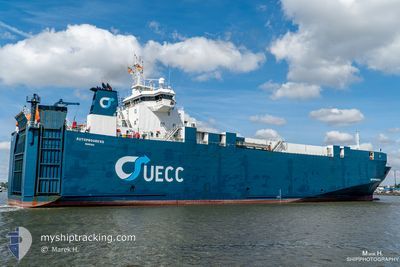
PTOLEMY
Vehicles Carrier
Current Trip
JPTOY
| Time Travelled | 2 days |
|---|---|
| Remaining Time | --- |
| Distance Travelled | 1.55 nm |
| Remaining Distance | --- |
| AVG Speed | 6.1 Knots |
| MAX Speed | 6.1 Knots |
| AVG Wind | 13 knots |
| MAX Wind | 13 knots |
| MIN Temp | -3.4°C / 25.88°F |
| MAX Temp | -3.3°C / 26.06°F |
| Draught | 4.6 m |
| Position Received | 4 d ago |
Current Position
| Longitude | --- |
|---|---|
| Latitude | --- |
| Status | Under way using engine |
| Speed | 13.1 Knots |
| Course | 323.4° |
| Area | Japan Sea |
| Station | T-AIS |
| Position Received | 4 d ago |
Info
Information
The current position of PTOLEMY is in Japan Sea with coordinates 37.59034° / 137.40181° as reported on 2025-02-14 11:29 by AIS to our vessel tracker app. The vessel's current speed is 13.1 Knots
The vessel PTOLEMY (IMO: 9131967, MMSI: 352002257) is a Vehicles Carrier that was built in 1998 ( 27 years old ). It's sailing under the flag of [PA] Panama.
In this page you can find informations about the vessels current position, last detected port calls, and current voyage information. If the vessels is not in coverage by AIS you will find the latest position.
The current position of PTOLEMY is detected by our AIS receivers and we are not responsible for the reliability of the data. The last position was recorded while the vessel was in Coverage by the Ais receivers of our vessel tracking app.
The current draught of PTOLEMY as reported by AIS is 4.6 meters
Weather
| Temperature | -3.2°C / 26.24°F |
|---|---|
| Wind Speed | 13 knots |
| Direction | 340° NNW |
| Pressure | 1013.2 hPa |
| Humidity | 69.9 % |
| Cloud Coverage | 61 % |
Featured Company
Last Port Calls
| Port | Arrival | Departure | Time In Port |
|---|---|---|---|
| 2025-02-15 16:49 | 2025-02-16 12:21 | 19 h | |
| 2025-02-10 06:05 | 2025-02-10 13:49 | 7 h | |
| 2024-12-21 01:00 | 2024-12-21 16:49 | 15 h | |
| 2024-12-15 12:40 | 2024-12-17 07:56 | 1 d | |
| 2024-12-04 13:52 | 2024-12-05 08:44 | 18 h |
Most Visited Ports (Last year)
| Port | Arrivals | |
|---|---|---|
| 35 | ||
| 1 |
Last Trips
| Origin | Departure | Destination | Arrival | Distance | |
|---|---|---|---|---|---|
| 2025-02-10 23:49 | 2025-02-16 02:49 | 945.96 nm | |||
| 2024-12-22 02:49 | 2025-02-10 16:05 | 6.04 nm | |||
| 2024-12-17 15:56 | 2024-12-21 11:00 | 1262.20 nm | |||
| 2024-12-05 18:44 | 2024-12-15 20:40 | 1260.75 nm | |||
| 2024-11-26 23:36 | 2024-12-04 23:52 | 955.89 nm |
Events
| Time | Event | Details | Position / Dest | Info |
|---|---|---|---|---|
| 2025-02-16 12:21 | PORT DEPARTURE |
|
43.07584 / 131.87560
JPTOY
|
Speed: 6.6 kn Course: 170° |
| 2025-02-15 17:17 | STOP Moving |
43.09073 / 131.86900
[RU] VLADIVOSTOK
|
Speed: 0.3 kn Course: 223° |
|
| 2025-02-15 16:49 | PORT ARRIVAL |
|
43.07727 / 131.87715
[RU] VLADIVOSTOK
|
Speed: 3.9 kn Course: 301° |
| 2025-02-14 11:47 | Status Changed | Default Under way using engine |
37.64577 / 137.35120
JPTOY
|
Speed: 13.1 kn Course: 323.4° |
| 2025-02-14 11:29 | OUT of Coverage |
37.59034 / 137.40181
Japan Sea
|
Speed: 13.1 kn Course: 323.4° |
|
| 2025-02-14 08:59 | Status Changed | Under way using engine Default |
37.01091 / 137.29567
JPTOY
|
Speed: 14.9 kn Course: 16° |
| 2025-02-14 08:25 | Status Changed | Default Under way using engine |
36.87585 / 137.25107
JPTOY
|
Speed: 15.1 kn Course: 15.3° |
| 2025-02-14 08:11 | Status Changed | Under way using engine Default |
36.81934 / 137.23275
JPTOY
|
Speed: 15.1 kn Course: 12° |
| 2025-02-14 08:09 | Status Changed | Default Under way using engine |
36.81166 / 137.23044
JPTOY
|
Speed: 13.6 kn Course: 359.7° |
| 2025-02-14 08:03 | Status Changed | Under way using engine Default |
36.78695 / 137.22680
JPTOY
|
Speed: 9.8 kn Course: 359° |