
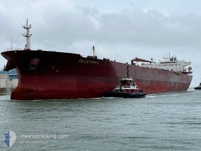
PS GENOVA
Oil Products Tanker
Current Trip
| Time Travelled | 2 days |
|---|---|
| Remaining Time | 45 days |
| Distance Travelled | 727.85 nm |
| Remaining Distance | 11378.01 nm |
| AVG Speed | 10.7 Knots |
| MAX Speed | 15.4 Knots |
| AVG Wind | 12 knots |
| MAX Wind | 30 knots |
| MIN Temp | 12.5°C / 54.5°F |
| MAX Temp | 17.7°C / 63.86°F |
| Draught | 15.1 m |
| Position Received | 1 d ago |
Current Position
| Longitude | --- |
|---|---|
| Latitude | --- |
| Status | Under way using engine |
| Speed | 8.4 Knots |
| Course | 206.4° |
| Area | Celtic Sea |
| Station | T-AIS |
| Position Received | 1 d ago |
Info
Information
The current position of PS GENOVA is in Celtic Sea with coordinates 48.90404° / -5.82773° as reported on 2024-10-05 15:54 by AIS to our vessel tracker app. The vessel's current speed is 8.4 Knots and is heading at the port of SINGAPORE. The estimated time of arrival as calculated by MyShipTracking vessel tracking app is 2024-11-21 14:26 LT
The vessel PS GENOVA (IMO: 9439383, MMSI: 229903000) is a Oil Products Tanker that was built in 2010 ( 14 years old ). It's sailing under the flag of [MT] Malta.
In this page you can find informations about the vessels current position, last detected port calls, and current voyage information. If the vessels is not in coverage by AIS you will find the latest position.
The current position of PS GENOVA is detected by our AIS receivers and we are not responsible for the reliability of the data. The last position was recorded while the vessel was in Coverage by the Ais receivers of our vessel tracking app.
The current draught of PS GENOVA as reported by AIS is 15.1 meters
Weather
| Temperature | 17.9°C / 64.22°F |
|---|---|
| Wind Speed | 17 knots |
| Direction | 236° SW |
| Pressure | 1003.2 hPa |
| Humidity | 73.1 % |
| Cloud Coverage | 4 % |
Featured Company
Last Port Calls
| Port | Arrival | Departure | Time In Port |
|---|---|---|---|
| 2024-10-02 23:41 | 2024-10-04 02:15 | 1 d | |
| 2024-09-27 18:37 | 2024-09-30 01:48 | 2 d | |
| 2024-09-23 00:22 | 2024-09-24 19:50 | 1 d | |
| 2024-08-25 05:35 | 2024-08-26 17:00 | 1 d | |
| 2024-08-05 14:50 | 2024-08-09 00:59 | 3 d |
Most Visited Ports (Last year)
| Port | Arrivals | |
|---|---|---|
| 5 | ||
| 3 | ||
| 3 | ||
| 2 | ||
| 2 | ||
| 2 |
Last Trips
| Origin | Departure | Destination | Arrival | Distance | |
|---|---|---|---|---|---|
| 2024-09-30 03:48 | 2024-10-03 01:41 | 687.08 nm | |||
| 2024-09-24 21:50 | 2024-09-27 20:37 | 567.19 nm | |||
| 2024-08-26 19:00 | 2024-09-23 02:22 | 6748.54 nm | |||
| 2024-08-08 19:59 | 2024-08-25 07:35 | 4704.12 nm | |||
| 2024-07-15 08:02 | 2024-08-05 09:50 | 2106.95 nm |
Events
| Time | Event | Details | Position / Dest | Info |
|---|---|---|---|---|
| 2024-10-05 15:58 | Status Changed | Default Under way using engine |
48.89630 / -5.83336
NLRTM > SGSIN
|
Speed: 8.4 kn Course: 206.4° |
| 2024-10-05 15:54 | Status Changed | Under way using engine Default |
48.90404 / -5.82773
NLRTM > SGSIN
|
Speed: 8.6 kn Course: 223° |
| 2024-10-05 15:54 | OUT of Coverage |
48.90404 / -5.82773
Celtic Sea
|
Speed: 8.4 kn Course: 206.4° |
|
| 2024-10-05 15:44 | Status Changed | Default Under way using engine |
48.92489 / -5.81192
NLRTM > SGSIN
|
Speed: 9.1 kn Course: 235.6° |
| 2024-10-05 15:28 | Status Changed | Under way using engine Default |
48.94691 / -5.76141
NLRTM > SGSIN
|
Speed: 9.5 kn Course: 242° |
| 2024-10-05 15:20 | IN Coverage |
48.94691 / -5.76141
Celtic Sea
|
Speed: 9.3 kn Course: 246.7° |
|
| 2024-10-05 14:31 | Status Changed | Default Under way using engine |
49.01644 / -5.54859
NLRTM > SGSIN
|
Speed: 10.4 kn Course: 241.5° |
| 2024-10-05 14:25 | OUT of Coverage |
49.02393 / -5.52638
Celtic Sea
|
Speed: 10.4 kn Course: 241.5° |
|
| 2024-10-05 14:07 | Detected in Sea | French part of the Celtic Sea |
49.04989 / -5.45179
Celtic Sea
|
Speed: 10.7 kn Course: 241.6° |
| 2024-10-05 14:07 | Status Changed | Under way using engine Default |
49.04989 / -5.45179
NLRTM > SGSIN
|
Speed: 10.5 kn Course: 240° |