
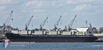
PRT BELLE
Bulk Carrier
Current Trip
TONDA JAPAN
| Time Travelled | 9 days |
|---|---|
| Remaining Time | --- |
| Distance Travelled | 108.34 nm |
| Remaining Distance | --- |
| AVG Speed | 9.8 Knots |
| MAX Speed | 14.7 Knots |
| AVG Wind | 10.4 knots |
| MAX Wind | 23 knots |
| MIN Temp | 20.2°C / 68.36°F |
| MAX Temp | 27.3°C / 81.14°F |
| Draught | 10.4 m |
| Position Received | 2024-12-13 20:41 |
Current Position
| Longitude | --- |
|---|---|
| Latitude | --- |
| Status | Under way using engine |
| Speed | 7.4 Knots |
| Course | 41.1° |
| Area | Eastern China Sea |
| Station | T-AIS |
| Position Received | 2024-12-13 20:41 |
Info
Information
The current position of PRT BELLE is in Eastern China Sea with coordinates 25.47064° / 121.09336° as reported on 2024-12-13 20:41 by AIS to our vessel tracker app. The vessel's current speed is 7.4 Knots
The vessel PRT BELLE (IMO: 9615119, MMSI: 373393000) is a Bulk Carrier that was built in 2012 ( 13 years old ). It's sailing under the flag of [PA] Panama.
In this page you can find informations about the vessels current position, last detected port calls, and current voyage information. If the vessels is not in coverage by AIS you will find the latest position.
The current position of PRT BELLE is detected by our AIS receivers and we are not responsible for the reliability of the data. The last position was recorded while the vessel was in Coverage by the Ais receivers of our vessel tracking app.
The current draught of PRT BELLE as reported by AIS is 10.4 meters
Weather
| Temperature | 26.1°C / 78.98°F |
|---|---|
| Wind Speed | 7 knots |
| Direction | 61° ENE |
| Pressure | 1011 hPa |
| Humidity | 68.6 % |
| Cloud Coverage | 17 % |
Featured Company
Most Visited Ports (Last year)
| Port | Arrivals | |
|---|---|---|
| 4 | ||
| 3 | ||
| 2 | ||
| 2 | ||
| 2 | ||
| 1 |
Last Trips
| Origin | Departure | Destination | Arrival | Distance | |
|---|---|---|---|---|---|
| 2024-12-28 07:49 | 2025-01-07 06:49 | 2793.15 nm | |||
| 2024-12-13 18:56 | 2024-12-22 16:08 | 1168.01 nm | |||
| 2024-11-27 16:36 | 2024-12-12 21:08 | 3506.56 nm | |||
| 2024-11-14 05:52 | 2024-11-25 01:15 | 3053.11 nm | |||
| 2024-10-31 17:24 | 2024-11-12 07:32 | 620.20 nm |
Events
| Time | Event | Details | Position / Dest | Info |
|---|---|---|---|---|
| 2025-01-10 09:11 | STOP Moving |
9.61706 / 99.42690
TONDA JAPAN
|
Speed: 0.1 kn Course: 29° |
|
| 2025-01-08 23:41 | PORT DEPARTURE |
|
11.19585 / 99.58493
TONDA JAPAN
|
Speed: 3.4 kn Course: 150° |
| 2025-01-08 23:37 | START Moving |
11.19934 / 99.58217
[TH] PRACHUAP
|
Speed: 3.4 kn Course: 150° |