
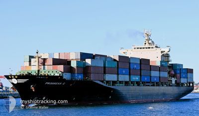
PROGRESS C
Container Ship
Current Trip
TZDAR
| Time Travelled | 6 days |
|---|---|
| Remaining Time | --- |
| Distance Travelled | 2068.46 nm |
| Remaining Distance | --- |
| AVG Speed | 15.3 Knots |
| MAX Speed | 16.9 Knots |
| AVG Wind | 8.2 knots |
| MAX Wind | 18.8 knots |
| MIN Temp | 25.4°C / 77.72°F |
| MAX Temp | 31.2°C / 88.16°F |
| Draught | 11.2 m |
| Position Received | 20 d ago |
Current Position
| Longitude | --- |
|---|---|
| Latitude | --- |
| Status | Under way using engine |
| Speed | 16.5 Knots |
| Course | 309.3° |
| Area | Malacca Strait |
| Station | T-AIS |
| Position Received | 20 d ago |
Info
Information
The current position of PROGRESS C is in Malacca Strait with coordinates 2.13757° / 102.01581° as reported on 2026-01-27 12:52 by AIS to our vessel tracker app. The vessel's current speed is 16.5 Knots
The vessel PROGRESS C (IMO: 9158563, MMSI: 352157000) is a Container Ship that was built in 1998 ( 28 years old ). It's sailing under the flag of [PA] Panama.
In this page you can find informations about the vessels current position, last detected port calls, and current voyage information. If the vessels is not in coverage by AIS you will find the latest position.
The current position of PROGRESS C is detected by our AIS receivers and we are not responsible for the reliability of the data. The last position was recorded while the vessel was in Coverage by the Ais receivers of our vessel tracking app.
The current draught of PROGRESS C as reported by AIS is 11.2 meters
Weather
| Temperature | 27.9°C / 82.22°F |
|---|---|
| Wind Speed | 9 knots |
| Direction | 318° NW |
| Pressure | 1011.5 hPa |
| Humidity | 74.5 % |
| Cloud Coverage | 100 % |
Featured Company
Last Port Calls
| Port | Arrival | Departure | Time In Port |
|---|---|---|---|
| 2026-02-07 16:36 | 2026-02-11 02:56 | 3 d | |
| 2026-01-27 00:56 | 2026-01-27 12:59 | 12 h | |
| 2026-01-24 12:11 | 2026-01-25 10:19 | 22 h | |
| 2026-01-05 04:43 | 2026-01-08 01:36 | 2 d | |
| 2025-12-22 04:26 | 2025-12-22 20:16 | 15 h | |
| 2025-12-20 04:23 | 2025-12-21 03:47 | 23 h | |
| 2025-12-04 18:22 | 2025-12-07 05:16 | 2 d |
Most Visited Ports (Last year)
| Port | Arrivals | |
|---|---|---|
| 8 | ||
| 7 | ||
| 7 | ||
| 3 | ||
| 2 | ||
| 2 |
Last Trips
| Origin | Departure | Destination | Arrival | Distance | |
|---|---|---|---|---|---|
| 2026-01-27 12:59 | 2026-02-07 16:36 | 4112.81 nm | |||
| 2026-01-25 10:19 | 2026-01-27 00:56 | 187.36 nm | |||
| 2026-01-08 01:36 | 2026-01-24 12:11 | 4257.42 nm | |||
| 2025-12-22 20:16 | 2026-01-05 04:43 | 4109.61 nm | |||
| 2025-12-21 03:47 | 2025-12-22 04:26 | 89.13 nm | |||
| 2025-12-07 05:16 | 2025-12-20 04:23 | 4555.87 nm | |||
| 2025-11-14 10:47 | 2025-12-04 18:22 | 545.68 nm |
Events
| Time | Event | Details | Position / Dest | Info |
|---|---|---|---|---|
| 2026-02-11 15:08 | START Moving | --- |
-6.76883 / 39.35036
TZDAR
|
Speed: 4.9 kn Course: 49° |
| 2026-02-11 00:55 | STOP Moving | --- |
-6.77153 / 39.35008
TZDAR
|
Speed: 0.3 kn Course: 6° |
| 2026-02-10 23:56 | PORT DEPARTURE |
|
-6.81446 / 39.30815
TZDAR
|
Speed: 5 kn Course: 51° |
| 2026-02-10 23:28 | START Moving |
-6.83553 / 39.29641
[TZ] DAR ES SALAAM
|
Speed: 3.6 kn Course: 345° |
|
| 2026-02-07 13:36 | STOP Moving |
-6.84112 / 39.29716
[TZ] DAR ES SALAAM
|
Speed: Course: 158° |
|
| 2026-02-07 13:36 | PORT ARRIVAL |
|
-6.84112 / 39.29716
[TZ] DAR ES SALAAM
|
Speed: 2.9 kn Course: 163° |
| 2026-02-07 12:00 | START Moving | --- |
-6.76956 / 39.36411
TZDAR
|
Speed: 4.9 kn Course: 301° |