
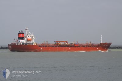
PRINCESS NORIA
Oil/Chemical Tanker
Current Trip
| Time Travelled | 27 days |
|---|---|
| Remaining Time | --- |
| Distance Travelled | 2053.24 nm |
| Remaining Distance | --- |
| AVG Speed | 10.1 Knots |
| MAX Speed | 13.3 Knots |
| AVG Wind | 8.6 knots |
| MAX Wind | 23 knots |
| MIN Temp | 28.1°C / 82.58°F |
| MAX Temp | 33.2°C / 91.76°F |
| Draught | 5.4 m |
| Position Received | 3 d ago |
Current Position
| Longitude | 56.94891° |
|---|---|
| Latitude | 25.87544° |
| Status | Under way using engine |
| Speed | 5.3 Knots |
| Course | 40.1° |
| Area | Gulf of Oman |
| Station | T-AIS |
| Position Received | 3 d ago |
Info
Information
The current position of PRINCESS NORIA is in Gulf of Oman with coordinates 25.87544° / 56.94891° as reported on 2024-05-11 21:58 by AIS to our vessel tracker app. The vessel's current speed is 5.3 Knots and is heading at the port of FUJAIRAH. The estimated time of arrival as calculated by MyShipTracking vessel tracking app is 2024-05-12 18:00 LT
The vessel PRINCESS NORIA (IMO: 9196448, MMSI: 352986196) is a Oil/Chemical Tanker that was built in 1998 ( 26 years old ). It's sailing under the flag of [PA] Panama.
In this page you can find informations about the vessels current position, last detected port calls, and current voyage information. If the vessels is not in coverage by AIS you will find the latest position.
The current position of PRINCESS NORIA is detected by our AIS receivers and we are not responsible for the reliability of the data. The last position was recorded while the vessel was in Coverage by the Ais receivers of our vessel tracking app.
The current draught of PRINCESS NORIA as reported by AIS is 5.4 meters
Weather
| Temperature | 30.2°C / 86.36°F |
|---|---|
| Wind Speed | 2 knots |
| Direction | 23° NNE |
| Pressure | 1007.6 hPa |
| Humidity | 66.7 % |
| Cloud Coverage | 92 % |
Featured Company
Events
| Time | Event | Details | Position / Dest | Info |
|---|---|---|---|---|
| 2024-05-11 22:34 | STOP Moving |
25.88952 / 56.96493
AE FJR
|
Speed: 0.1 kn Course: 316° |
|
| 2024-05-11 22:09 | Status Changed | Default Under way using engine |
25.88593 / 56.95916
AE FJR
|
Speed: 5.3 kn Course: 40.1° |
| 2024-05-11 21:58 | OUT of Coverage |
25.87544 / 56.94891
Gulf of Oman
AE FJR
|
Speed: 5.3 kn Course: 40.1° |
|
| 2024-05-11 21:10 | Change Sea Area | Iranian part of the Gulf of Oman Omani part of the Gulf of Oman |
25.78841 / 56.85903
Gulf of Oman
AE FJR
|
Speed: 10.4 kn Course: 50.5° |
| 2024-05-11 20:28 | Change Sea Area | Omani part of the Gulf of Oman United Arab Emirates part of the Gulf of Oman |
25.67288 / 56.80907
Gulf of Oman
AE FJR
|
Speed: 11.3 kn Course: 12.5° |
| 2024-05-11 18:53 | START Moving | 20.69 nm, East of KHORFAKKAN |
25.39888 / 56.73998
AE FJR
|
Speed: 3.1 kn Course: 41° |
| 2024-05-11 17:54 | Status Changed | Under way using engine At anchor |
25.39930 / 56.73785
AE FJR
|
Speed: 0.1 kn Course: 136° |
| 2024-05-11 17:13 | Status Changed | At anchor Default |
25.39917 / 56.73767
AE FJR
|
Speed: Course: 127° |
| 2024-05-11 17:10 | Status Changed | Default At anchor |
25.39919 / 56.73766
AE FJR
|
Speed: 0.1 kn Course: 127° |
| 2024-05-11 16:10 | STOP Moving | 20.55 nm, East of KHORFAKKAN |
25.39898 / 56.73741
AE FJR
|
Speed: 0.2 kn Course: 130° |