
PORTAITISSA
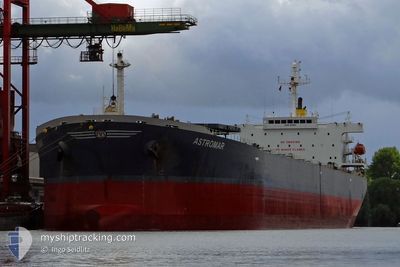
Bulk Carrier
Current Trip
| Time Travelled | 52 days |
|---|---|
| Remaining Time | --- |
| Distance Travelled | 9947.85 nm |
| Remaining Distance | --- |
| AVG Speed | 11.5 Knots |
| MAX Speed | 15.3 Knots |
| AVG Wind | 11.5 knots |
| MAX Wind | 27 knots |
| MIN Temp | 1.4°C / 34.52°F |
| MAX Temp | 29°C / 84.2°F |
| Draught | 9.4 m |
| Position Received | 9 d ago |
Current Position
| Longitude | --- |
|---|---|
| Latitude | --- |
| Status | Under way using engine |
| Speed | 13.1 Knots |
| Course | 283° |
| Area | South Atlantic Ocean |
| Station | T-AIS |
| Position Received | 9 d ago |
Info
Information
The current position of PORTAITISSA is in South Atlantic Ocean with coordinates -34.75488° / 18.09557° as reported on 2025-02-18 10:21 by AIS to our vessel tracker app. The vessel's current speed is 13.1 Knots and is heading at the port of TERNEUZEN. The estimated time of arrival as calculated by MyShipTracking vessel tracking app is 2025-02-17 16:00 LT
The vessel PORTAITISSA (IMO: 9323883, MMSI: 212131000) is a Bulk Carrier that was built in 2006 ( 19 years old ). It's sailing under the flag of [CY] Cyprus.
In this page you can find informations about the vessels current position, last detected port calls, and current voyage information. If the vessels is not in coverage by AIS you will find the latest position.
The current position of PORTAITISSA is detected by our AIS receivers and we are not responsible for the reliability of the data. The last position was recorded while the vessel was in Coverage by the Ais receivers of our vessel tracking app.
The current draught of PORTAITISSA as reported by AIS is 9.4 meters
Weather
| Temperature | 21.9°C / 71.42°F |
|---|---|
| Wind Speed | 5 knots |
| Direction | 84° E |
| Pressure | 1020.9 hPa |
| Humidity | 76.1 % |
| Cloud Coverage | 11 % |
Featured Company
Events
| Time | Event | Details | Position / Dest | Info |
|---|---|---|---|---|
| 2025-02-27 14:26 | START Moving |
-31.50882 / -3.91010
FOR ORDERS
|
Speed: 4.6 kn Course: 5° |
|
| 2025-02-24 00:21 | STOP Moving |
-31.94075 / -4.36420
FOR ORDERS
|
Speed: 0.2 kn Course: 81° |
|
| 2025-02-22 12:17 | STOP Moving |
-32.36845 / -4.75822
FOR ORDERS
|
Speed: 0.3 kn Course: 201° |
|
| 2025-02-22 09:13 | START Moving |
-32.41720 / -4.17200
FOR ORDERS
|
Speed: 3.9 kn Course: 278° |
|
| 2025-02-22 08:36 | STOP Moving |
-32.42273 / -4.16107
FOR ORDERS
|
Speed: 0.3 kn Course: 278° |
|
| 2025-02-18 10:28 | Status Changed | Default Under way using engine |
-34.75006 / 18.06760
FOR ORDERS
|
Speed: 13.1 kn Course: 283° |
| 2025-02-18 10:21 | Status Changed | Under way using engine Default |
-34.75488 / 18.09557
FOR ORDERS
|
Speed: 12.9 kn Course: 280° |
| 2025-02-18 10:21 | OUT of Coverage |
-34.75488 / 18.09557
South Atlantic Ocean
|
Speed: 13.1 kn Course: 283° |
|
| 2025-02-18 10:19 | Status Changed | Default Under way using engine |
-34.75635 / 18.10347
FOR ORDERS
|
Speed: 12.5 kn Course: 267° |
| 2025-02-18 10:14 | Status Changed | Under way using engine Default |
-34.75705 / 18.12702
FOR ORDERS
|
Speed: 12.5 kn Course: 268° |