

PORT FUKUOKA
Cargo

Current Trip
| Time Travelled | 13 days |
|---|---|
| Remaining Time | --- |
| Distance Travelled | 1997.73 nm |
| Remaining Distance | --- |
| AVG Speed | 11.2 Knots |
| MAX Speed | 14.7 Knots |
| AVG Wind | 11.5 knots |
| MAX Wind | 23.7 knots |
| MIN Temp | 7.2°C / 44.96°F |
| MAX Temp | 29.5°C / 85.1°F |
| Draught | 12.3 m |
| Position Received | 20 h, 20 m ago |
Current Position
| Longitude | --- |
|---|---|
| Latitude | --- |
| Status | Under way using engine |
| Speed | 14 Knots |
| Course | 270° |
| Area | North Pacific Ocean |
| Station | T-AIS |
| Position Received | 20 h, 20 m ago |
Information
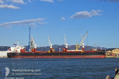
The current position of PORT FUKUOKA is in North Pacific Ocean with coordinates 6.97021° / -80.39110° as reported on 2025-02-23 05:59 by AIS to our vessel tracker app. The vessel's current speed is 14 Knots and is heading at the port of KINUURA. The estimated time of arrival as calculated by MyShipTracking vessel tracking app is 2025-03-24 21:00 LT
The vessel PORT FUKUOKA (IMO: 9932799, MMSI: 538010081) is a Cargo It's sailing under the flag of [MH] Marshall Is.
In this page you can find informations about the vessels current position, last detected port calls, and current voyage information. If the vessels is not in coverage by AIS you will find the latest position.
The current position of PORT FUKUOKA is detected by our AIS receivers and we are not responsible for the reliability of the data. The last position was recorded while the vessel was in Coverage by the Ais receivers of our vessel tracking app.
The current draught of PORT FUKUOKA as reported by AIS is 12.3 meters
Weather
| Temperature | 27.9°C / 82.22°F |
|---|---|
| Wind Speed | 6 knots |
| Direction | 210° SSW |
| Pressure | 1010.3 hPa |
| Humidity | 76 % |
| Cloud Coverage | 100 % |


Featured Company
Last Port Calls
| Port | Arrival | Departure | Time In Port |
|---|---|---|---|
| 2025-02-03 18:22 | 2025-02-10 12:11 | 6 d | |
| 2024-12-14 02:21 | 2024-12-21 08:35 | 7 d | |
| 2024-12-05 22:09 |
Most Visited Ports (Last year)
| Port | Arrivals | |
|---|---|---|
| 3 | ||
| 2 | ||
| 2 | ||
| 2 | ||
| 1 | ||
| 1 |
Last Trips
| Origin | Departure | Destination | Arrival | Distance | |
|---|---|---|---|---|---|
| 2024-12-21 08:35 | 2025-02-03 18:22 | 9761.02 nm | |||
| 2024-12-05 22:09 | 2024-12-14 02:21 | 494.46 nm |
Events
| Time | Event | Details | Position / Dest | Info |
|---|---|---|---|---|
| 2025-02-23 06:05 | Status Changed | Default Under way using engine |
6.97058 / -80.41540
JP KNU
|
Speed: 14 kn Course: 270° |
| 2025-02-23 05:59 | Status Changed | Under way using engine Default |
6.97021 / -80.39110
JP KNU
|
Speed: 14 kn Course: 271° |
| 2025-02-23 05:59 | OUT of Coverage |
6.97021 / -80.39110
North Pacific Ocean
JP KNU
|
Speed: 14 kn Course: 270° |
|
| 2025-02-23 05:49 | Status Changed | Default Under way using engine |
6.96944 / -80.35202
JP KNU
|
Speed: 14 kn Course: 269° |
| 2025-02-23 05:41 | Status Changed | Under way using engine Default |
6.96927 / -80.32181
JP KNU
|
Speed: 14 kn Course: 270° |
| 2025-02-23 05:35 | Status Changed | Default Under way using engine |
6.96939 / -80.29713
JP KNU
|
Speed: 13 kn Course: 269° |
| 2025-02-23 04:05 | Status Changed | Under way using engine Default |
7.19051 / -80.02014
JP KNU
|
Speed: 14.7 kn Course: 226° |
| 2025-02-23 04:00 | Status Changed | Default Under way using engine |
7.20254 / -80.00773
JP KNU
|
Speed: 14.5 kn Course: 225.4° |
| 2025-02-23 03:46 | Status Changed | Under way using engine Default |
7.24316 / -79.96541
JP KNU
|
Speed: 14.3 kn Course: 227° |
| 2025-02-23 03:42 | IN Coverage |
7.24035 / -79.96831
North Pacific Ocean
JP KNU
|
Speed: 14.4 kn Course: 226° |