
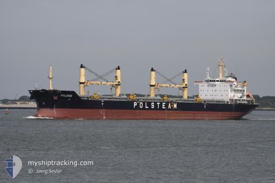
POLESIE
Bulk Carrier
Current Trip
| Time Travelled | 3 days |
|---|---|
| Remaining Time | --- |
| Distance Travelled | 626.44 nm |
| Remaining Distance | --- |
| AVG Speed | 11.1 Knots |
| MAX Speed | 12.4 Knots |
| AVG Wind | 13.7 knots |
| MAX Wind | 31.5 knots |
| MIN Temp | 10.4°C / 50.72°F |
| MAX Temp | 16°C / 60.8°F |
| Draught | 10.5 m |
| Position Received | 1 d ago |
Current Position
| Longitude | --- |
|---|---|
| Latitude | --- |
| Status | Under way using engine |
| Speed | 11.1 Knots |
| Course | 359.6° |
| Area | North Atlantic Ocean |
| Station | T-AIS |
| Position Received | 1 d ago |
Info
Information
The current position of POLESIE is in North Atlantic Ocean with coordinates 41.50872° / -9.80081° as reported on 2025-02-28 21:24 by AIS to our vessel tracker app. The vessel's current speed is 11.1 Knots and is heading at the port of KLAIPEDA. The estimated time of arrival as calculated by MyShipTracking vessel tracking app is 2025-03-07 10:00 LT
The vessel POLESIE (IMO: 9488097, MMSI: 311018000) is a Bulk Carrier that was built in 2009 ( 16 years old ). It's sailing under the flag of [BS] Bahamas.
In this page you can find informations about the vessels current position, last detected port calls, and current voyage information. If the vessels is not in coverage by AIS you will find the latest position.
The current position of POLESIE is detected by our AIS receivers and we are not responsible for the reliability of the data. The last position was recorded while the vessel was in Coverage by the Ais receivers of our vessel tracking app.
The current draught of POLESIE as reported by AIS is 10.5 meters
Weather
| Temperature | 8.3°C / 46.94°F |
|---|---|
| Wind Speed | 17 knots |
| Direction | 71° ENE |
| Pressure | 1029.4 hPa |
| Humidity | 68.7 % |
| Cloud Coverage | 14 % |
Featured Company
Last Port Calls
| Port | Arrival | Departure | Time In Port |
|---|---|---|---|
| 2025-02-25 11:02 | 2025-02-27 01:40 | 1 d | |
| 2025-02-18 03:40 | 2025-02-21 19:42 | 3 d | |
| 2025-01-27 02:17 | 2025-01-27 03:34 | 1 h | |
| 2025-01-23 13:45 | 2025-01-26 15:17 | 3 d | |
| 2025-01-20 14:37 |
Last Trips
| Origin | Departure | Destination | Arrival | Distance | |
|---|---|---|---|---|---|
| 2025-02-21 20:42 | 2025-02-25 11:02 | 174.22 nm | |||
| 2025-01-27 06:34 | 2025-02-18 04:40 | 2040.73 nm | |||
| 2025-01-26 17:17 | 2025-01-27 05:17 | 115.11 nm | |||
| 2025-01-20 16:37 | 2025-01-23 15:45 | 78.32 nm |
Events
| Time | Event | Details | Position / Dest | Info |
|---|---|---|---|---|
| 2025-02-28 21:30 | Status Changed | Default Under way using engine |
41.52652 / -9.80077
LT KLJ
|
Speed: 11.1 kn Course: 359.6° |
| 2025-02-28 21:24 | OUT of Coverage |
41.50872 / -9.80081
North Atlantic Ocean
LT KLJ
|
Speed: 11.1 kn Course: 359.6° |
|
| 2025-02-28 18:47 | Status Changed | Under way using engine Default |
41.01743 / -9.82197
LT KLJ
|
Speed: 11.3 kn Course: 2° |
| 2025-02-28 18:35 | Status Changed | Default Under way using engine |
40.98059 / -9.82328
LT KLJ
|
Speed: 11.2 kn Course: 1.3° |
| 2025-02-28 18:25 | Status Changed | Under way using engine Default |
40.94862 / -9.82409
LT KLJ
|
Speed: 11.4 kn Course: 1° |
| 2025-02-28 18:23 | Status Changed | Default Under way using engine |
40.94235 / -9.82427
LT KLJ
|
Speed: 11.4 kn Course: 359.6° |
| 2025-02-28 17:57 | Status Changed | Under way using engine Default |
40.86211 / -9.82657
LT KLJ
|
Speed: 11.5 kn Course: 1° |
| 2025-02-28 17:35 | Status Changed | Default Under way using engine |
40.79129 / -9.82921
LT KLJ
|
Speed: 11.7 kn Course: 1.3° |
| 2025-02-28 16:49 | Status Changed | Under way using engine Default |
40.64527 / -9.83382
LT KLJ
|
Speed: 11.4 kn Course: 2° |
| 2025-02-28 15:59 | Status Changed | Default Under way using engine |
40.48524 / -9.83453
LT KLJ
|
Speed: 11.4 kn Course: 358.2° |