
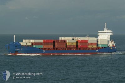
PHOENIX J
Container Ship
Current Trip
| Time Travelled | 1 day |
|---|---|
| Remaining Time | 2 days |
| Distance Travelled | 370.57 nm |
| Remaining Distance | 896.81 nm |
| AVG Speed | 13 Knots |
| MAX Speed | 14.2 Knots |
| AVG Wind | 8.6 knots |
| MAX Wind | 15.3 knots |
| MIN Temp | 11.1°C / 51.98°F |
| MAX Temp | 15.6°C / 60.08°F |
| Draught | 8 m |
| Position Received | 6 h, 53 m ago |
Current Position
| Longitude | --- |
|---|---|
| Latitude | --- |
| Status | Under way using engine |
| Speed | 13.3 Knots |
| Course | 156.5° |
| Area | Adriatic Sea |
| Station | T-AIS |
| Position Received | 6 h, 53 m ago |
Info
Information
The current position of PHOENIX J is in Adriatic Sea with coordinates 39.93277° / 18.83276° as reported on 2025-12-14 23:51 by AIS to our vessel tracker app. The vessel's current speed is 13.3 Knots and is heading at the port of SUEZ CANAL. The estimated time of arrival as calculated by MyShipTracking vessel tracking app is 2025-12-17 22:59 LT
The vessel PHOENIX J (IMO: 9504047, MMSI: 305648000) is a Container Ship that was built in 2010 ( 15 years old ). It's sailing under the flag of [AG] Antigua Barbuda.
In this page you can find informations about the vessels current position, last detected port calls, and current voyage information. If the vessels is not in coverage by AIS you will find the latest position.
The current position of PHOENIX J is detected by our AIS receivers and we are not responsible for the reliability of the data. The last position was recorded while the vessel was in Coverage by the Ais receivers of our vessel tracking app.
The current draught of PHOENIX J as reported by AIS is 8 meters
Weather
| Temperature | 15.7°C / 60.26°F |
|---|---|
| Wind Speed | 11 knots |
| Direction | 351° N |
| Pressure | 1024.8 hPa |
| Humidity | 61 % |
| Cloud Coverage | --- |
Featured Company
Last Port Calls
| Port | Arrival | Departure | Time In Port |
|---|---|---|---|
| 2025-12-13 08:07 | 2025-12-13 22:46 | 14 h | |
| 2025-12-09 07:23 | 2025-12-11 18:32 | 2 d | |
| 2025-12-03 00:12 | 2025-12-04 12:44 | 1 d | |
| 2025-11-26 11:23 | 2025-11-27 16:37 | 1 d | |
| 2025-11-23 21:00 | 2025-11-26 01:06 | 2 d | |
| 2025-11-17 11:38 | 2025-11-18 21:17 | 1 d | |
| 2025-11-12 10:10 | 2025-11-12 19:10 | 9 h | |
| 2025-11-10 07:19 | 2025-11-12 00:06 | 1 d | |
| 2025-11-02 23:50 | 2025-11-03 17:03 | 17 h | |
| 2025-10-28 17:46 | 2025-10-30 11:47 | 1 d |
Most Visited Ports (Last year)
| Port | Arrivals | |
|---|---|---|
| 11 | ||
| 10 | ||
| 9 | ||
| 9 | ||
| 9 | ||
| 7 |
Last Trips
| Origin | Departure | Destination | Arrival | Distance | |
|---|---|---|---|---|---|
| 2025-12-11 18:32 | 2025-12-13 08:07 | 135.19 nm | |||
| 2025-11-27 16:37 | 2025-12-09 07:23 | 2580.46 nm | |||
| 2025-11-27 16:37 | 2025-12-03 00:12 | 1234.96 nm | |||
| 2025-11-26 01:06 | 2025-11-26 11:23 | 131.86 nm | |||
| 2025-11-12 19:10 | 2025-11-23 21:00 | 2580.96 nm | |||
| 2025-11-12 19:10 | 2025-11-17 11:38 | 1233.33 nm | |||
| 2025-11-12 00:06 | 2025-11-12 10:10 | 139.34 nm | |||
| 2025-10-30 11:47 | 2025-11-10 07:19 | 2096.17 nm | |||
| 2025-10-30 11:47 | 2025-11-02 23:50 | 753.74 nm | |||
| 2025-10-24 03:26 | 2025-10-28 17:46 | 966.17 nm |
Events
| Time | Event | Details | Position / Dest | Info |
|---|---|---|---|---|
| 2025-12-14 23:58 | Status Changed | Default Under way using engine |
39.90910 / 18.84627
EGPSE
|
Speed: 13.3 kn Course: 156.5° |
| 2025-12-14 23:51 | OUT of Coverage |
39.93277 / 18.83276
Adriatic Sea
EGPSE
|
Speed: 13.3 kn Course: 156.5° |
|
| 2025-12-14 19:22 | Status Changed | Under way using engine Default |
40.80200 / 18.27867
EGPSE
|
Speed: 13.4 kn Course: 131° |
| 2025-12-14 18:52 | Status Changed | Default Under way using engine |
40.87400 / 18.16883
EGPSE
|
Speed: 13.2 kn Course: 133.8° |
| 2025-12-14 18:41 | Status Changed | Under way using engine Default |
40.90293 / 18.12925
EGPSE
|
Speed: 12.9 kn Course: 132° |
| 2025-12-14 18:20 | Status Changed | Default Under way using engine |
40.95550 / 18.05283
EGPSE
|
Speed: 13.2 kn Course: 132.7° |
| 2025-12-14 18:18 | Status Changed | Under way using engine Default |
40.95917 / 18.04750
EGPSE
|
Speed: 12.8 kn Course: 132° |
| 2025-12-14 17:40 | Status Changed | Default Under way using engine |
41.05028 / 17.91342
EGPSE
|
Speed: 12.5 kn Course: 131.6° |
| 2025-12-14 17:25 | Status Changed | Under way using engine Default |
41.08305 / 17.85881
EGPSE
|
Speed: 12.7 kn Course: 132° |
| 2025-12-14 16:39 | Status Changed | Default Under way using engine |
41.18614 / 17.69339
EGPSE
|
Speed: 12.9 kn Course: 130.1° |