

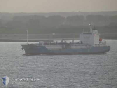
PGC EIRINI
Tanker

Current Trip
| Time Travelled | 2 days |
|---|---|
| Remaining Time | 1 day |
| Distance Travelled | 369.16 nm |
| Remaining Distance | 396.20 nm |
| AVG Speed | 11.6 Knots |
| MAX Speed | 13.8 Knots |
| AVG Wind | 6.1 knots |
| MAX Wind | 13.7 knots |
| MIN Temp | 10.5°C / 50.9°F |
| MAX Temp | 14.5°C / 58.1°F |
| Draught | 5 m |
| Position Received | 4 m ago |
Current Position
| Longitude | --- |
|---|---|
| Latitude | --- |
| Status | Under way using engine |
| Speed | 12.6 Knots |
| Course | 99.9° |
| Area | Adriatic Sea |
| Station | T-AIS |
| Position Received | 4 m ago |
Information
The current position of PGC EIRINI is in Adriatic Sea with coordinates 42.06004° / 16.50640° as reported on 2025-03-26 06:55 by AIS to our vessel tracker app. The vessel's current speed is 12.6 Knots and is heading at the port of AUGUSTA. The estimated time of arrival as calculated by MyShipTracking vessel tracking app is 2025-03-27 13:43 LT
The vessel PGC EIRINI (IMO: 9800178, MMSI: 248586000) is a Tanker It's sailing under the flag of [MT] Malta.
In this page you can find informations about the vessels current position, last detected port calls, and current voyage information. If the vessels is not in coverage by AIS you will find the latest position.
The current position of PGC EIRINI is detected by our AIS receivers and we are not responsible for the reliability of the data. The last position was recorded while the vessel was in Coverage by the Ais receivers of our vessel tracking app.
The current draught of PGC EIRINI as reported by AIS is 5 meters
Weather
| Temperature | 14.1°C / 57.38°F |
|---|---|
| Wind Speed | 10 knots |
| Direction | 305° NW |
| Pressure | 1010.5 hPa |
| Humidity | 93.1 % |
| Cloud Coverage | 100 % |


Featured Company
Last Port Calls
| Port | Arrival | Departure | Time In Port |
|---|---|---|---|
| 2025-03-22 10:46 | 2025-03-24 01:50 | 1 d | |
| 2025-03-18 09:46 | 2025-03-18 11:05 | 1 h | |
| 2025-03-16 22:26 | 2025-03-17 08:46 | 10 h | |
| 2025-03-12 22:57 | 2025-03-14 14:13 | 1 d | |
| 2025-03-07 20:21 | 2025-03-09 12:22 | 1 d | |
| 2025-03-04 22:03 | 2025-03-05 18:22 | 20 h | |
| 2025-03-01 13:36 | 2025-03-02 16:51 | 1 d | |
| 2025-02-26 15:37 | 2025-02-28 10:28 | 1 d | |
| 2025-02-21 08:25 | 2025-02-22 14:54 | 1 d | |
| 2025-02-18 17:34 | 2025-02-20 01:16 | 1 d |
Last Trips
| Origin | Departure | Destination | Arrival | Distance | |
|---|---|---|---|---|---|
| 2025-03-18 11:05 | 2025-03-22 10:46 | 778.16 nm | |||
| 2025-03-17 08:46 | 2025-03-18 09:46 | 1.72 nm | |||
| 2025-03-14 14:13 | 2025-03-16 22:26 | 646.26 nm | |||
| 2025-03-09 12:22 | 2025-03-12 22:57 | 652.74 nm | |||
| 2025-03-05 18:22 | 2025-03-07 20:21 | 651.86 nm | |||
| 2025-03-02 16:51 | 2025-03-04 22:03 | 356.23 nm | |||
| 2025-02-28 10:28 | 2025-03-01 13:36 | 357.32 nm | |||
| 2025-02-22 14:54 | 2025-02-26 15:37 | 965.82 nm | |||
| 2025-02-20 01:16 | 2025-02-21 08:25 | 359.99 nm | |||
| 2025-02-16 02:51 | 2025-02-18 17:34 | 324.75 nm |
Events
| Time | Event | Details | Position / Dest | Info |
|---|---|---|---|---|
| 2025-03-26 03:22 | Detected in Sea | Italian part of the Adriatic Sea |
42.51303 / 15.67106
Adriatic Sea
ITAUG
|
Speed: 13.5 kn Course: 133.2° |
| 2025-03-25 23:55 | Change Sea Area | Croatian part of the Adriatic Sea Italian part of the Adriatic Sea |
43.05437 / 14.96156
Adriatic Sea
ITAUG
|
Speed: 12.9 kn Course: 137° |
| 2025-03-25 23:55 | IN Coverage |
43.05437 / 14.96156
Adriatic Sea
ITAUG
|
Speed: 12.9 kn Course: 137° |
|
| 2025-03-25 23:52 | Status Changed | Under way using engine Default |
43.06129 / 14.95271
ITAUG
|
Speed: 13 kn Course: 135° |
| 2025-03-25 18:42 | Status Changed | Default Under way using engine |
43.85772 / 13.87746
ITAUG
|
Speed: 13 kn Course: 127.1° |
| 2025-03-25 18:39 | Status Changed | Under way using engine Default |
43.86427 / 13.86560
ITAUG
|
Speed: 13 kn Course: 127° |
| 2025-03-25 18:39 | OUT of Coverage |
43.86427 / 13.86560
Adriatic Sea
ITAUG
|
Speed: 13 kn Course: 127.1° |
|
| 2025-03-25 18:38 | Status Changed | Default Under way using engine |
43.86653 / 13.86149
ITAUG
|
Speed: 13 kn Course: 126.6° |
| 2025-03-25 16:03 | Status Changed | Under way using engine Default |
44.19178 / 13.23482
ITAUG
|
Speed: 13.3 kn Course: 138° |
| 2025-03-25 15:58 | IN Coverage |
44.17959 / 13.25154
Adriatic Sea
ITAUG
|
Speed: 13.2 kn Course: 128.1° |