
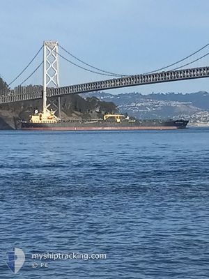
PELAGIC TURBOT
Oil Products Tanker
Current Trip
| Trip Time | 55 days |
|---|---|
| Trip Distance | 2654.55 nm |
| AVG Speed | 9.2 Knots |
| MAX Speed | 13.8 Knots |
| Draught | 7.9 m |
| AVG Wind | 9.4 knots |
| MAX Wind | 25 knots |
| MIN Temp | 19.2°C / 66.56°F |
| MAX Temp | 32.6°C / 90.68°F |
| Position Received | 5 d ago |
Current Position
| Longitude | --- |
|---|---|
| Latitude | --- |
| Status | At anchor |
| Speed | 0.1 Knots |
| Course | 30° |
| Area | North Pacific Ocean |
| Station | T-AIS |
| Position Received | 5 d ago |
Info
Information
The current position of PELAGIC TURBOT is in North Pacific Ocean with coordinates 16.10548° / -95.15752° as reported on 2025-02-11 19:43 by AIS to our vessel tracker app. The vessel's current speed is 0.1 Knots and is currently inside the port of SALINA CRUZ.
The vessel PELAGIC TURBOT (IMO: 9550709, MMSI: 210063000) is a Oil Products Tanker that was built in 2009 ( 16 years old ). It's sailing under the flag of [CY] Cyprus.
In this page you can find informations about the vessels current position, last detected port calls, and current voyage information. If the vessels is not in coverage by AIS you will find the latest position.
The current position of PELAGIC TURBOT is detected by our AIS receivers and we are not responsible for the reliability of the data. The last position was recorded while the vessel was in Coverage by the Ais receivers of our vessel tracking app.
The current draught of PELAGIC TURBOT as reported by AIS is 7.9 meters
Weather
| Temperature | 24.4°C / 75.92°F |
|---|---|
| Wind Speed | 8 knots |
| Direction | 351° N |
| Pressure | 1013.3 hPa |
| Humidity | 69.1 % |
| Cloud Coverage | 49 % |
Featured Company
Last Port Calls
| Port | Arrival | Departure | Time In Port |
|---|---|---|---|
| 2025-02-14 19:03 | |||
| 2024-12-20 08:26 | 2024-12-21 08:29 | 1 d |
Most Visited Ports (Last year)
| Port | Arrivals | |
|---|---|---|
| 3 | ||
| 2 | ||
| 1 | ||
| 1 | ||
| 1 | ||
| 1 |
Last Trips
| Origin | Departure | Destination | Arrival | Distance | |
|---|---|---|---|---|---|
| 2024-12-21 03:29 | 2025-02-14 13:03 | 2654.55 nm | |||
| 2024-11-22 19:07 | 2024-12-20 03:26 | 973.45 nm |
Events
| Time | Event | Details | Position / Dest | Info |
|---|---|---|---|---|
| 2025-02-14 19:23 | STOP Moving |
16.15542 / -95.20779
[MX] SALINA CRUZ
|
Speed: 0.3 kn Course: 324° |
|
| 2025-02-14 19:03 | PORT ARRIVAL |
|
16.15329 / -95.20723
[MX] SALINA CRUZ
|
Speed: 5.2 kn Course: 320° |
| 2025-02-14 17:35 | START Moving | 3.81 nm, South East of SALINA CRUZ |
16.10171 / -95.16127
BALBOA
|
Speed: 3.3 kn Course: 306° |
| 2025-02-11 19:52 | Status Changed | Default At anchor |
16.10546 / -95.15746
BALBOA
|
Speed: 0.1 kn Course: 30° |
| 2025-02-11 19:43 | Status Changed | At anchor Default |
16.10548 / -95.15752
BALBOA
|
Speed: 0.2 kn Course: 27° |
| 2025-02-11 19:43 | OUT of Coverage |
16.10548 / -95.15752
North Pacific Ocean
|
Speed: 0.1 kn Course: 8.5° |
|
| 2025-02-11 19:13 | Status Changed | Default At anchor |
16.10503 / -95.15688
BALBOA
|
Speed: 0.1 kn Course: 354° |
| 2025-02-11 18:34 | Status Changed | At anchor Default |
16.10501 / -95.15641
BALBOA
|
Speed: 0.1 kn Course: 344° |
| 2025-02-11 18:13 | Status Changed | Default At anchor |
16.10489 / -95.15639
BALBOA
|
Speed: 0.1 kn Course: 344° |
| 2025-02-11 18:07 | Detected in Sea | Mexican part of the North Pacific Ocean |
16.10492 / -95.15642
North Pacific Ocean
|
Speed: 0.1 kn Course: 317.9° |