

PAQIZE
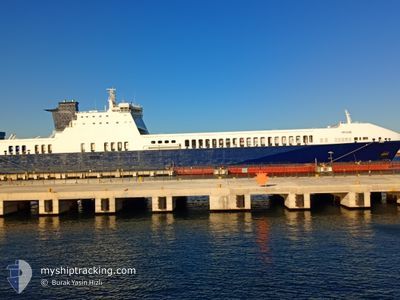
Ro-Ro Cargo

Current Trip
FRSET
| Time Travelled | 10 h, 34 mins |
|---|---|
| Remaining Time | --- |
| Distance Travelled | 174.00 nm |
| Remaining Distance | --- |
| AVG Speed | 18.8 Knots |
| MAX Speed | 19.5 Knots |
| AVG Wind | 6.2 knots |
| MAX Wind | 11 knots |
| MIN Temp | 13.5°C / 56.3°F |
| MAX Temp | 17°C / 62.6°F |
| Draught | 6.5 m |
| Position Received | 1 h, 12 m ago |
Current Position
| Longitude | --- |
|---|---|
| Latitude | --- |
| Status | Under way using engine |
| Speed | 19.1 Knots |
| Course | 118.2° |
| Area | Mediterranean Sea - Western Basin |
| Station | T-AIS |
| Position Received | 1 h, 12 m ago |
Information
The current position of PAQIZE is in Mediterranean Sea - Western Basin with coordinates 41.99263° / 7.21763° as reported on 2025-03-25 23:37 by AIS to our vessel tracker app. The vessel's current speed is 19.1 Knots
The vessel PAQIZE (IMO: 9457206, MMSI: 256263000) is a Ro-Ro Cargo that was built in 2010 ( 15 years old ). It's sailing under the flag of [MT] Malta.
In this page you can find informations about the vessels current position, last detected port calls, and current voyage information. If the vessels is not in coverage by AIS you will find the latest position.
The current position of PAQIZE is detected by our AIS receivers and we are not responsible for the reliability of the data. The last position was recorded while the vessel was in Coverage by the Ais receivers of our vessel tracking app.
The current draught of PAQIZE as reported by AIS is 6.5 meters
Weather
| Temperature | 13.8°C / 56.84°F |
|---|---|
| Wind Speed | 4 knots |
| Direction | 315° NW |
| Pressure | 1016 hPa |
| Humidity | 74.9 % |
| Cloud Coverage | 60 % |


Featured Company
Last Port Calls
| Port | Arrival | Departure | Time In Port |
|---|---|---|---|
| 2025-03-25 05:46 | 2025-03-25 14:16 | 8 h | |
| 2025-03-21 13:48 | 2025-03-22 01:08 | 11 h | |
| 2025-03-20 18:54 | 2025-03-21 09:08 | 14 h | |
| 2025-03-16 13:17 | 2025-03-16 20:40 | 7 h | |
| 2025-03-12 16:42 | 2025-03-13 03:16 | 10 h | |
| 2025-03-11 03:32 | 2025-03-11 05:34 | 2 h | |
| 2025-03-08 12:45 | 2025-03-08 21:42 | 8 h | |
| 2025-03-04 04:14 | 2025-03-05 01:32 | 21 h | |
| 2025-02-27 14:13 | 2025-02-27 21:48 | 7 h | |
| 2025-02-24 00:33 | 2025-02-24 09:53 | 9 h |
Last Trips
| Origin | Departure | Destination | Arrival | Distance | |
|---|---|---|---|---|---|
| 2025-03-22 04:08 | 2025-03-25 06:46 | 1390.26 nm | |||
| 2025-03-21 12:08 | 2025-03-21 16:48 | 72.83 nm | |||
| 2025-03-16 21:40 | 2025-03-20 21:54 | 1452.18 nm | |||
| 2025-03-13 06:16 | 2025-03-16 14:17 | 1454.26 nm | |||
| 2025-03-11 07:34 | 2025-03-12 19:42 | 626.58 nm | |||
| 2025-03-08 22:42 | 2025-03-11 05:32 | 948.44 nm | |||
| 2025-03-05 04:32 | 2025-03-08 13:45 | 1456.08 nm | |||
| 2025-02-27 22:48 | 2025-03-04 07:14 | 1459.99 nm | |||
| 2025-02-24 12:53 | 2025-02-27 15:13 | 1460.04 nm | |||
| 2025-02-20 15:18 | 2025-02-24 03:33 | 1452.08 nm |
Events
| Time | Event | Details | Position / Dest | Info |
|---|---|---|---|---|
| 2025-03-25 23:37 | OUT of Coverage |
41.99263 / 7.21763
Mediterranean Sea - Western Basin
|
Speed: 19.1 kn Course: 118.2° |
|
| 2025-03-25 21:35 | Status Changed | Under way using engine Default |
42.28243 / 6.43814
FRSET
|
Speed: 18.9 kn Course: 116° |
| 2025-03-25 21:33 | Status Changed | Default Under way using engine |
42.28668 / 6.42648
FRSET
|
Speed: 19 kn Course: 116.5° |
| 2025-03-25 20:46 | Status Changed | Under way using engine Default |
42.39260 / 6.12213
FRSET
|
Speed: 19 kn Course: 115° |
| 2025-03-25 20:40 | Status Changed | Default Under way using engine |
42.40509 / 6.08446
FRSET
|
Speed: 19.1 kn Course: 113.8° |
| 2025-03-25 20:00 | Status Changed | Under way using engine Default |
42.49302 / 5.81720
FRSET
|
Speed: 18.8 kn Course: 114° |
| 2025-03-25 19:51 | Status Changed | Default Under way using engine |
42.51186 / 5.75921
FRSET
|
Speed: 19 kn Course: 113.3° |
| 2025-03-25 19:12 | IN Coverage |
42.59223 / 5.51573
Mediterranean Sea - Western Basin
|
Speed: 18.8 kn Course: 116.1° |
|
| 2025-03-25 19:11 | Status Changed | Under way using engine Default |
42.59728 / 5.50068
FRSET
|
Speed: 18.8 kn Course: 114° |
| 2025-03-25 14:16 | PORT DEPARTURE |
|
43.37741 / 3.76431
FRSET
|
Speed: 7.6 kn Course: 88° |