

PANDA 006
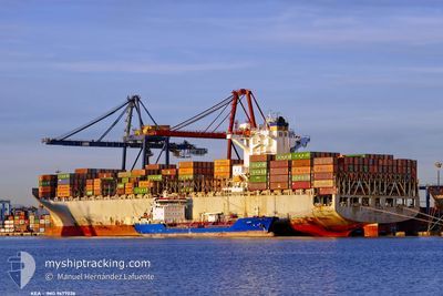
Container Ship

Current Trip
SIN PEBGB
| Time Travelled | 27 days |
|---|---|
| Remaining Time | --- |
| Distance Travelled | 12588.18 nm |
| Remaining Distance | --- |
| AVG Speed | 18.7 Knots |
| MAX Speed | 22.7 Knots |
| AVG Wind | 9.9 knots |
| MAX Wind | 26.8 knots |
| MIN Temp | 7°C / 44.6°F |
| MAX Temp | 29.5°C / 85.1°F |
| Draught | 9.9 m |
| Position Received | 4 m ago |
Current Position
| Longitude | --- |
|---|---|
| Latitude | --- |
| Status | At anchor |
| Speed | |
| Course | 106° |
| Area | Singapore Strait |
| Station | T-AIS |
| Position Received | 4 m ago |
Information
The current position of PANDA 006 is in Singapore Strait with coordinates 1.24665° / 103.89145° as reported on 2025-03-23 07:36 by AIS to our vessel tracker app. The vessel's current speed is 0 Knots
The vessel PANDA 006 (IMO: 9677026, MMSI: 636015872) is a Container Ship that was built in 2013 ( 12 years old ). It's sailing under the flag of [LR] Liberia.
In this page you can find informations about the vessels current position, last detected port calls, and current voyage information. If the vessels is not in coverage by AIS you will find the latest position.
The current position of PANDA 006 is detected by our AIS receivers and we are not responsible for the reliability of the data. The last position was recorded while the vessel was in Coverage by the Ais receivers of our vessel tracking app.
The current draught of PANDA 006 as reported by AIS is 9.9 meters
Weather
| Temperature | 29.3°C / 84.74°F |
|---|---|
| Wind Speed | 6 knots |
| Direction | 33° NNE |
| Pressure | 1008.8 hPa |
| Humidity | 70.3 % |
| Cloud Coverage | 100 % |


Featured Company
Last Port Calls
| Port | Arrival | Departure | Time In Port |
|---|---|---|---|
| 2025-02-23 01:19 | 2025-02-24 05:39 | 1 d | |
| 2025-02-19 07:52 | 2025-02-20 16:17 | 1 d | |
| 2025-02-12 13:00 | 2025-02-13 23:11 | 1 d | |
| 2025-01-17 15:15 | 2025-01-18 16:11 | 1 d | |
| 2025-01-08 23:29 | 2025-01-09 17:41 | 18 h | |
| 2025-01-05 04:57 | 2025-01-06 13:53 | 1 d | |
| 2025-01-02 08:05 | 2025-01-02 20:57 | 12 h |
Last Trips
| Origin | Departure | Destination | Arrival | Distance | |
|---|---|---|---|---|---|
| 2025-02-20 16:17 | 2025-02-23 01:19 | 138.89 nm | |||
| 2025-02-13 23:11 | 2025-02-19 07:52 | 1561.33 nm | |||
| 2025-01-18 16:11 | 2025-02-12 13:00 | 10041.84 nm | |||
| 2025-01-09 17:41 | 2025-01-17 15:15 | 3165.59 nm | |||
| 2025-01-06 13:53 | 2025-01-08 23:29 | 784.75 nm | |||
| 2025-01-02 20:57 | 2025-01-05 04:57 | 528.63 nm | |||
| 2024-11-25 14:17 | 2025-01-02 08:05 | 12845.89 nm |
Events
| Time | Event | Details | Position / Dest | Info |
|---|---|---|---|---|
| 2025-03-23 07:02 | Draught Changed | 9.9 10 |
1.24635 / 103.89148
SIN PEBGB
|
Speed: 0.2 kn Course: 92° |
| 2025-03-23 06:39 | Status Changed | At anchor Under way using engine |
1.24590 / 103.89157
SIN PEBGB
|
Speed: 0.4 kn Course: 81° |
| 2025-03-23 06:05 | STOP Moving | 2.59 nm, East of SINGAPORE |
1.24444 / 103.89556
SIN PEBGB
|
Speed: 0.3 kn Course: 336° |
| 2025-03-23 05:04 | Change Sea Area | Singaporean part of the Singapore Strait Indonesian part of the Singapore Strait |
1.25148 / 103.98168
Singapore Strait
SIN PEBGB
|
Speed: 6.8 kn Course: 327.5° |
| 2025-03-23 04:56 | ETA Changed | 2025/03/23 05:15 2025/03/23 05:00 |
1.24065 / 103.98098
SIN PEBGB
|
Speed: 2.9 kn Course: 47° |
| 2025-03-23 04:54 | START Moving | 4.1 nm, North of BATU AMPAR |
1.23900 / 103.97973
SIN PEBGB
|
Speed: 3.2 kn Course: 36° |
| 2025-03-23 04:41 | STOP Moving | 4.01 nm, North of BATU AMPAR |
1.23725 / 103.97899
SIN PEBGB
|
Speed: 0.3 kn Course: 7° |
| 2025-03-23 00:57 | Change Sea Area | Indonesian part of the Singapore Strait Indonesian part of the Malacca Strait |
1.17275 / 103.42857
Singapore Strait
SIN PEBGB
|
Speed: 14.2 kn Course: 133.6° |
| 2025-03-23 00:44 | Destination Changed | SIN PEBGB CNTAO |
1.20904 / 103.38878
SIN PEBGB
|
Speed: 15.2 kn Course: 135.5° |
| 2025-03-23 00:44 | ETA Changed | 2025/03/23 05:00 2025/03/28 15:30 |
1.20904 / 103.38878
SIN PEBGB
|
Speed: 15.2 kn Course: 135.5° |