
PALOMA
Fishing
Current Trip
HAMBURG
| Time Travelled | 2 days |
|---|---|
| Remaining Time | --- |
| Distance Travelled | 115.48 nm |
| Remaining Distance | --- |
| AVG Speed | 6.4 Knots |
| MAX Speed | 8.3 Knots |
| AVG Wind | 7.3 knots |
| MAX Wind | 13 knots |
| MIN Temp | 6.9°C / 44.42°F |
| MAX Temp | 12.9°C / 55.22°F |
| Draught | 2.4 m |
| Position Received | 18 m ago |
Current Position
| Longitude | --- |
|---|---|
| Latitude | --- |
| Status | Moored |
| Speed | 5.2 Knots |
| Course | 299.6° |
| Area | North Sea |
| Station | T-AIS |
| Position Received | 18 m ago |
Info
Information
The current position of PALOMA is in North Sea with coordinates 52.41489° / 9.71889° as reported on 2025-12-09 14:37 by AIS to our vessel tracker app. The vessel's current speed is 5.2 Knots
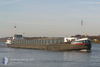
The vessel PALOMA (MMSI: 211188900) is a Fishing It's sailing under the flag of [DE] Germany.
In this page you can find informations about the vessels current position, last detected port calls, and current voyage information. If the vessels is not in coverage by AIS you will find the latest position.
The current position of PALOMA is detected by our AIS receivers and we are not responsible for the reliability of the data. The last position was recorded while the vessel was in Coverage by the Ais receivers of our vessel tracking app.
The current draught of PALOMA as reported by AIS is 2.4 meters
Weather
| Temperature | 12.6°C / 54.68°F |
|---|---|
| Wind Speed | 7 knots |
| Direction | 185° S |
| Pressure | 1011.8 hPa |
| Humidity | 77.1 % |
| Cloud Coverage | 100 % |
Featured Company
Last Port Calls
| Port | Arrival | Departure | Time In Port |
|---|---|---|---|
| 2025-12-04 17:19 | 2025-12-07 14:20 | 2 d | |
| 2025-12-01 13:17 | 2025-12-02 12:51 | 23 h | |
| 2025-11-29 14:53 | 2025-11-29 15:10 | 17 m | |
| 2025-11-25 14:18 | 2025-11-28 09:37 | 2 d | |
| 2025-11-24 20:44 | 2025-11-25 07:18 | 10 h | |
| 2025-11-18 18:25 | 2025-11-21 08:35 | 2 d | |
| 2025-11-14 08:17 | 2025-11-17 12:08 | 3 d | |
| 2025-11-08 16:46 | 2025-11-08 17:49 | 1 h | |
| 2025-11-07 15:45 | 2025-11-08 13:55 | 22 h | |
| 2025-11-06 18:42 | 2025-11-07 13:08 | 18 h |
Most Visited Ports (Last year)
| Port | Arrivals | |
|---|---|---|
| 23 | ||
| 14 | ||
| 13 | ||
| 3 | ||
| 3 | ||
| 1 |
Last Trips
| Origin | Departure | Destination | Arrival | Distance | |
|---|---|---|---|---|---|
| 2025-12-02 12:51 | 2025-12-04 17:19 | 123.97 nm | |||
| 2025-11-29 15:10 | 2025-12-01 13:17 | 81.69 nm | |||
| 2025-11-28 09:37 | 2025-11-29 14:53 | 53.34 nm | |||
| 2025-11-25 07:18 | 2025-11-25 14:18 | 24.07 nm | |||
| 2025-11-21 08:35 | 2025-11-24 20:44 | 200.50 nm | |||
| 2025-11-17 12:08 | 2025-11-18 18:25 | 89.57 nm | |||
| 2025-11-08 17:49 | 2025-11-14 08:17 | 164.71 nm | |||
| 2025-11-08 13:55 | 2025-11-08 16:46 | 12.98 nm | |||
| 2025-11-07 13:08 | 2025-11-07 15:45 | 18.90 nm | |||
| 2025-11-01 07:44 | 2025-11-06 18:42 | 239.90 nm |
Events
| Time | Event | Details | Position / Dest | Info |
|---|---|---|---|---|
| 2025-12-09 14:29 | IN Coverage |
52.40785 / 9.73929
North Sea
|
Speed: 5.8 kn Course: 298.8° |
|
| 2025-12-09 07:57 | OUT of Coverage |
52.31204 / 10.46424
North Sea
|
Speed: 6.5 kn Course: 261.3° |
|
| 2025-12-09 07:54 | IN Coverage |
52.31254 / 10.46855
North Sea
|
Speed: 6.5 kn Course: 257° |
|
| 2025-12-08 17:50 | Status Changed | Default Moored |
52.50834 / 10.66667
HAMBURG
|
Speed: 5.7 kn Course: 160.2° |
| 2025-12-08 17:43 | OUT of Coverage |
52.51973 / 10.66106
North Sea
|
Speed: 5.7 kn Course: 160.2° |
|
| 2025-12-08 17:00 | IN Coverage |
52.57983 / 10.67674
North Sea
|
Speed: 5.8 kn Course: 187.6° |
|
| 2025-12-08 12:14 | STOP Moving | 4.36 nm, South of UELZEN |
52.91500 / 10.61167
HAMBURG
|
Speed: Course: -1° |
| 2025-12-08 08:50 | Status Changed | Default Moored |
53.19500 / 10.49833
HAMBURG
|
Speed: 5.8 kn Course: 170.4° |
| 2025-12-08 08:31 | OUT of Coverage |
53.22663 / 10.49080
North Sea
|
Speed: 5.8 kn Course: 170.4° |
|
| 2025-12-08 07:52 | Status Changed | Moored Default |
53.28690 / 10.48812
HAMBURG
|
Speed: Course: -1° |