

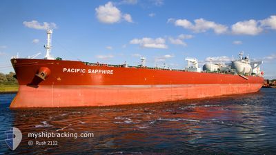
PACIFIC SAPPHIRE
Tanker

Current Trip
| Time Travelled | 14 days |
|---|---|
| Remaining Time | --- |
| Distance Travelled | 1574.34 nm |
| Remaining Distance | --- |
| AVG Speed | 10.4 Knots |
| MAX Speed | 14 Knots |
| AVG Wind | 15.2 knots |
| MAX Wind | 23 knots |
| MIN Temp | -4.3°C / 24.26°F |
| MAX Temp | 7.5°C / 45.5°F |
| Draught | 8.8 m |
| Position Received | 2 m ago |
Current Position
| Longitude | --- |
|---|---|
| Latitude | --- |
| Status | At anchor |
| Speed | 0.1 Knots |
| Course | 181° |
| Area | Kattegat |
| Station | T-AIS |
| Position Received | 2 m ago |
Information
The current position of PACIFIC SAPPHIRE is in Kattegat with coordinates 57.56936° / 11.58084° as reported on 2025-02-20 08:47 by AIS to our vessel tracker app. The vessel's current speed is 0.1 Knots
The vessel PACIFIC SAPPHIRE (IMO: 9893058, MMSI: 538009200) is a Tanker It's sailing under the flag of [MH] Marshall Is.
In this page you can find informations about the vessels current position, last detected port calls, and current voyage information. If the vessels is not in coverage by AIS you will find the latest position.
The current position of PACIFIC SAPPHIRE is detected by our AIS receivers and we are not responsible for the reliability of the data. The last position was recorded while the vessel was in Coverage by the Ais receivers of our vessel tracking app.
The current draught of PACIFIC SAPPHIRE as reported by AIS is 8.8 meters
Weather
| Temperature | 0.6°C / 33.08°F |
|---|---|
| Wind Speed | 23 knots |
| Direction | 151° SSE |
| Pressure | 1026.3 hPa |
| Humidity | 86.3 % |
| Cloud Coverage | 100 % |


Featured Company
Last Port Calls
| Port | Arrival | Departure | Time In Port |
|---|---|---|---|
| 2025-02-04 06:49 | 2025-02-05 18:50 | 1 d | |
| 2025-01-30 06:33 | 2025-01-31 18:15 | 1 d | |
| 2025-01-08 08:26 | 2025-01-09 22:39 | 1 d | |
| 2025-01-01 15:36 | 2025-01-03 15:21 | 1 d | |
| 2024-12-11 12:52 | 2024-12-12 15:13 | 1 d | |
| 2024-12-05 00:51 | 2024-12-06 07:31 | 1 d |
Most Visited Ports (Last year)
| Port | Arrivals | |
|---|---|---|
| 4 | ||
| 4 | ||
| 3 | ||
| 3 | ||
| 2 | ||
| 2 |
Last Trips
| Origin | Departure | Destination | Arrival | Distance | |
|---|---|---|---|---|---|
| 2025-01-31 18:15 | 2025-02-04 07:49 | 631.95 nm | |||
| 2025-01-09 16:39 | 2025-01-30 06:33 | 5296.35 nm | |||
| 2025-01-03 09:21 | 2025-01-08 02:26 | 228.47 nm | |||
| 2024-12-12 15:13 | 2025-01-01 09:36 | 5042.17 nm | |||
| 2024-12-06 07:31 | 2024-12-11 12:52 | 277.28 nm | |||
| 2024-11-25 14:42 | 2024-12-05 00:51 | 863.75 nm |
Events
| Time | Event | Details | Position / Dest | Info |
|---|---|---|---|---|
| 2025-02-17 22:22 | STOP Moving | 6.35 nm, West of VRANGO |
57.56427 / 11.58193
GOTHENBURG
|
Speed: Course: 338° |
| 2025-02-17 22:21 | START Moving | 6.35 nm, West of VRANGO |
57.56427 / 11.58194
GOTHENBURG
|
Speed: 6.7 kn Course: 219.4° |
| 2025-02-17 14:54 | Status Changed | At anchor Default |
57.56468 / 11.58338
GOTHENBURG
|
Speed: Course: 317° |
| 2025-02-17 14:51 | Status Changed | Default At anchor |
57.56472 / 11.58340
GOTHENBURG
|
Speed: Course: 316° |
| 2025-02-16 13:18 | Status Changed | At anchor Default |
57.56627 / 11.58394
GOTHENBURG
|
Speed: Course: 265° |
| 2025-02-16 13:15 | Status Changed | Default At anchor |
57.56625 / 11.58399
GOTHENBURG
|
Speed: Course: 265° |
| 2025-02-14 05:06 | Status Changed | At anchor Under way using engine |
57.56710 / 11.57958
GOTHENBURG
|
Speed: 0.3 kn Course: 113° |
| 2025-02-14 05:03 | STOP Moving | 6.4 nm, West of VRANGO |
57.56701 / 11.57997
GOTHENBURG
|
Speed: 0.2 kn Course: 111° |
| 2025-02-13 23:20 | Change Sea Area | Swedish part of the Kattegat Danish part of the Kattegat |
56.81917 / 11.90116
Kattegat
GOTHENBURG
|
Speed: 11.3 kn Course: 343.3° |
| 2025-02-13 15:04 | Destination Changed | GOTHENBURG SKAW,DENMARK |
55.49350 / 10.90320
GOTHENBURG
|
Speed: 13.6 kn Course: 328.4° |