
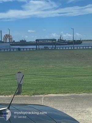
PACIFIC DAWN
Tug
Current Trip
| Trip Time | 3 days |
|---|---|
| Trip Distance | 462.51 nm |
| AVG Speed | 4.7 Knots |
| MAX Speed | 9 Knots |
| Draught | 3.7 m |
| AVG Wind | 12.5 knots |
| MAX Wind | 22.7 knots |
| MIN Temp | 16.4°C / 61.52°F |
| MAX Temp | 23.3°C / 73.94°F |
| Position Received | 9 h, 0 m ago |
Current Position
| Longitude | --- |
|---|---|
| Latitude | --- |
| Status | Under way using engine |
| Speed | 4.4 Knots |
| Course | 26° |
| Area | Gulf of Mexico |
| Station | T-AIS |
| Position Received | 9 h, 0 m ago |
Info
Information
The current position of PACIFIC DAWN is in Gulf of Mexico with coordinates 30.35955° / -87.22790° as reported on 2026-01-06 14:01 by AIS to our vessel tracker app. The vessel's current speed is 4.4 Knots and is currently inside the port of PENSACOLA.
The vessel PACIFIC DAWN (IMO: 7400467, MMSI: 366847780) is a Tug that was built in 1974 ( 52 years old ). It's sailing under the flag of [US] USA.
In this page you can find informations about the vessels current position, last detected port calls, and current voyage information. If the vessels is not in coverage by AIS you will find the latest position.
The current position of PACIFIC DAWN is detected by our AIS receivers and we are not responsible for the reliability of the data. The last position was recorded while the vessel was in Coverage by the Ais receivers of our vessel tracking app.
The current draught of PACIFIC DAWN as reported by AIS is 3.7 meters
Weather
| Temperature | 22°C / 71.6°F |
|---|---|
| Wind Speed | 8 knots |
| Direction | 234° SW |
| Pressure | 1014.8 hPa |
| Humidity | 69.6 % |
| Cloud Coverage | 63 % |
Featured Company
Last Port Calls
| Port | Arrival | Departure | Time In Port |
|---|---|---|---|
| 2026-01-06 08:45 | |||
| 2026-01-01 11:06 | 2026-01-02 10:43 | 23 h | |
| 2025-12-24 10:28 | 2025-12-24 13:31 | 3 h | |
| 2025-12-23 16:21 | 2025-12-23 17:33 | 1 h | |
| 2025-12-20 07:03 | 2025-12-21 10:31 | 1 d | |
| 2025-12-17 02:22 | 2025-12-17 03:02 | 40 m | |
| 2025-12-16 02:05 | 2025-12-17 00:48 | 22 h | |
| 2025-12-12 15:45 | 2025-12-12 16:46 | 1 h | |
| 2025-12-09 08:46 | 2025-12-10 09:33 | 1 d | |
| 2025-12-05 22:02 | 2025-12-05 22:58 | 56 m |
Most Visited Ports (Last year)
| Port | Arrivals | |
|---|---|---|
| 42 | ||
| 40 | ||
| 22 | ||
| 4 | ||
| 1 | ||
| 1 |
Last Trips
| Origin | Departure | Destination | Arrival | Distance | |
|---|---|---|---|---|---|
| 2026-01-02 10:43 | 2026-01-06 08:45 | 462.51 nm | |||
| 2025-12-24 13:31 | 2026-01-01 11:06 | 5.78 nm | |||
| 2025-12-23 17:33 | 2025-12-24 10:28 | 15.51 nm | |||
| 2025-12-21 10:31 | 2025-12-23 16:21 | 400.53 nm | |||
| 2025-12-17 03:02 | 2025-12-20 07:03 | 402.15 nm | |||
| 2025-12-17 00:48 | 2025-12-17 02:22 | 7.00 nm | |||
| 2025-12-12 16:46 | 2025-12-16 02:05 | 35.35 nm | |||
| 2025-12-10 09:33 | 2025-12-12 15:45 | 402.83 nm | |||
| 2025-12-05 22:58 | 2025-12-09 08:46 | 404.70 nm | |||
| 2025-12-05 20:28 | 2025-12-05 22:02 | 6.85 nm |
Events
| Time | Event | Details | Position / Dest | Info |
|---|---|---|---|---|
| 2026-01-06 14:48 | STOP Moving |
30.40167 / -87.21167
[US] PENSACOLA
|
Speed: Course: -1° |
|
| 2026-01-06 14:45 | PORT ARRIVAL |
|
30.40200 / -87.21227
[US] PENSACOLA
|
Speed: 9 kn Course: 349° |
| 2026-01-06 14:06 | Status Changed | Default Under way using engine |
30.36167 / -87.22667
XX XXX>
|
Speed: 4.4 kn Course: 26° |
| 2026-01-06 14:01 | OUT of Coverage |
30.35955 / -87.22790
Gulf of Mexico
[US] PENSACOLA
|
Speed: 4.4 kn Course: 27.7° |
|
| 2026-01-06 14:01 | Status Changed | Under way using engine Default |
30.35935 / -87.22802
XX XXX>
|
Speed: 5 kn Course: 38° |
| 2026-01-06 13:57 | Status Changed | Default Under way using engine |
30.35333 / -87.23167
XX XXX>
|
Speed: 5.3 kn Course: 30.5° |
| 2026-01-06 11:57 | Status Changed | Under way using engine Default |
30.27460 / -87.29910
XX XXX>
|
Speed: 5 kn Course: 14° |
| 2026-01-06 11:48 | Status Changed | Default Under way using engine |
30.26167 / -87.30334
XX XXX>
|
Speed: 4.6 kn Course: 356° |
| 2026-01-06 11:35 | Destination Changed | XX XXX> PENSACOLA |
30.25723 / -87.29598
XX XXX>
|
Speed: 2.6 kn Course: 273° |
| 2026-01-06 11:28 | Status Changed | Under way using engine Default |
30.25542 / -87.29143
PENSACOLA
|
Speed: 3 kn Course: -1° |