
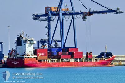
PACIFIC DALIAN
Container Ship
Current Trip
| Time Travelled | 1 day |
|---|---|
| Remaining Time | 7 h, 39 mins |
| Distance Travelled | 390.62 nm |
| Remaining Distance | 139.36 nm |
| AVG Speed | 16.3 Knots |
| MAX Speed | 17 Knots |
| AVG Wind | 14.6 knots |
| MAX Wind | 23.4 knots |
| MIN Temp | 17°C / 62.6°F |
| MAX Temp | 21.3°C / 70.34°F |
| Draught | 6.1 m |
| Position Received | 1 h, 0 m ago |
Current Position
| Longitude | 30.64800° |
|---|---|
| Latitude | 35.43974° |
| Status | Under way using engine |
| Speed | 15.6 Knots |
| Course | 118.3° |
| Area | Mediterranean Sea - Eastern Basin |
| Station | T-AIS |
| Position Received | 1 h, 0 m ago |
Info
Information
The current position of PACIFIC DALIAN is in Mediterranean Sea - Eastern Basin with coordinates 35.43974° / 30.64800° as reported on 2024-04-29 19:55 by AIS to our vessel tracker app. The vessel's current speed is 15.6 Knots and is heading at the port of LIMASSOL. The estimated time of arrival as calculated by MyShipTracking vessel tracking app is 2024-04-30 04:34 LT
The vessel PACIFIC DALIAN (IMO: 9339090, MMSI: 563159400) is a Container Ship that was built in 2008 ( 16 years old ). It's sailing under the flag of [SG] Singapore.
In this page you can find informations about the vessels current position, last detected port calls, and current voyage information. If the vessels is not in coverage by AIS you will find the latest position.
The current position of PACIFIC DALIAN is detected by our AIS receivers and we are not responsible for the reliability of the data. The last position was recorded while the vessel was in Coverage by the Ais receivers of our vessel tracking app.
The current draught of PACIFIC DALIAN as reported by AIS is 6.1 meters
Weather
| Temperature | 19.8°C / 67.64°F |
|---|---|
| Wind Speed | 7 knots |
| Direction | 278° W |
| Pressure | 1011.6 hPa |
| Humidity | 81.3 % |
| Cloud Coverage | --- |
Featured Company
Last Port Calls
| Port | Arrival | Departure | Time In Port |
|---|---|---|---|
| 2024-04-27 09:19 | 2024-04-28 20:14 | 1 d | |
| 2024-04-24 11:43 | 2024-04-25 04:23 | 16 h | |
| 2024-04-21 14:00 | 2024-04-22 19:49 | 1 d | |
| 2024-04-17 01:11 | 2024-04-17 22:49 | 21 h | |
| 2024-04-13 20:37 | 2024-04-15 10:14 | 1 d | |
| 2024-04-09 20:08 | 2024-04-10 21:21 | 1 d | |
| 2024-04-06 19:27 | 2024-04-08 05:39 | 1 d | |
| 2024-04-02 17:08 | 2024-04-03 19:25 | 1 d | |
| 2024-03-30 15:14 | 2024-04-01 03:45 | 1 d | |
| 2024-03-26 15:14 | 2024-03-27 09:44 | 18 h |
Last Trips
| Origin | Departure | Destination | Arrival | Distance | |
|---|---|---|---|---|---|
| 2024-04-25 07:23 | 2024-04-27 12:19 | 527.12 nm | |||
| 2024-04-22 22:49 | 2024-04-24 14:43 | 524.63 nm | |||
| 2024-04-18 01:49 | 2024-04-21 17:00 | 537.94 nm | |||
| 2024-04-15 13:14 | 2024-04-17 04:11 | 544.10 nm | |||
| 2024-04-11 00:21 | 2024-04-13 23:37 | 532.58 nm | |||
| 2024-04-08 08:39 | 2024-04-09 23:08 | 524.33 nm | |||
| 2024-04-03 22:25 | 2024-04-06 22:27 | 531.62 nm | |||
| 2024-04-01 06:45 | 2024-04-02 20:08 | 524.69 nm | |||
| 2024-03-27 11:44 | 2024-03-30 17:14 | 535.65 nm | |||
| 2024-03-25 04:08 | 2024-03-26 17:14 | 524.76 nm |
Events
| Time | Event | Details | Position / Dest | Info |
|---|---|---|---|---|
| 2024-04-29 19:58 | Status Changed | Default Under way using engine |
35.43216 / 30.66409
CYLMS
|
Speed: 15.6 kn Course: 118.3° |
| 2024-04-29 19:37 | Status Changed | Under way using engine Default |
35.47726 / 30.56629
CYLMS
|
Speed: 15.3 kn Course: 118° |
| 2024-04-29 19:31 | Status Changed | Default Under way using engine |
35.48976 / 30.53814
CYLMS
|
Speed: 15.5 kn Course: 116.4° |
| 2024-04-29 17:08 | Change Sea Area | Turkish part of the Mediterranean Sea - Eastern Basin Greek part of the Mediterranean Sea - Eastern Basin |
35.79198 / 29.84120
Mediterranean Sea - Eastern Basin
CYLMS
|
Speed: 16.7 kn Course: 118.4° |
| 2024-04-29 16:16 | Status Changed | Under way using engine Default |
35.90015 / 29.57936
CYLMS
|
Speed: 15.9 kn Course: 118° |
| 2024-04-29 16:01 | Status Changed | Default Under way using engine |
35.92947 / 29.50709
CYLMS
|
Speed: 16 kn Course: 116.3° |
| 2024-04-29 15:23 | Change Sea Area | Greek part of the Mediterranean Sea - Eastern Basin Turkish part of the Mediterranean Sea - Eastern Basin |
36.01197 / 29.32157
Mediterranean Sea - Eastern Basin
CYLMS
|
Speed: 16.5 kn Course: 117.1° |
| 2024-04-29 13:05 | Change Sea Area | Turkish part of the Mediterranean Sea - Eastern Basin Greek part of the Mediterranean Sea - Eastern Basin |
36.30971 / 28.62329
Mediterranean Sea - Eastern Basin
CYLMS
|
Speed: 16.7 kn Course: 118.2° |
| 2024-04-29 11:47 | Change Sea Area | Greek part of the Mediterranean Sea - Eastern Basin Greek part of the Aegean Sea |
36.47496 / 28.22800
Mediterranean Sea - Eastern Basin
CYLMS
|
Speed: 16.7 kn Course: 112.9° |
| 2024-04-29 11:16 | Change Sea Area | Greek part of the Aegean Sea Turkish part of the Aegean Sea |
36.49321 / 28.05582
Aegean Sea
CYLMS
|
Speed: 16.7 kn Course: 96.1° |