
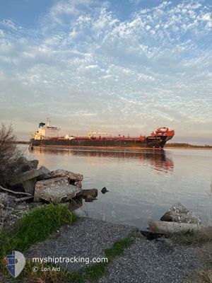
OVERSEAS TAMPA
Oil/Chemical Tanker
Current Trip
| Time Travelled | 5 days |
|---|---|
| Remaining Time | --- |
| Distance Travelled | 1356.44 nm |
| Remaining Distance | --- |
| AVG Speed | 12.4 Knots |
| MAX Speed | 15.5 Knots |
| AVG Wind | 9.5 knots |
| MAX Wind | 26.8 knots |
| MIN Temp | 5.8°C / 42.44°F |
| MAX Temp | 27.9°C / 82.22°F |
| Draught | 8.6 m |
| Position Received | 1 h, 31 m ago |
Current Position
| Longitude | --- |
|---|---|
| Latitude | --- |
| Status | Under way using engine |
| Speed | 8.5 Knots |
| Course | 328.1° |
| Area | Gulf of Mexico |
| Station | T-AIS |
| Position Received | 1 h, 31 m ago |
Info
Information
The current position of OVERSEAS TAMPA is in Gulf of Mexico with coordinates 30.10970° / -93.33340° as reported on 2025-12-09 16:26 by AIS to our vessel tracker app. The vessel's current speed is 8.5 Knots
The vessel OVERSEAS TAMPA (IMO: 9353606, MMSI: 368295000) is a Oil/Chemical Tanker that was built in 2010 ( 15 years old ). It's sailing under the flag of [US] USA.
In this page you can find informations about the vessels current position, last detected port calls, and current voyage information. If the vessels is not in coverage by AIS you will find the latest position.
The current position of OVERSEAS TAMPA is detected by our AIS receivers and we are not responsible for the reliability of the data. The last position was recorded while the vessel was in Coverage by the Ais receivers of our vessel tracking app.
The current draught of OVERSEAS TAMPA as reported by AIS is 8.6 meters
Weather
| Temperature | 11.3°C / 52.34°F |
|---|---|
| Wind Speed | 3 knots |
| Direction | 118° ESE |
| Pressure | 1023.8 hPa |
| Humidity | 49.3 % |
| Cloud Coverage | --- |
Featured Company
Last Port Calls
| Port | Arrival | Departure | Time In Port |
|---|---|---|---|
| 2025-12-03 18:45 | 2025-12-04 12:24 | 17 h | |
| 2025-12-01 11:15 | 2025-12-02 16:38 | 1 d | |
| 2025-11-24 16:46 | 2025-11-26 17:43 | 2 d | |
| 2025-11-19 05:12 | 2025-11-19 05:19 | 6 m | |
| 2025-11-08 16:58 | 2025-11-11 17:56 | 3 d | |
| 2025-11-03 14:38 | 2025-11-05 07:09 | 1 d | |
| 2025-10-30 09:40 | 2025-10-31 22:45 | 1 d | |
| 2025-10-22 13:34 | 2025-10-24 20:00 | 2 d | |
| 2025-10-16 15:59 | 2025-10-18 04:30 | 1 d | |
| 2025-10-12 19:49 | 2025-10-15 05:56 | 2 d |
Most Visited Ports (Last year)
| Port | Arrivals | |
|---|---|---|
| 10 | ||
| 8 | ||
| 6 | ||
| 6 | ||
| 4 | ||
| 4 |
Last Trips
| Origin | Departure | Destination | Arrival | Distance | |
|---|---|---|---|---|---|
| 2025-12-02 16:38 | 2025-12-03 18:45 | 397.03 nm | |||
| 2025-11-26 17:43 | 2025-12-01 11:15 | 900.10 nm | |||
| 2025-11-19 05:19 | 2025-11-24 16:46 | 1867.15 nm | |||
| 2025-11-11 17:56 | 2025-11-19 05:12 | 2050.95 nm | |||
| 2025-11-05 07:09 | 2025-11-08 16:58 | 1112.41 nm | |||
| 2025-10-31 22:45 | 2025-11-03 14:38 | 905.51 nm | |||
| 2025-10-24 20:00 | 2025-10-30 09:40 | 878.27 nm | |||
| 2025-10-18 04:30 | 2025-10-22 13:34 | 1033.52 nm | |||
| 2025-10-15 05:56 | 2025-10-16 15:59 | 480.94 nm | |||
| 2025-10-02 19:33 | 2025-10-12 19:49 | 1857.91 nm |
Events
| Time | Event | Details | Position / Dest | Info |
|---|---|---|---|---|
| 2025-12-09 17:39 | STOP Moving | 4.71 nm, South West of LAKE CHARLES |
30.18110 / -93.30803
USLCH
|
Speed: Course: 165° |
| 2025-12-09 16:31 | Status Changed | Default Under way using engine |
30.12180 / -93.33286
USLCH
|
Speed: 8.5 kn Course: 328.1° |
| 2025-12-09 16:26 | Status Changed | Under way using engine Default |
30.10970 / -93.33340
USLCH
|
Speed: 6.9 kn Course: 342° |
| 2025-12-09 16:26 | OUT of Coverage |
30.10970 / -93.33340
Gulf of Mexico
|
Speed: 8.5 kn Course: 328.1° |
|
| 2025-12-09 15:59 | Status Changed | Default Under way using engine |
30.05079 / -93.32878
USLCH
|
Speed: 7 kn Course: 4.5° |
| 2025-12-09 12:52 | START Moving | 12.68 nm, South of CAMERON |
29.59405 / -93.24668
USLCH
|
Speed: 3.1 kn Course: 262° |
| 2025-12-09 12:40 | Status Changed | Under way using engine Default |
29.59333 / -93.24491
USLCH
|
Speed: 0.1 kn Course: 75° |
| 2025-12-09 12:07 | Status Changed | Default At anchor |
29.59258 / -93.24563
USLCH
|
Speed: Course: 87° |
| 2025-12-09 12:01 | Status Changed | At anchor Default |
29.59276 / -93.24554
USLCH
|
Speed: Course: -1° |
| 2025-12-09 11:10 | Status Changed | Default At anchor |
29.59297 / -93.24560
USLCH
|
Speed: Course: 89° |