
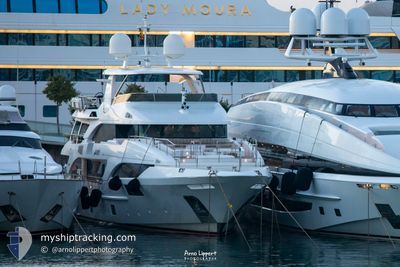
ORYX
Yacht
Current Trip
FORT LOUIS
| Time Travelled | 4 days |
|---|---|
| Remaining Time | --- |
| Distance Travelled | --- |
| Remaining Distance | --- |
| AVG Speed | --- |
| MAX Speed | --- |
| AVG Wind | --- |
| MAX Wind | --- |
| MIN Temp | --- |
| MAX Temp | --- |
| Draught | 2.7 m |
| Position Received | 4 d ago |
Current Position
| Longitude | -60.94182° |
|---|---|
| Latitude | 14.11751° |
| Status | Under way using engine |
| Speed | 9 Knots |
| Course | 87° |
| Area | Caribbean Sea |
| Station | T-AIS |
| Position Received | 4 d ago |
Info
Information
The current position of ORYX is in Caribbean Sea with coordinates 14.11751° / -60.94182° as reported on 2024-05-21 10:04 by AIS to our vessel tracker app. The vessel's current speed is 9 Knots
The vessel ORYX (IMO: 9695236, MMSI: 538071092) is a Yacht that was built in 2013 ( 11 years old ). It's sailing under the flag of [MH] Marshall Is.
In this page you can find informations about the vessels current position, last detected port calls, and current voyage information. If the vessels is not in coverage by AIS you will find the latest position.
The current position of ORYX is detected by our AIS receivers and we are not responsible for the reliability of the data. The last position was recorded while the vessel was in Coverage by the Ais receivers of our vessel tracking app.
The current draught of ORYX as reported by AIS is 2.7 meters
Weather
| Temperature | 26.7°C / 80.06°F |
|---|---|
| Wind Speed | 10 knots |
| Direction | 101° E |
| Pressure | 1013.5 hPa |
| Humidity | 79.3 % |
| Cloud Coverage | 45 % |
Featured Company
Last Port Calls
| Port | Arrival | Departure | Time In Port |
|---|---|---|---|
| 2024-05-21 05:47 | |||
| 2024-05-14 12:26 | 2024-05-16 10:55 | 1 d | |
| 2024-05-13 14:30 | 2024-05-14 11:11 | 20 h | |
| 2024-05-12 16:07 | 2024-05-13 09:06 | 16 h | |
| 2024-05-11 16:36 | 2024-05-12 11:02 | 18 h | |
| 2024-04-25 13:19 | 2024-05-11 15:15 | 16 d | |
| 2024-04-23 08:02 | 2024-04-24 09:11 | 1 d | |
| 2024-04-08 07:48 | 2024-04-23 07:59 | 15 d | |
| 2024-03-27 14:54 | 2024-04-08 07:42 | 11 d | |
| 2024-03-21 14:56 | 2024-03-26 09:12 | 4 d |
Most Visited Ports (Last year)
| Port | Arrivals | |
|---|---|---|
| 12 | ||
| 11 | ||
| 7 | ||
| 6 | ||
| 5 | ||
| 4 |
Last Trips
| Origin | Departure | Destination | Arrival | Distance | |
|---|---|---|---|---|---|
| 2024-05-14 11:11 | 2024-05-14 12:26 | 14.06 nm | |||
| 2024-05-13 09:06 | 2024-05-13 14:30 | 6.85 nm | |||
| 2024-05-12 11:02 | 2024-05-12 16:07 | 29.45 nm | |||
| 2024-05-11 15:15 | 2024-05-11 16:36 | 13.34 nm | |||
| 2024-04-24 09:11 | 2024-04-25 13:19 | 256.48 nm | |||
| 2024-04-23 07:59 | 2024-04-23 08:02 | 0.26 nm | |||
| 2024-04-08 07:42 | 2024-04-08 07:48 | 0.23 nm | |||
| 2024-03-26 09:12 | 2024-03-27 14:54 | 257.19 nm | |||
| 2024-03-21 13:44 | 2024-03-21 14:56 | 13.76 nm | |||
| 2024-03-20 11:30 | 2024-03-20 16:34 | 7.37 nm |
Events
| Time | Event | Details | Position / Dest | Info |
|---|---|---|---|---|
| 2024-05-21 10:04 | OUT of Coverage |
14.11751 / -60.94182
Caribbean Sea
|
Speed: 9 kn Course: 76° |
|
| 2024-05-21 10:04 | Detected in Sea | Saint Lucia part of the Caribbean Sea |
14.11751 / -60.94182
Caribbean Sea
|
Speed: 9 kn Course: 76° |
| 2024-05-21 10:04 | IN Coverage |
14.11751 / -60.94182
Caribbean Sea
|
Speed: 9 kn Course: 76° |
|
| 2024-05-21 09:47 | PORT DEPARTURE |
|
14.11751 / -60.94182
FORT LOUIS
|
Speed: Course: 225° |
| 2024-05-20 19:12 | OUT of Coverage |
14.07747 / -60.94998
Caribbean Sea
[LC] RODNEY BAY
|
Speed: Course: 197° |
|
| 2024-05-20 19:12 | IN Coverage |
14.07747 / -60.94998
Caribbean Sea
[LC] RODNEY BAY
|
Speed: Course: 197° |
|
| 2024-05-18 13:31 | OUT of Coverage |
14.07744 / -60.94997
Caribbean Sea
[LC] RODNEY BAY
|
Speed: Course: 73° |
|
| 2024-05-18 13:31 | IN Coverage |
14.07744 / -60.94997
Caribbean Sea
[LC] RODNEY BAY
|
Speed: Course: 73° |
|
| 2024-05-17 15:30 | OUT of Coverage |
14.32612 / -61.05288
Caribbean Sea
|
Speed: 9.6 kn Course: 162° |
|
| 2024-05-17 13:09 | Detected in Sea | Guadeloupe and Martinique part of the Caribbean Sea |
14.69774 / -61.21593
Caribbean Sea
|
Speed: 11 kn Course: 151° |