
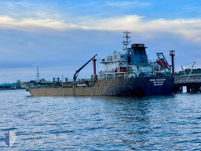
ORKIM DISCOVERY
Oil Products Tanker
Current Trip
| Time Travelled | 1 day |
|---|---|
| Remaining Time | 9 h, 53 mins |
| Distance Travelled | 209.51 nm |
| Remaining Distance | 236.67 nm |
| AVG Speed | 8.9 Knots |
| MAX Speed | 12.4 Knots |
| AVG Wind | 7.6 knots |
| MAX Wind | 17 knots |
| MIN Temp | 23.7°C / 74.66°F |
| MAX Temp | 28.3°C / 82.94°F |
| Draught | 6.6 m |
| Position Received | 11 h, 40 m ago |
Current Position
| Longitude | --- |
|---|---|
| Latitude | --- |
| Status | Under way using engine |
| Speed | 10.4 Knots |
| Course | 303.3° |
| Area | Malacca Strait |
| Station | T-AIS |
| Position Received | 11 h, 40 m ago |
Info
Information
The current position of ORKIM DISCOVERY is in Malacca Strait with coordinates 2.42356° / 101.69576° as reported on 2024-10-05 21:16 by AIS to our vessel tracker app. The vessel's current speed is 10.4 Knots and is heading at the port of PENANG. The estimated time of arrival as calculated by MyShipTracking vessel tracking app is 2024-10-06 18:50 LT
The vessel ORKIM DISCOVERY (IMO: 9564396, MMSI: 533057100) is a Oil Products Tanker that was built in 2010 ( 14 years old ). It's sailing under the flag of [MY] Malaysia.
In this page you can find informations about the vessels current position, last detected port calls, and current voyage information. If the vessels is not in coverage by AIS you will find the latest position.
The current position of ORKIM DISCOVERY is detected by our AIS receivers and we are not responsible for the reliability of the data. The last position was recorded while the vessel was in Coverage by the Ais receivers of our vessel tracking app.
The current draught of ORKIM DISCOVERY as reported by AIS is 6.6 meters
Weather
| Temperature | 25.6°C / 78.08°F |
|---|---|
| Wind Speed | 11 knots |
| Direction | 180° S |
| Pressure | 1008.7 hPa |
| Humidity | 87.6 % |
| Cloud Coverage | 100 % |
Featured Company
Last Port Calls
| Port | Arrival | Departure | Time In Port |
|---|---|---|---|
| 2024-10-04 10:39 | 2024-10-05 06:12 | 19 h | |
| 2024-09-20 20:03 | 2024-09-21 21:17 | 1 d | |
| 2024-09-17 13:12 | 2024-09-18 21:09 | 1 d | |
| 2024-09-12 05:41 | 2024-09-13 07:09 | 1 d | |
| 2024-09-06 10:18 | 2024-09-07 08:46 | 22 h | |
| 2024-09-03 06:33 | 2024-09-04 04:21 | 21 h | |
| 2024-08-30 18:13 | 2024-08-31 19:25 | 1 d | |
| 2024-08-28 02:29 | 2024-08-29 04:20 | 1 d | |
| 2024-08-20 05:41 | 2024-08-21 17:05 | 1 d | |
| 2024-08-18 04:20 | 2024-08-19 05:39 | 1 d |
Most Visited Ports (Last year)
| Port | Arrivals | |
|---|---|---|
| 17 | ||
| 14 | ||
| 9 | ||
| 8 | ||
| 8 | ||
| 7 |
Last Trips
| Origin | Departure | Destination | Arrival | Distance | |
|---|---|---|---|---|---|
| 2024-09-22 05:17 | 2024-10-04 18:39 | 246.95 nm | |||
| 2024-09-19 05:09 | 2024-09-21 04:03 | 196.62 nm | |||
| 2024-09-13 15:09 | 2024-09-17 21:12 | 423.28 nm | |||
| 2024-09-07 16:46 | 2024-09-12 13:41 | 440.19 nm | |||
| 2024-09-04 12:21 | 2024-09-06 18:18 | 208.70 nm | |||
| 2024-09-01 03:25 | 2024-09-03 14:33 | 408.17 nm | |||
| 2024-08-29 12:20 | 2024-08-31 02:13 | 359.20 nm | |||
| 2024-08-22 01:05 | 2024-08-28 10:29 | 275.72 nm | |||
| 2024-08-19 13:39 | 2024-08-20 13:41 | 241.66 nm | |||
| 2024-08-16 14:25 | 2024-08-18 12:20 | 197.36 nm |
Events
| Time | Event | Details | Position / Dest | Info |
|---|---|---|---|---|
| 2024-10-05 21:16 | Status Changed | Default Under way using engine |
2.42386 / 101.69531
MYPENANG
|
Speed: 10.4 kn Course: 303.3° |
| 2024-10-05 21:16 | OUT of Coverage |
2.42356 / 101.69576
Malacca Strait
MYPENANG
|
Speed: 10.4 kn Course: 303.3° |
|
| 2024-10-05 20:15 | Status Changed | Under way using engine Default |
2.31181 / 101.84497
MYPENANG
|
Speed: 11.4 kn Course: 307° |
| 2024-10-05 20:11 | Status Changed | Default Under way using engine |
2.30353 / 101.85599
MYPENANG
|
Speed: 11.4 kn Course: 306.1° |
| 2024-10-05 19:58 | Detected in Sea | Malaysian part of the Malacca Strait |
2.27799 / 101.89005
Malacca Strait
MYPENANG
|
Speed: 11.6 kn Course: 306.4° |
| 2024-10-05 19:58 | Status Changed | Under way using engine Default |
2.27799 / 101.89005
MYPENANG
|
Speed: 11.5 kn Course: 306° |
| 2024-10-05 19:49 | IN Coverage |
2.27799 / 101.89005
Malacca Strait
MYPENANG
|
Speed: 11.6 kn Course: 306.4° |
|
| 2024-10-05 07:53 | Status Changed | Default Under way using engine |
1.19603 / 103.56884
MYPENANG
|
Speed: 8.7 kn Course: 270.8° |
| 2024-10-05 07:48 | OUT of Coverage |
1.19355 / 103.58148
Singapore Strait
MYPENANG
|
Speed: 8.7 kn Course: 270.8° |
|
| 2024-10-05 07:46 | Change Sea Area | Malaysian part of the Singapore Strait Indonesian part of the Singapore Strait |
1.19353 / 103.58512
Singapore Strait
MYPENANG
|
Speed: 8.6 kn Course: 265.3° |