

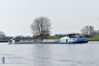
ORION
Cargo

Current Trip
SNITS
| Time Travelled | 4 h, 59 mins |
|---|---|
| Remaining Time | --- |
| Distance Travelled | 5.31 nm |
| Remaining Distance | --- |
| AVG Speed | 4.7 Knots |
| MAX Speed | 5.4 Knots |
| AVG Wind | 6.9 knots |
| MAX Wind | 7.8 knots |
| MIN Temp | 3.9°C / 39.02°F |
| MAX Temp | 7.4°C / 45.32°F |
| Draught | 2.7 m |
| Position Received | 1 m ago |
Current Position
| Longitude | --- |
|---|---|
| Latitude | --- |
| Status | Moored |
| Speed | |
| Course | --- |
| Area | North Sea |
| Station | T-AIS |
| Position Received | 1 m ago |
Information
The current position of ORION is in North Sea with coordinates 51.89234° / 5.68350° as reported on 2025-03-31 08:20 by AIS to our vessel tracker app. The vessel's current speed is 0 Knots
The vessel ORION (MMSI: 244770601) is a Cargo It's sailing under the flag of [NL] Netherlands.
In this page you can find informations about the vessels current position, last detected port calls, and current voyage information. If the vessels is not in coverage by AIS you will find the latest position.
The current position of ORION is detected by our AIS receivers and we are not responsible for the reliability of the data. The last position was recorded while the vessel was in Coverage by the Ais receivers of our vessel tracking app.
The current draught of ORION as reported by AIS is 2.7 meters
Weather
| Temperature | 8.2°C / 46.76°F |
|---|---|
| Wind Speed | 8 knots |
| Direction | 357° N |
| Pressure | 1026 hPa |
| Humidity | 67.9 % |
| Cloud Coverage | 10 % |


Featured Company
Last Port Calls
| Port | Arrival | Departure | Time In Port |
|---|---|---|---|
| 2025-03-27 11:28 | 2025-03-31 05:22 | 3 d | |
| 2025-03-26 21:48 | 2025-03-27 06:06 | 8 h | |
| 2025-03-26 11:10 | 2025-03-26 16:40 | 5 h | |
| 2025-03-24 12:21 | 2025-03-25 09:26 | 21 h | |
| 2025-03-23 11:32 | 2025-03-23 11:54 | 22 m | |
| 2025-03-21 14:25 | 2025-03-21 15:04 | 39 m | |
| 2025-03-21 07:24 | 2025-03-21 12:49 | 5 h | |
| 2025-03-20 21:01 | 2025-03-20 21:45 | 43 m | |
| 2025-03-20 15:11 | 2025-03-20 15:52 | 40 m | |
| 2025-03-19 22:28 | 2025-03-20 10:19 | 11 h |
Last Trips
| Origin | Departure | Destination | Arrival | Distance | |
|---|---|---|---|---|---|
| 2025-03-27 06:06 | 2025-03-27 11:28 | 11.32 nm | |||
| 2025-03-26 16:40 | 2025-03-26 21:48 | 18.03 nm | |||
| 2025-03-25 09:26 | 2025-03-26 11:10 | 85.74 nm | |||
| 2025-03-23 11:54 | 2025-03-24 12:21 | 67.83 nm | |||
| 2025-03-21 15:04 | 2025-03-23 11:32 | 36.56 nm | |||
| 2025-03-21 12:49 | 2025-03-21 14:25 | 10.52 nm | |||
| 2025-03-20 21:45 | 2025-03-21 07:24 | 9.83 nm | |||
| 2025-03-20 15:52 | 2025-03-20 21:01 | 36.75 nm | |||
| 2025-03-20 10:19 | 2025-03-20 15:11 | 20.76 nm | |||
| 2025-03-18 09:40 | 2025-03-19 22:28 | 107.68 nm |
Events
| Time | Event | Details | Position / Dest | Info |
|---|---|---|---|---|
| 2025-03-31 08:05 | Status Changed | Moored Default |
51.89234 / 5.68365
SNITS
|
Speed: Course: -1° |
| 2025-03-31 07:59 | Status Changed | Default Moored |
51.89225 / 5.68358
SNITS
|
Speed: 0.1 kn Course: 511° |
| 2025-03-31 07:47 | Status Changed | Moored Under way using engine |
51.89228 / 5.68376
SNITS
|
Speed: 0.2 kn Course: 511° |
| 2025-03-31 07:28 | STOP Moving | 0.43 nm, East of DEEST |
51.89258 / 5.68367
SNITS
|
Speed: 0.2 kn Course: 511° |
| 2025-03-31 07:25 | START Moving | 0.49 nm, East of DEEST |
51.89230 / 5.68517
SNITS
|
Speed: 3.4 kn Course: 288.6° |
| 2025-03-31 07:23 | Status Changed | Under way using engine Moored |
51.89193 / 5.68789
SNITS
|
Speed: 0.6 kn Course: 511° |
| 2025-03-31 07:10 | Status Changed | Moored Under way using engine |
51.89191 / 5.68819
SNITS
|
Speed: 0.1 kn Course: 511° |
| 2025-03-31 06:51 | STOP Moving | 0.6 nm, East of DEEST |
51.89188 / 5.68817
SNITS
|
Speed: 0.3 kn Course: 511° |
| 2025-03-31 06:02 | START Moving | 0.58 nm, West of DRUTEN |
51.89957 / 5.58596
SNITS
|
Speed: 5 kn Course: 93.6° |
| 2025-03-31 06:00 | Status Changed | Under way using engine Moored |
51.89962 / 5.58335
SNITS
|
Speed: 0.4 kn Course: 511° |