
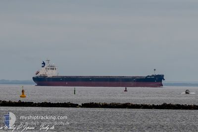
ORIENT VISION
Cargo
Current Trip
| Time Travelled | 36 days |
|---|---|
| Remaining Time | 9 h, 55 mins |
| Distance Travelled | 9166.14 nm |
| Remaining Distance | 97.22 nm |
| AVG Speed | 10.6 Knots |
| MAX Speed | 16.5 Knots |
| AVG Wind | 18.2 knots |
| MAX Wind | 41 knots |
| MIN Temp | -2.3°C / 27.86°F |
| MAX Temp | 28.7°C / 83.66°F |
| Draught | 7.8 m |
| Position Received | 1 h, 28 m ago |
Current Position
| Longitude | --- |
|---|---|
| Latitude | --- |
| Status | Under way using engine |
| Speed | 4.7 Knots |
| Course | 77° |
| Area | Gulf of Finland |
| Station | T-AIS |
| Position Received | 1 h, 28 m ago |
Info
Information
The current position of ORIENT VISION is in Gulf of Finland with coordinates 59.86571° / 25.78955° as reported on 2025-01-11 01:20 by AIS to our vessel tracker app. The vessel's current speed is 4.7 Knots and is heading at the port of UST-LUGA. The estimated time of arrival as calculated by MyShipTracking vessel tracking app is 2025-01-11 12:44 LT
The vessel ORIENT VISION (IMO: 9673202, MMSI: 352002707) is a Cargo It's sailing under the flag of [PA] Panama.
In this page you can find informations about the vessels current position, last detected port calls, and current voyage information. If the vessels is not in coverage by AIS you will find the latest position.
The current position of ORIENT VISION is detected by our AIS receivers and we are not responsible for the reliability of the data. The last position was recorded while the vessel was in Coverage by the Ais receivers of our vessel tracking app.
The current draught of ORIENT VISION as reported by AIS is 7.8 meters
Weather
| Temperature | 0.7°C / 33.26°F |
|---|---|
| Wind Speed | 26 knots |
| Direction | 70° ENE |
| Pressure | 1003.3 hPa |
| Humidity | 97.5 % |
| Cloud Coverage | 100 % |
Featured Company
Last Port Calls
| Port | Arrival | Departure | Time In Port |
|---|---|---|---|
| 2024-12-20 06:14 | 2024-12-20 15:33 | 9 h | |
| 2024-12-02 11:49 | 2024-12-05 04:21 | 2 d | |
| 2024-11-28 06:01 | 2024-11-30 03:37 | 1 d |
Most Visited Ports (Last year)
| Port | Arrivals | |
|---|---|---|
| 2 | ||
| 2 | ||
| 1 | ||
| 1 | ||
| 1 | ||
| 1 |
Last Trips
| Origin | Departure | Destination | Arrival | Distance | |
|---|---|---|---|---|---|
| 2024-12-05 09:51 | 2024-12-20 08:14 | 4498.82 nm | |||
| 2024-11-30 09:07 | 2024-12-02 17:19 | 547.70 nm | |||
| 2024-08-31 07:20 | 2024-11-28 11:31 | 13094.22 nm |
Events
| Time | Event | Details | Position / Dest | Info |
|---|---|---|---|---|
| 2025-01-11 01:25 | Status Changed | Default Under way using engine |
59.86693 / 25.80192
RU ULU
|
Speed: 4.7 kn Course: 77° |
| 2025-01-11 01:20 | OUT of Coverage |
59.86571 / 25.78955
Gulf of Finland
RU ULU
|
Speed: 4.7 kn Course: 77.7° |
|
| 2025-01-10 23:58 | Status Changed | Under way using engine Default |
59.85934 / 25.60052
RU ULU
|
Speed: 3.4 kn Course: 116° |
| 2025-01-10 23:57 | Status Changed | Default Under way using engine |
59.86020 / 25.59931
RU ULU
|
Speed: 4.5 kn Course: 120° |
| 2025-01-10 23:46 | Change Sea Area | Estonian part of the Gulf of Finland Finnish part of the Gulf of Finland |
59.87208 / 25.59235
Gulf of Finland
RU ULU
|
Speed: 5.4 kn Course: 185.3° |
| 2025-01-10 21:10 | Status Changed | Under way using engine Default |
59.97235 / 26.14202
RU ULU
|
Speed: 6.4 kn Course: 254° |
| 2025-01-10 21:09 | Status Changed | Default Under way using engine |
59.97294 / 26.14602
RU ULU
|
Speed: 6.6 kn Course: 253.5° |
| 2025-01-10 21:04 | Change Sea Area | Finnish part of the Gulf of Finland Estonian part of the Gulf of Finland |
59.97535 / 26.16192
Gulf of Finland
RU ULU
|
Speed: 6.6 kn Course: 253.5° |
| 2025-01-10 21:04 | Status Changed | Under way using engine Default |
59.97551 / 26.16300
RU ULU
|
Speed: 6.9 kn Course: 257° |
| 2025-01-10 21:01 | Status Changed | Default Under way using engine |
59.97685 / 26.17369
RU ULU
|
Speed: 8.4 kn Course: 263.2° |