
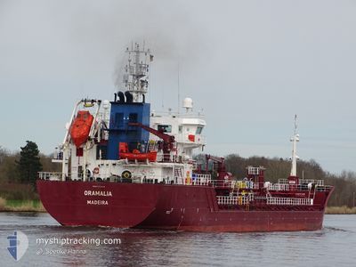
ORAMALIA
Oil/Chemical Tanker
Current Trip
| Time Travelled | 8 days |
|---|---|
| Remaining Time | 3 days |
| Distance Travelled | 1658.41 nm |
| Remaining Distance | 866.54 nm |
| AVG Speed | 9.3 Knots |
| MAX Speed | 12.9 Knots |
| AVG Wind | 20.4 knots |
| MAX Wind | 30 knots |
| MIN Temp | 6.1°C / 42.98°F |
| MAX Temp | 17.5°C / 63.5°F |
| Draught | 7.3 m |
| Position Received | 2 h, 59 m ago |
Current Position
| Longitude | --- |
|---|---|
| Latitude | --- |
| Status | Under way using engine |
| Speed | 10.7 Knots |
| Course | 84° |
| Area | Alboran Sea |
| Station | T-AIS |
| Position Received | 2 h, 59 m ago |
Info
Information
The current position of ORAMALIA is in Alboran Sea with coordinates 36.27569° / -3.03919° as reported on 2024-12-18 03:15 by AIS to our vessel tracker app. The vessel's current speed is 10.7 Knots and is heading at the port of VALLETTA. The estimated time of arrival as calculated by MyShipTracking vessel tracking app is 2024-12-21 12:21 LT
The vessel ORAMALIA (IMO: 9392640, MMSI: 255806229) is a Oil/Chemical Tanker that was built in 2007 ( 17 years old ). It's sailing under the flag of [PT] Portugal.
In this page you can find informations about the vessels current position, last detected port calls, and current voyage information. If the vessels is not in coverage by AIS you will find the latest position.
The current position of ORAMALIA is detected by our AIS receivers and we are not responsible for the reliability of the data. The last position was recorded while the vessel was in Coverage by the Ais receivers of our vessel tracking app.
The current draught of ORAMALIA as reported by AIS is 7.3 meters
Weather
| Temperature | 15.4°C / 59.72°F |
|---|---|
| Wind Speed | 3 knots |
| Direction | 261° W |
| Pressure | 1031.4 hPa |
| Humidity | 66.8 % |
| Cloud Coverage | 20 % |
Featured Company
Last Port Calls
| Port | Arrival | Departure | Time In Port |
|---|---|---|---|
| 2024-12-08 20:04 | 2024-12-10 00:21 | 1 d | |
| 2024-12-02 04:20 | 2024-12-03 03:29 | 23 h | |
| 2024-11-26 23:22 | 2024-11-28 19:34 | 1 d | |
| 2024-11-02 03:48 | 2024-11-03 06:01 | 1 d | |
| 2024-10-31 11:29 | 2024-10-31 17:16 | 5 h | |
| 2024-10-24 21:03 | 2024-10-26 00:47 | 1 d | |
| 2024-10-17 19:52 | 2024-10-20 02:53 | 2 d | |
| 2024-10-17 11:23 | 2024-10-17 17:08 | 5 h | |
| 2024-10-15 10:13 | 2024-10-15 18:59 | 8 h | |
| 2024-10-09 09:11 | 2024-10-12 21:36 | 3 d |
Last Trips
| Origin | Departure | Destination | Arrival | Distance | |
|---|---|---|---|---|---|
| 2024-12-03 04:29 | 2024-12-08 21:04 | 687.67 nm | |||
| 2024-11-28 20:34 | 2024-12-02 05:20 | 618.43 nm | |||
| 2024-11-03 07:01 | 2024-11-27 00:22 | 1786.82 nm | |||
| 2024-10-31 17:16 | 2024-11-02 04:48 | 343.46 nm | |||
| 2024-10-26 02:47 | 2024-10-31 11:29 | 755.51 nm | |||
| 2024-10-20 03:53 | 2024-10-24 23:03 | 641.68 nm | |||
| 2024-10-15 20:59 | 2024-10-17 20:52 | 451.32 nm | |||
| 2024-10-15 20:59 | 2024-10-17 12:23 | 429.03 nm | |||
| 2024-10-12 23:36 | 2024-10-15 12:13 | 584.68 nm | |||
| 2024-10-05 01:55 | 2024-10-09 11:11 | 822.77 nm |
Events
| Time | Event | Details | Position / Dest | Info |
|---|---|---|---|---|
| 2024-12-18 03:27 | Status Changed | Default Under way using engine |
36.27983 / -2.99529
MALTA
|
Speed: 10.7 kn Course: 84° |
| 2024-12-18 03:15 | OUT of Coverage |
36.27569 / -3.03919
Alboran Sea
MALTA
|
Speed: 10.7 kn Course: 84° |
|
| 2024-12-18 03:08 | Status Changed | Under way using engine Default |
36.27311 / -3.06543
MALTA
|
Speed: 10.7 kn Course: 84° |
| 2024-12-18 03:06 | Status Changed | Default Under way using engine |
36.27236 / -3.07274
MALTA
|
Speed: 10.8 kn Course: 83° |
| 2024-12-18 02:47 | Status Changed | Under way using engine Default |
36.26541 / -3.14222
MALTA
|
Speed: 10.7 kn Course: 84° |
| 2024-12-18 02:05 | Status Changed | Default Under way using engine |
36.24942 / -3.29331
MALTA
|
Speed: 10.7 kn Course: 81.5° |
| 2024-12-18 02:01 | Status Changed | Under way using engine Default |
36.24743 / -3.31013
MALTA
|
Speed: 10.7 kn Course: 81° |
| 2024-12-18 01:52 | Status Changed | Default Under way using engine |
36.24363 / -3.34238
MALTA
|
Speed: 10.8 kn Course: 81.1° |
| 2024-12-18 00:07 | Status Changed | Under way using engine Default |
36.19712 / -3.73072
MALTA
|
Speed: 10.5 kn Course: 85° |
| 2024-12-18 00:02 | Status Changed | Default Under way using engine |
36.19565 / -3.74930
MALTA
|
Speed: 10.6 kn Course: 84.7° |