
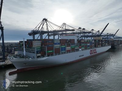
OOCL TURKIYE
Cargo D
Current Trip
| Time Travelled | 22 days |
|---|---|
| Remaining Time | --- |
| Distance Travelled | 9463.73 nm |
| Remaining Distance | --- |
| AVG Speed | 17.5 Knots |
| MAX Speed | 21.4 Knots |
| AVG Wind | 13.3 knots |
| MAX Wind | 30.7 knots |
| MIN Temp | 15°C / 59°F |
| MAX Temp | 31.1°C / 87.98°F |
| Draught | 16.3 m |
| Position Received | 8 d ago |
Current Position
| Longitude | 17.93702° |
|---|---|
| Latitude | -34.50902° |
| Status | Under way using engine |
| Speed | 19.3 Knots |
| Course | 312.5° |
| Area | South Atlantic Ocean |
| Station | T-AIS |
| Position Received | 8 d ago |
Info
Information
The current position of OOCL TURKIYE is in South Atlantic Ocean with coordinates -34.50902° / 17.93702° as reported on 2024-06-08 00:20 by AIS to our vessel tracker app. The vessel's current speed is 19.3 Knots and is heading at the port of FELIXSTOWE. The estimated time of arrival as calculated by MyShipTracking vessel tracking app is 2024-06-21 10:00 LT
The vessel OOCL TURKIYE (IMO: 9908138, MMSI: 477887800) is a Cargo D It's sailing under the flag of [HK] Hong Kong.
In this page you can find informations about the vessels current position, last detected port calls, and current voyage information. If the vessels is not in coverage by AIS you will find the latest position.
The current position of OOCL TURKIYE is detected by our AIS receivers and we are not responsible for the reliability of the data. The last position was recorded while the vessel was in Coverage by the Ais receivers of our vessel tracking app.
The current draught of OOCL TURKIYE as reported by AIS is 16.3 meters
Weather
| Temperature | 20.6°C / 69.08°F |
|---|---|
| Wind Speed | 15 knots |
| Direction | 347° NNW |
| Pressure | 1011 hPa |
| Humidity | 88.8 % |
| Cloud Coverage | 26 % |
Featured Company
Last Port Calls
| Port | Arrival | Departure | Time In Port |
|---|---|---|---|
| 2024-05-24 06:06 | 2024-05-25 14:29 | 1 d | |
| 2024-05-19 15:00 | 2024-05-20 14:23 | 23 h | |
| 2024-05-12 12:04 | 2024-05-14 09:07 | 1 d | |
| 2024-05-08 07:16 | 2024-05-08 22:16 | 14 h | |
| 2024-05-02 05:08 | 2024-05-03 15:20 | 1 d | |
| 2024-04-24 13:49 | 2024-04-26 14:37 | 2 d |
Last Trips
| Origin | Departure | Destination | Arrival | Distance | |
|---|---|---|---|---|---|
| 2024-05-20 22:23 | 2024-05-24 14:06 | 1470.60 nm | |||
| 2024-05-14 17:07 | 2024-05-19 23:00 | 936.21 nm | |||
| 2024-05-09 06:16 | 2024-05-12 20:04 | 459.12 nm | |||
| 2024-05-03 23:20 | 2024-05-08 15:16 | 1167.05 nm | |||
| 2024-04-26 22:37 | 2024-05-02 13:08 | 1493.76 nm | |||
| 2024-03-18 08:13 | 2024-04-24 21:49 | 11829.41 nm |
Events
| Time | Event | Details | Position / Dest | Info |
|---|---|---|---|---|
| 2024-06-08 00:27 | Status Changed | Default Under way using engine |
-34.48497 / 17.90503
SGSIN>GBFXT
|
Speed: 19.3 kn Course: 312.5° |
| 2024-06-08 00:20 | OUT of Coverage |
-34.50902 / 17.93702
South Atlantic Ocean
SGSIN>GBFXT
|
Speed: 19.3 kn Course: 312.5° |
|
| 2024-06-08 00:14 | Status Changed | Under way using engine Default |
-34.53064 / 17.96951
SGSIN>GBFXT
|
Speed: 19.3 kn Course: 307° |
| 2024-06-08 00:00 | Status Changed | Default Under way using engine |
-34.57557 / 18.04225
SGSIN>GBFXT
|
Speed: 19.7 kn Course: 304.5° |
| 2024-06-07 23:16 | Status Changed | Under way using engine Default |
-34.71092 / 18.29058
SGSIN>GBFXT
|
Speed: 19.6 kn Course: 297° |
| 2024-06-07 23:11 | Status Changed | Default Under way using engine |
-34.72263 / 18.31915
SGSIN>GBFXT
|
Speed: 19.4 kn Course: 296.3° |
| 2024-06-07 23:06 | Status Changed | Under way using engine Default |
-34.73565 / 18.35110
SGSIN>GBFXT
|
Speed: 19.1 kn Course: 296° |
| 2024-06-07 23:03 | Status Changed | Default Under way using engine |
-34.74226 / 18.36750
SGSIN>GBFXT
|
Speed: 19.2 kn Course: 296.2° |
| 2024-06-07 22:33 | Status Changed | Under way using engine Default |
-34.81200 / 18.53931
SGSIN>GBFXT
|
Speed: 18.9 kn Course: 296° |
| 2024-06-07 21:58 | Status Changed | Default Under way using engine |
-34.89600 / 18.74118
SGSIN>GBFXT
|
Speed: 18.9 kn Course: 292.3° |