

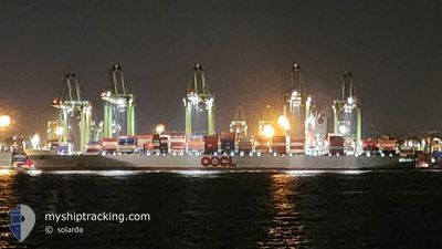
OOCL GENOA
Cargo

Current Trip
CNSHA
| Time Travelled | 2 days |
|---|---|
| Remaining Time | --- |
| Distance Travelled | 559.73 nm |
| Remaining Distance | --- |
| AVG Speed | 14.8 Knots |
| MAX Speed | 19.7 Knots |
| AVG Wind | 12 knots |
| MAX Wind | 23 knots |
| MIN Temp | 10.2°C / 50.36°F |
| MAX Temp | 17.6°C / 63.68°F |
| Draught | 11.3 m |
| Position Received | 2025-02-07 11:35 |
Current Position
| Longitude | --- |
|---|---|
| Latitude | --- |
| Status | Under way using engine |
| Speed | 19.2 Knots |
| Course | 288.8° |
| Area | North Pacific Ocean |
| Station | T-AIS |
| Position Received | 2025-02-07 11:35 |
Information
The current position of OOCL GENOA is in North Pacific Ocean with coordinates 19.57253° / -110.30603° as reported on 2025-02-07 11:35 by AIS to our vessel tracker app. The vessel's current speed is 19.2 Knots
The vessel OOCL GENOA (IMO: 9613587, MMSI: 477454900) is a Cargo It's sailing under the flag of [HK] Hong Kong.
In this page you can find informations about the vessels current position, last detected port calls, and current voyage information. If the vessels is not in coverage by AIS you will find the latest position.
The current position of OOCL GENOA is detected by our AIS receivers and we are not responsible for the reliability of the data. The last position was recorded while the vessel was in Coverage by the Ais receivers of our vessel tracking app.
The current draught of OOCL GENOA as reported by AIS is 11.3 meters
Weather
| Temperature | 17.3°C / 63.14°F |
|---|---|
| Wind Speed | 4 knots |
| Direction | 44° NE |
| Pressure | 1020.2 hPa |
| Humidity | 79.4 % |
| Cloud Coverage | 2 % |


Featured Company
Last Trips
| Origin | Departure | Destination | Arrival | Distance | |
|---|---|---|---|---|---|
| 2025-02-25 11:28 | 2025-03-20 03:31 | 521.71 nm | |||
| 2025-01-29 13:58 | 2025-02-24 22:45 | 10473.85 nm | |||
| 2025-01-26 02:55 | 2025-01-28 11:09 | 396.78 nm | |||
| 2025-01-24 07:45 | 2025-01-25 16:23 | 512.12 nm | |||
| 2024-12-22 12:28 | 2025-01-19 12:01 | 11045.16 nm |
Events
| Time | Event | Details | Position / Dest | Info |
|---|---|---|---|---|
| 2025-03-21 18:42 | START Moving | 13.54 nm, South East of NINGBO |
29.76876 / 122.01044
CNSHA
|
Speed: 5.1 kn Course: 84° |
| 2025-03-21 03:14 | STOP Moving | 13.31 nm, South East of NINGBO |
29.77040 / 122.00551
CNSHA
|
Speed: Course: 228° |
| 2025-03-20 08:07 | START Moving | 4.4 nm, South East of SHANGHAI |
31.32942 / 121.67933
CNSHA
|
Speed: 3.3 kn Course: 111° |
| 2025-03-20 08:07 | PORT DEPARTURE |
|
31.32942 / 121.67933
CNSHA
|
Speed: 1.8 kn Course: 113° |
| 2025-03-19 19:31 | STOP Moving |
31.32947 / 121.67030
[CN] SHANGHAI
|
Speed: Course: 127° |
|
| 2025-03-19 19:31 | PORT ARRIVAL |
|
31.32947 / 121.67030
[CN] SHANGHAI
|
Speed: 1.1 kn Course: 142° |
| 2025-03-19 01:18 | START Moving | 9.7 nm, South West of ZHOUSHAN |
29.81972 / 122.12219
CNSHA
|
Speed: 6.4 kn Course: 153° |
| 2025-03-18 19:00 | STOP Moving | 9.53 nm, South West of ZHOUSHAN |
29.82295 / 122.12186
CNSHA
|
Speed: 0.2 kn Course: 274° |
| 2025-03-18 18:02 | START Moving | 10.33 nm, South of ZHOUSHAN |
29.80093 / 122.14560
CNSHA
|
Speed: 5.1 kn Course: 342° |