
ONEGO OTRA
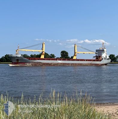
General Cargo
Current Trip
| Time Travelled | 10 days |
|---|---|
| Remaining Time | --- |
| Distance Travelled | 558.04 nm |
| Remaining Distance | --- |
| AVG Speed | 8.7 Knots |
| MAX Speed | 14.2 Knots |
| AVG Wind | 14.1 knots |
| MAX Wind | 27 knots |
| MIN Temp | -3.1°C / 26.42°F |
| MAX Temp | 11°C / 51.8°F |
| Draught | 5 m |
| Position Received | 2 m ago |
Current Position
| Longitude | --- |
|---|---|
| Latitude | --- |
| Status | At anchor |
| Speed | 0.3 Knots |
| Course | 329° |
| Area | North Atlantic Ocean |
| Station | T-AIS |
| Position Received | 2 m ago |
Info
Information
The current position of ONEGO OTRA is in North Atlantic Ocean with coordinates 38.64185° / -74.71964° as reported on 2025-03-02 10:59 by AIS to our vessel tracker app. The vessel's current speed is 0.3 Knots and is heading at the port of WILMINGTON. The estimated time of arrival as calculated by MyShipTracking vessel tracking app is 2025-02-23 20:00 LT
The vessel ONEGO OTRA (IMO: 9535606, MMSI: 305656000) is a General Cargo that was built in 2010 ( 15 years old ). It's sailing under the flag of [AG] Antigua Barbuda.
In this page you can find informations about the vessels current position, last detected port calls, and current voyage information. If the vessels is not in coverage by AIS you will find the latest position.
The current position of ONEGO OTRA is detected by our AIS receivers and we are not responsible for the reliability of the data. The last position was recorded while the vessel was in Coverage by the Ais receivers of our vessel tracking app.
The current draught of ONEGO OTRA as reported by AIS is 5 meters
Weather
| Temperature | -2.8°C / 26.96°F |
|---|---|
| Wind Speed | 24 knots |
| Direction | 325° NW |
| Pressure | 1017.6 hPa |
| Humidity | 55.9 % |
| Cloud Coverage | 5 % |
Featured Company
Last Port Calls
| Port | Arrival | Departure | Time In Port |
|---|---|---|---|
| 2025-02-19 12:35 | 2025-02-19 14:07 | 1 h | |
| 2025-02-01 19:03 | 2025-02-03 21:27 | 2 d | |
| 2025-01-30 00:21 | 2025-01-30 10:21 | 9 h | |
| 2025-01-23 16:27 | 2025-01-26 08:41 | 2 d |
Most Visited Ports (Last year)
| Port | Arrivals | |
|---|---|---|
| 3 | ||
| 2 | ||
| 2 | ||
| 2 | ||
| 2 | ||
| 2 |
Last Trips
| Origin | Departure | Destination | Arrival | Distance | |
|---|---|---|---|---|---|
| 2025-02-03 21:27 | 2025-02-19 07:35 | 3802.05 nm | |||
| 2025-01-30 11:21 | 2025-02-01 19:03 | 558.87 nm | |||
| 2025-01-26 09:41 | 2025-01-30 01:21 | 703.52 nm | |||
| 2024-12-30 15:59 | 2025-01-23 17:27 | 6154.11 nm |
Events
| Time | Event | Details | Position / Dest | Info |
|---|---|---|---|---|
| 2025-03-02 10:35 | Status Changed | At anchor Default |
38.64176 / -74.71976
USILG
|
Speed: 0.1 kn Course: 343° |
| 2025-03-02 10:26 | Status Changed | Default At anchor |
38.64199 / -74.71937
USILG
|
Speed: 0.9 kn Course: 355° |
| 2025-03-02 08:59 | Status Changed | At anchor Default |
38.64200 / -74.71932
USILG
|
Speed: 1 kn Course: 346° |
| 2025-03-02 08:55 | Status Changed | Default At anchor |
38.64171 / -74.72001
USILG
|
Speed: 0.5 kn Course: 304° |
| 2025-03-02 08:29 | Status Changed | At anchor Default |
38.64193 / -74.71951
USILG
|
Speed: 0.2 kn Course: 345° |
| 2025-03-02 08:26 | Status Changed | Default At anchor |
38.64160 / -74.72025
USILG
|
Speed: 0.6 kn Course: 312° |
| 2025-03-02 07:29 | Status Changed | At anchor Default |
38.64197 / -74.71955
USILG
|
Speed: 0.7 kn Course: 319° |
| 2025-03-02 07:26 | Status Changed | Default At anchor |
38.64224 / -74.71904
USILG
|
Speed: 1.2 kn Course: 356° |
| 2025-03-02 06:41 | Status Changed | At anchor Default |
38.64202 / -74.71971
USILG
|
Speed: 0.8 kn Course: 326° |
| 2025-03-02 06:38 | Status Changed | Default At anchor |
38.64203 / -74.71947
USILG
|
Speed: 0.1 kn Course: 349° |