
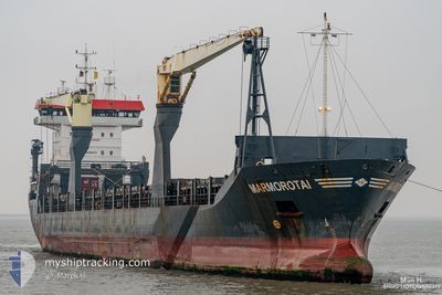
ONEGO EMS
General Cargo
Current Trip
| Time Travelled | 8 h, 50 mins |
|---|---|
| Remaining Time | 1 day |
| Distance Travelled | 105.50 nm |
| Remaining Distance | 441.33 nm |
| AVG Speed | 12.7 Knots |
| MAX Speed | 14.6 Knots |
| AVG Wind | 17.6 knots |
| MAX Wind | 21 knots |
| MIN Temp | 7.8°C / 46.04°F |
| MAX Temp | 8.5°C / 47.3°F |
| Draught | 5.1 m |
| Position Received | 15 m ago |
Current Position
| Longitude | --- |
|---|---|
| Latitude | --- |
| Status | At anchor |
| Speed | |
| Course | 254° |
| Area | Kattegat |
| Station | T-AIS |
| Position Received | 15 m ago |
Info
Information
The current position of ONEGO EMS is in Kattegat with coordinates 57.66598° / 10.59726° as reported on 2025-12-13 17:52 by AIS to our vessel tracker app. The vessel's current speed is 0 Knots and is heading at the port of TEES. The estimated time of arrival as calculated by MyShipTracking vessel tracking app is 2025-12-15 07:09 LT
The vessel ONEGO EMS (IMO: 9290074, MMSI: 304587000) is a General Cargo that was built in 2004 ( 21 years old ). It's sailing under the flag of [AG] Antigua Barbuda.
In this page you can find informations about the vessels current position, last detected port calls, and current voyage information. If the vessels is not in coverage by AIS you will find the latest position.
The current position of ONEGO EMS is detected by our AIS receivers and we are not responsible for the reliability of the data. The last position was recorded while the vessel was in Coverage by the Ais receivers of our vessel tracking app.
The current draught of ONEGO EMS as reported by AIS is 5.1 meters
Weather
| Temperature | 8.3°C / 46.94°F |
|---|---|
| Wind Speed | 20 knots |
| Direction | 259° W |
| Pressure | 1017.3 hPa |
| Humidity | 87.5 % |
| Cloud Coverage | 18 % |
Featured Company
Last Port Calls
| Port | Arrival | Departure | Time In Port |
|---|---|---|---|
| 2025-12-09 22:48 | 2025-12-13 10:17 | 3 d | |
| 2025-11-18 17:36 | 2025-11-21 04:58 | 2 d | |
| 2025-11-08 03:30 | 2025-11-12 06:05 | 4 d | |
| 2025-11-06 00:01 | 2025-11-06 12:14 | 12 h | |
| 2025-10-29 05:23 | 2025-10-29 20:21 | 14 h | |
| 2025-10-13 20:05 | 2025-10-15 02:32 | 1 d | |
| 2025-10-03 15:50 | 2025-10-07 12:44 | 3 d | |
| 2025-10-01 04:08 |
Most Visited Ports (Last year)
| Port | Arrivals | |
|---|---|---|
| 4 | ||
| 3 | ||
| 2 | ||
| 2 | ||
| 1 | ||
| 1 |
Last Trips
| Origin | Departure | Destination | Arrival | Distance | |
|---|---|---|---|---|---|
| 2025-11-21 04:58 | 2025-12-09 22:48 | 5047.20 nm | |||
| 2025-11-12 06:05 | 2025-11-18 17:36 | 2038.62 nm | |||
| 2025-11-06 12:14 | 2025-11-08 03:30 | 495.68 nm | |||
| 2025-10-29 20:21 | 2025-11-06 00:01 | 1877.19 nm | |||
| 2025-10-15 02:32 | 2025-10-29 05:23 | 4068.08 nm | |||
| 2025-10-07 12:44 | 2025-10-13 20:05 | 743.70 nm | |||
| 2025-10-01 04:08 | 2025-10-03 15:50 | 795.55 nm |
Events
| Time | Event | Details | Position / Dest | Info |
|---|---|---|---|---|
| 2025-12-13 17:55 | Status Changed | Default At anchor |
57.66600 / 10.59714
GBTEE
|
Speed: Course: 254° |
| 2025-12-13 17:49 | Status Changed | At anchor Default |
57.66609 / 10.59704
GBTEE
|
Speed: 0.1 kn Course: 227° |
| 2025-12-13 17:43 | Status Changed | Default At anchor |
57.66647 / 10.59681
GBTEE
|
Speed: 0.4 kn Course: 274° |
| 2025-12-13 17:37 | Status Changed | At anchor Default |
57.66575 / 10.59705
GBTEE
|
Speed: 0.5 kn Course: 229° |
| 2025-12-13 17:31 | Status Changed | Default At anchor |
57.66582 / 10.59675
GBTEE
|
Speed: 0.7 kn Course: 203° |
| 2025-12-13 17:25 | Status Changed | At anchor Under way using engine |
57.66644 / 10.59518
GBTEE
|
Speed: 0.6 kn Course: 234° |
| 2025-12-13 17:25 | STOP Moving | 2.82 nm, South of SKAGEN |
57.66644 / 10.59518
GBTEE
|
Speed: 0.3 kn Course: 189° |
| 2025-12-13 17:20 | Status Changed | Under way using engine Default |
57.66608 / 10.59478
GBTEE
|
Speed: 4.9 kn Course: 249° |
| 2025-12-13 17:17 | Status Changed | Default Under way using engine |
57.66676 / 10.59883
GBTEE
|
Speed: 4.9 kn Course: 249° |
| 2025-12-13 17:17 | Status Changed | Under way using engine Default |
57.66683 / 10.59923
GBTEE
|
Speed: 6.5 kn Course: 240° |