
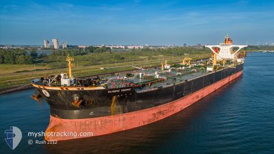
OLYMPIC TROPHY
Ore/Oil Carrier
Current Trip
CUOPL
| Time Travelled | --- |
|---|---|
| Remaining Time | --- |
| Distance Travelled | 71.01 nm |
| Remaining Distance | --- |
| AVG Speed | --- |
| MAX Speed | --- |
| AVG Wind | 11.9 knots |
| MAX Wind | 26.9 knots |
| MIN Temp | 24.1°C / 75.38°F |
| MAX Temp | 29.1°C / 84.38°F |
| Draught | 14.2 m |
| Position Received | 5 d ago |
Current Position
| Longitude | -69.01941° |
|---|---|
| Latitude | 12.09018° |
| Status | Under way using engine |
| Speed | 4.9 Knots |
| Course | 120° |
| Area | Caribbean Sea |
| Station | T-AIS |
| Position Received | 5 d ago |
Info
Information
The current position of OLYMPIC TROPHY is in Caribbean Sea with coordinates 12.09018° / -69.01941° as reported on 2024-04-24 15:02 by AIS to our vessel tracker app. The vessel's current speed is 4.9 Knots
The vessel OLYMPIC TROPHY (IMO: 9445461, MMSI: 241412000) is a Ore/Oil Carrier that was built in 2010 ( 14 years old ). It's sailing under the flag of [GR] Greece.
In this page you can find informations about the vessels current position, last detected port calls, and current voyage information. If the vessels is not in coverage by AIS you will find the latest position.
The current position of OLYMPIC TROPHY is detected by our AIS receivers and we are not responsible for the reliability of the data. The last position was recorded while the vessel was in Coverage by the Ais receivers of our vessel tracking app.
The current draught of OLYMPIC TROPHY as reported by AIS is 14.2 meters
Weather
| Temperature | 26.2°C / 79.16°F |
|---|---|
| Wind Speed | 5 knots |
| Direction | 53° NE |
| Pressure | 1012.6 hPa |
| Humidity | 81 % |
| Cloud Coverage | 28 % |
Featured Company
Last Port Calls
Most Visited Ports (Last year)
| Port | Arrivals | |
|---|---|---|
| 3 | ||
| 2 | ||
| 2 | ||
| 2 | ||
| 1 | ||
| 1 |
Last Trips
| Origin | Departure | Destination | Arrival | Distance |
|---|
Events
| Time | Event | Details | Position / Dest | Info |
|---|---|---|---|---|
| 2024-04-27 00:58 | STOP Moving | 5.86 nm, North of JOSE TERMINAL |
10.19833 / -64.87167
CUOPL
|
Speed: Course: -1° |
| 2024-04-26 21:45 | START Moving |
10.45863 / -65.10697
CUOPL
|
Speed: 4.3 kn Course: 131° |
|
| 2024-04-26 17:01 | STOP Moving |
10.44122 / -65.10998
CUOPL
|
Speed: 0.2 kn Course: 138° |
|
| 2024-04-26 09:40 | START Moving |
10.38500 / -65.30334
CUOPL
|
Speed: 4 kn Course: -1° |
|
| 2024-04-25 16:31 | STOP Moving |
10.46667 / -65.25833
CUOPL
|
Speed: Course: -1° |
|
| 2024-04-24 15:10 | Status Changed | Default Under way using engine |
12.08249 / -69.00652
CUOPL
|
Speed: 4.9 kn Course: 120° |
| 2024-04-24 15:02 | OUT of Coverage |
12.09018 / -69.01941
Caribbean Sea
CUOPL
|
Speed: 4.9 kn Course: 121° |
|
| 2024-04-24 12:51 | Draught Changed | 14.2 11.2 |
12.19887 / -69.14101
CUOPL
|
Speed: 5.7 kn Course: 137.6° |
| 2024-04-24 12:51 | Destination Changed | CUOPL VEJOT |
12.19887 / -69.14101
CUOPL
|
Speed: 5.7 kn Course: 137.6° |
| 2024-04-24 12:51 | ETA Changed | 2024/04/24 17:00 2023/12/04 05:00 |
12.19887 / -69.14101
CUOPL
|
Speed: 5.7 kn Course: 137.6° |