
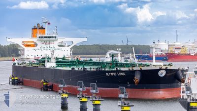
OLYMPIC LUNA
Tanker
Current Trip
| Time Travelled | 14 h, 46 mins |
|---|---|
| Remaining Time | --- |
| Distance Travelled | 16.69 nm |
| Remaining Distance | --- |
| AVG Speed | 7.3 Knots |
| MAX Speed | 9.2 Knots |
| AVG Wind | 6.5 knots |
| MAX Wind | 9 knots |
| MIN Temp | 26.3°C / 79.34°F |
| MAX Temp | 28.2°C / 82.76°F |
| Draught | 11.1 m |
| Position Received | 3 m ago |
Current Position
| Longitude | --- |
|---|---|
| Latitude | --- |
| Status | At anchor |
| Speed | 0.1 Knots |
| Course | 329° |
| Area | Singapore Strait |
| Station | T-AIS |
| Position Received | 3 m ago |
Info
Information
The current position of OLYMPIC LUNA is in Singapore Strait with coordinates 1.23879° / 103.92197° as reported on 2025-12-12 13:42 by AIS to our vessel tracker app. The vessel's current speed is 0.1 Knots
The vessel OLYMPIC LUNA (IMO: 9731157, MMSI: 538008976) is a Tanker It's sailing under the flag of [MH] Marshall Is.
In this page you can find informations about the vessels current position, last detected port calls, and current voyage information. If the vessels is not in coverage by AIS you will find the latest position.
The current position of OLYMPIC LUNA is detected by our AIS receivers and we are not responsible for the reliability of the data. The last position was recorded while the vessel was in Coverage by the Ais receivers of our vessel tracking app.
The current draught of OLYMPIC LUNA as reported by AIS is 11.1 meters
Weather
| Temperature | 26.6°C / 79.88°F |
|---|---|
| Wind Speed | 8 knots |
| Direction | 355° N |
| Pressure | 1009.7 hPa |
| Humidity | 82.1 % |
| Cloud Coverage | 100 % |
Featured Company
Last Port Calls
| Port | Arrival | Departure | Time In Port |
|---|---|---|---|
| 2025-12-10 00:55 | 2025-12-12 07:00 | 2 d |
Most Visited Ports (Last year)
| Port | Arrivals | |
|---|---|---|
| 2 | ||
| 1 | ||
| 1 | ||
| 1 |
Last Trips
| Origin | Departure | Destination | Arrival | Distance | |
|---|---|---|---|---|---|
| 2025-09-11 12:45 | 2025-12-10 00:55 | 8599.86 nm |
Events
| Time | Event | Details | Position / Dest | Info |
|---|---|---|---|---|
| 2025-12-12 13:18 | Status Changed | At anchor Default |
1.23912 / 103.92236
SG SIN
|
Speed: 0.1 kn Course: 317° |
| 2025-12-12 13:15 | Status Changed | Default At anchor |
1.23916 / 103.92241
SG SIN
|
Speed: 0.1 kn Course: 316° |
| 2025-12-12 01:55 | Draught Changed | 11.1 20.1 |
1.24017 / 103.91827
SG SIN
|
Speed: 0.3 kn Course: 60° |
| 2025-12-12 01:55 | ETA Changed | 2025/12/12 15:05 2025/12/10 15:05 |
1.24017 / 103.91827
SG SIN
|
Speed: 0.3 kn Course: 60° |
| 2025-12-12 01:54 | Status Changed | At anchor Under way using engine |
1.24017 / 103.91827
SG SIN
|
Speed: 0.3 kn Course: 61° |
| 2025-12-12 01:40 | STOP Moving | 4.01 nm, East of SINGAPORE |
1.24100 / 103.91917
SG SIN
|
Speed: 0.3 kn Course: 58° |
| 2025-12-11 23:11 | START Moving | 1.8 nm, South of JURONG ISLAND |
1.23027 / 103.69074
SG SIN
|
Speed: 3.1 kn Course: 55° |
| 2025-12-11 23:00 | PORT DEPARTURE |
|
1.22792 / 103.68465
SG SIN
|
Speed: 1.9 kn Course: 60° |
| 2025-12-11 22:34 | Status Changed | Under way using engine Moored |
1.22856 / 103.68178
[SG] JURONG ISLAND
|
Speed: Course: 44° |
| 2025-12-11 22:29 | Status Changed | Moored Default |
1.22857 / 103.68178
[SG] JURONG ISLAND
|
Speed: 0.1 kn Course: 44° |