
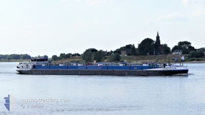
OBSEDIAAN
Tanker
Current Trip
Current Position
| Longitude | --- |
|---|---|
| Latitude | --- |
| Status | Under way using engine |
| Speed | |
| Course | --- |
| Area | North Sea |
| Station | T-AIS |
| Position Received | Now |
Info
Information
The current position of OBSEDIAAN is in North Sea with coordinates 51.27831° / 3.83929° as reported on 2026-02-24 06:57 by AIS to our vessel tracker app. The vessel's current speed is 0 Knots and is currently inside the port of SLUISKIL.
The vessel OBSEDIAAN (MMSI: 244890116) is a Tanker It's sailing under the flag of [NL] Netherlands.
In this page you can find informations about the vessels current position, last detected port calls, and current voyage information. If the vessels is not in coverage by AIS you will find the latest position.
The current position of OBSEDIAAN is detected by our AIS receivers and we are not responsible for the reliability of the data. The last position was recorded while the vessel was in Coverage by the Ais receivers of our vessel tracking app.
The current draught of OBSEDIAAN as reported by AIS is 2 meters
Weather
| Temperature | 10.7°C / 51.26°F |
|---|---|
| Wind Speed | 8 knots |
| Direction | 260° W |
| Pressure | 1017.8 hPa |
| Humidity | 96.1 % |
| Cloud Coverage | 100 % |
Featured Company
Last Port Calls
| Port | Arrival | Departure | Time In Port |
|---|---|---|---|
| 2026-02-22 14:51 | |||
| 2026-02-22 14:23 | 2026-02-22 14:39 | 15 m | |
| 2026-02-22 11:56 | 2026-02-22 12:40 | 44 m | |
| 2026-02-21 20:26 | 2026-02-22 03:26 | 6 h | |
| 2026-02-20 18:48 | 2026-02-21 09:19 | 14 h | |
| 2026-02-20 15:48 | 2026-02-20 17:33 | 1 h | |
| 2026-02-18 17:08 | 2026-02-19 07:02 | 13 h | |
| 2026-02-18 15:00 | 2026-02-18 16:05 | 1 h | |
| 2026-02-17 18:03 | 2026-02-18 04:32 | 10 h | |
| 2026-02-17 12:49 | 2026-02-17 17:09 | 4 h |
Most Visited Ports (Last year)
| Port | Arrivals | |
|---|---|---|
| 60 | ||
| 56 | ||
| 41 | ||
| 37 | ||
| 25 | ||
| 22 |
Last Trips
| Origin | Departure | Destination | Arrival | Distance | |
|---|---|---|---|---|---|
| 2026-02-22 14:39 | 2026-02-22 14:51 | 0.82 nm | |||
| 2026-02-22 12:40 | 2026-02-22 14:23 | 11.57 nm | |||
| 2026-02-22 03:26 | 2026-02-22 11:56 | 54.34 nm | |||
| 2026-02-21 09:19 | 2026-02-21 20:26 | 68.44 nm | |||
| 2026-02-20 17:33 | 2026-02-20 18:48 | 9.47 nm | |||
| 2026-02-19 07:02 | 2026-02-20 15:48 | 34.31 nm | |||
| 2026-02-18 16:05 | 2026-02-18 17:08 | 8.27 nm | |||
| 2026-02-18 04:32 | 2026-02-18 15:00 | 66.97 nm | |||
| 2026-02-17 17:09 | 2026-02-17 18:03 | 7.21 nm | |||
| 2026-02-17 10:39 | 2026-02-17 12:49 | 19.22 nm |
Events
| Time | Event | Details | Position / Dest | Info |
|---|---|---|---|---|
| 2026-02-22 13:51 | STOP Moving |
51.27932 / 3.84009
[NL] SLUISKIL
|
Speed: Course: 511° |
|
| 2026-02-22 13:51 | PORT ARRIVAL |
|
51.27932 / 3.84009
[NL] SLUISKIL
|
Speed: 1.4 kn Course: 511° |
| 2026-02-22 13:39 | PORT DEPARTURE |
|
51.29608 / 3.83386
BEGEN04017CITYX0003
|
Speed: 6.2 kn Course: 172.3° |
| 2026-02-22 13:23 | PORT ARRIVAL |
|
51.32333 / 3.82552
[NL] TERNEUZEN
|
Speed: 5.5 kn Course: 156.7° |
| 2026-02-22 13:16 | START Moving | --- |
51.33375 / 3.82034
BEGEN04017CITYX0003
|
Speed: 3.9 kn Course: 173.4° |
| 2026-02-22 12:56 | STOP Moving | --- |
51.33568 / 3.81995
BEGEN04017CITYX0003
|
Speed: Course: 511° |
| 2026-02-22 11:40 | PORT DEPARTURE |
|
51.43934 / 4.00793
BEGEN04017CITYX0003
|
Speed: 8 kn Course: 206.5° |
| 2026-02-22 11:13 | START Moving |
51.45906 / 4.00852
[NL] HANSWEERT
|
Speed: 3.4 kn Course: 159.6° |
|
| 2026-02-22 10:56 | STOP Moving |
51.46166 / 4.00767
[NL] HANSWEERT
|
Speed: Course: 511° |
|
| 2026-02-22 10:56 | PORT ARRIVAL |
|
51.46166 / 4.00767
[NL] HANSWEERT
|
Speed: 2.1 kn Course: 511° |