
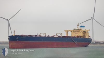
NORTH LOYALTY
Crude Oil Tanker
Current Trip
| Time Travelled | 24 days |
|---|---|
| Remaining Time | 8 days |
| Distance Travelled | 2887.03 nm |
| Remaining Distance | 2797.75 nm |
| AVG Speed | 10.4 Knots |
| MAX Speed | 16.7 Knots |
| AVG Wind | 17.3 knots |
| MAX Wind | 38.8 knots |
| MIN Temp | 6.5°C / 43.7°F |
| MAX Temp | 19.2°C / 66.56°F |
| Draught | 11.6 m |
| Position Received | 2 d ago |
Current Position
| Longitude | -30.43369° |
|---|---|
| Latitude | 38.93170° |
| Status | Under way using engine |
| Speed | 15.3 Knots |
| Course | 246.4° |
| Area | North Atlantic Ocean |
| Station | T-AIS |
| Position Received | 2 d ago |
Info
Information
The current position of NORTH LOYALTY is in North Atlantic Ocean with coordinates 38.93170° / -30.43369° as reported on 2024-04-28 01:33 by AIS to our vessel tracker app. The vessel's current speed is 15.3 Knots and is heading at the port of CORPUS CHRISTI. The estimated time of arrival as calculated by MyShipTracking vessel tracking app is 2024-05-09 10:01 LT
The vessel NORTH LOYALTY (IMO: 9537771, MMSI: 538010032) is a Crude Oil Tanker that was built in 2011 ( 13 years old ). It's sailing under the flag of [MH] Marshall Is.
In this page you can find informations about the vessels current position, last detected port calls, and current voyage information. If the vessels is not in coverage by AIS you will find the latest position.
The current position of NORTH LOYALTY is detected by our AIS receivers and we are not responsible for the reliability of the data. The last position was recorded while the vessel was in Coverage by the Ais receivers of our vessel tracking app.
The current draught of NORTH LOYALTY as reported by AIS is 11.6 meters
Weather
| Temperature | 19°C / 66.2°F |
|---|---|
| Wind Speed | 21 knots |
| Direction | 264° W |
| Pressure | 1010.3 hPa |
| Humidity | 85.3 % |
| Cloud Coverage | 3 % |
Featured Company
Last Port Calls
| Port | Arrival | Departure | Time In Port |
|---|---|---|---|
| 2024-03-25 01:29 | 2024-04-06 09:49 | 12 d | |
| 2024-03-06 04:59 | 2024-03-15 20:10 | 9 d |
Most Visited Ports (Last year)
| Port | Arrivals | |
|---|---|---|
| 3 | ||
| 2 | ||
| 1 | ||
| 1 | ||
| 1 |
Last Trips
| Origin | Departure | Destination | Arrival | Distance | |
|---|---|---|---|---|---|
| 2024-03-15 21:10 | 2024-03-25 02:29 | 730.65 nm | |||
| 2024-02-20 20:05 | 2024-03-06 05:59 | 827.21 nm |
Events
| Time | Event | Details | Position / Dest | Info |
|---|---|---|---|---|
| 2024-04-28 01:37 | Status Changed | Default Under way using engine |
38.92533 / -30.45280
USCRP FOR ORDER
|
Speed: 15.3 kn Course: 246.4° |
| 2024-04-28 01:33 | OUT of Coverage |
38.93170 / -30.43369
North Atlantic Ocean
USCRP FOR ORDER
|
Speed: 15.3 kn Course: 246.4° |
|
| 2024-04-27 16:50 | ETA Changed | 2024/05/11 18:00 2024/04/20 08:00 |
39.81942 / -27.83897
USCRP FOR ORDER
|
Speed: 14.4 kn Course: 246.3° |
| 2024-04-27 16:34 | Status Changed | Under way using engine Default |
39.84521 / -27.76565
USCRP FOR ORDER
|
Speed: 14.3 kn Course: 247° |
| 2024-04-27 16:28 | Status Changed | Default Under way using engine |
39.85571 / -27.73500
USCRP FOR ORDER
|
Speed: 14.3 kn Course: 245.2° |
| 2024-04-27 16:06 | Status Changed | Under way using engine Default |
39.89093 / -27.63047
USCRP FOR ORDER
|
Speed: 14.4 kn Course: 248° |
| 2024-04-27 15:56 | Status Changed | Default Under way using engine |
39.90533 / -27.58512
USCRP FOR ORDER
|
Speed: 14.3 kn Course: 249.5° |
| 2024-04-27 15:49 | Status Changed | Under way using engine Default |
39.91571 / -27.55050
USCRP FOR ORDER
|
Speed: 14.6 kn Course: 253° |
| 2024-04-27 15:25 | Status Changed | Default Under way using engine |
39.94863 / -27.43136
USCRP FOR ORDER
|
Speed: 14.3 kn Course: 248.7° |
| 2024-04-27 15:19 | Status Changed | Under way using engine Default |
39.95729 / -27.40155
USCRP FOR ORDER
|
Speed: 14.9 kn Course: 249° |