
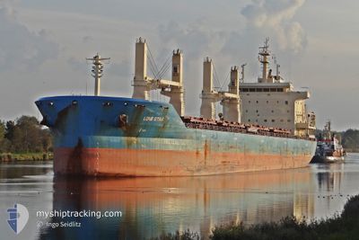
NORDIC OSLO
Bulk Carrier
Current Trip
| Trip Time | 3 days |
|---|---|
| Trip Distance | 241.02 nm |
| AVG Speed | 7.1 Knots |
| MAX Speed | 13.7 Knots |
| Draught | 6.5 m |
| AVG Wind | 9.5 knots |
| MAX Wind | 15.7 knots |
| MIN Temp | 8.8°C / 47.84°F |
| MAX Temp | 12.4°C / 54.32°F |
| Position Received | 4 d ago |
Current Position
| Longitude | --- |
|---|---|
| Latitude | --- |
| Status | Under way using engine |
| Speed | 12.8 Knots |
| Course | 57.8° |
| Area | Black Sea |
| Station | T-AIS |
| Position Received | 4 d ago |
Info
Information
The current position of NORDIC OSLO is in Black Sea with coordinates 41.34699° / 29.33061° as reported on 2025-12-08 16:38 by AIS to our vessel tracker app. The vessel's current speed is 12.8 Knots and is currently inside the port of EREN.
The vessel NORDIC OSLO (IMO: 9626601, MMSI: 636093133) is a Bulk Carrier that was built in 2012 ( 13 years old ). It's sailing under the flag of [LR] Liberia.
In this page you can find informations about the vessels current position, last detected port calls, and current voyage information. If the vessels is not in coverage by AIS you will find the latest position.
The current position of NORDIC OSLO is detected by our AIS receivers and we are not responsible for the reliability of the data. The last position was recorded while the vessel was in Coverage by the Ais receivers of our vessel tracking app.
The current draught of NORDIC OSLO as reported by AIS is 6.5 meters
Weather
| Temperature | 9.8°C / 49.64°F |
|---|---|
| Wind Speed | 5 knots |
| Direction | 247° WSW |
| Pressure | 1022.6 hPa |
| Humidity | 89.6 % |
| Cloud Coverage | 100 % |
Featured Company
Most Visited Ports (Last year)
| Port | Arrivals | |
|---|---|---|
| 2 | ||
| 2 | ||
| 1 | ||
| 1 | ||
| 1 | ||
| 1 |
Last Trips
| Origin | Departure | Destination | Arrival | Distance | |
|---|---|---|---|---|---|
| 2025-12-08 04:48 | 2025-12-11 14:35 | 241.02 nm | |||
| 2025-11-11 20:38 | 2025-12-03 10:49 | 5498.25 nm | |||
| 2025-10-31 08:11 | 2025-11-01 14:26 | 310.46 nm | |||
| 2025-10-16 21:27 | 2025-10-25 09:32 | 2310.10 nm | |||
| 2025-10-09 17:45 | 2025-10-15 17:43 | 1036.87 nm |
Events
| Time | Event | Details | Position / Dest | Info |
|---|---|---|---|---|
| 2025-12-11 12:11 | STOP Moving |
41.52336 / 31.90533
[TR] EREN
|
Speed: Course: 89° |
|
| 2025-12-11 11:35 | PORT ARRIVAL |
|
41.52354 / 31.90525
[TR] EREN
|
Speed: 5.6 kn Course: 157° |
| 2025-12-11 10:39 | START Moving | 1.09 nm, North of EREN |
41.54254 / 31.90166
TRHER>TRZON
|
Speed: 6.2 kn Course: 274° |
| 2025-12-09 13:52 | STOP Moving | 1.19 nm, North East of EREN |
41.54056 / 31.91616
TRHER>TRZON
|
Speed: 0.2 kn Course: 235° |
| 2025-12-08 16:45 | Status Changed | Default Under way using engine |
41.35682 / 29.35967
TRHER>TRZON
|
Speed: 12.8 kn Course: 57.8° |
| 2025-12-08 16:38 | OUT of Coverage |
41.34699 / 29.33061
Black Sea
TRHER>TRZON
|
Speed: 12.8 kn Course: 57.8° |
|
| 2025-12-08 16:02 | ETA Changed | 2025/12/09 14:00 2025/12/09 17:00 |
41.26509 / 29.19965
TRHER>TRZON
|
Speed: 11.9 kn Course: 49.6° |
| 2025-12-08 15:47 | Change Sea Area | Turkish part of the Black Sea Turkish part of the Sea of Marmara |
41.23398 / 29.15402
Black Sea
TRHER>TRZON
|
Speed: 10.9 kn Course: 46.8° |
| 2025-12-08 13:26 | ETA Changed | 2025/12/09 17:00 2025/12/09 12:00 |
40.91208 / 28.98980
TRHER>TRZON
|
Speed: 5.6 kn Course: 347.9° |
| 2025-12-08 13:19 | ETA Changed | 2025/12/09 12:00 2025/12/10 12:00 |
40.90331 / 28.99421
TRHER>TRZON
|
Speed: 5.9 kn Course: 334.7° |