
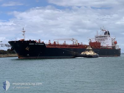
NORD VICTORIOUS
Tanker
Current Trip
| Time Travelled | 16 days |
|---|---|
| Remaining Time | 15 h, 27 mins |
| Distance Travelled | 2871.67 nm |
| Remaining Distance | 252.87 nm |
| AVG Speed | 11.9 Knots |
| MAX Speed | 15.2 Knots |
| AVG Wind | 11.4 knots |
| MAX Wind | 28 knots |
| MIN Temp | 11.7°C / 53.06°F |
| MAX Temp | 29.7°C / 85.46°F |
| Draught | 8.2 m |
| Position Received | 1 d ago |
Current Position
| Longitude | --- |
|---|---|
| Latitude | --- |
| Status | At anchor |
| Speed | |
| Course | 34° |
| Area | Gulf of Mexico |
| Station | T-AIS |
| Position Received | 1 d ago |
Info
Information
The current position of NORD VICTORIOUS is in Gulf of Mexico with coordinates 29.24615° / -94.62093° as reported on 2025-12-14 07:58 by AIS to our vessel tracker app. The vessel's current speed is 0 Knots and is heading at the port of HOUSTON. The estimated time of arrival as calculated by MyShipTracking vessel tracking app is 2025-12-16 04:36 LT
The vessel NORD VICTORIOUS (IMO: 9903138, MMSI: 538009098) is a Tanker It's sailing under the flag of [MH] Marshall Is.
In this page you can find informations about the vessels current position, last detected port calls, and current voyage information. If the vessels is not in coverage by AIS you will find the latest position.
The current position of NORD VICTORIOUS is detected by our AIS receivers and we are not responsible for the reliability of the data. The last position was recorded while the vessel was in Coverage by the Ais receivers of our vessel tracking app.
The current draught of NORD VICTORIOUS as reported by AIS is 8.2 meters
Weather
| Temperature | 22°C / 71.6°F |
|---|---|
| Wind Speed | 16 knots |
| Direction | 29° NNE |
| Pressure | 1023.5 hPa |
| Humidity | 72.9 % |
| Cloud Coverage | 48 % |
Featured Company
Last Port Calls
| Port | Arrival | Departure | Time In Port |
|---|---|---|---|
| 2025-11-27 15:18 | 2025-11-29 06:39 | 1 d | |
| 2025-11-19 10:34 | 2025-11-21 11:05 | 2 d | |
| 2025-11-14 07:34 | 2025-11-16 02:21 | 1 d | |
| 2025-11-11 01:29 | 2025-11-12 10:47 | 1 d | |
| 2025-10-21 06:27 | 2025-10-25 19:25 | 4 d | |
| 2025-10-12 14:21 | 2025-10-15 15:50 | 3 d | |
| 2025-10-07 16:14 | 2025-10-09 09:39 | 1 d |
Last Trips
| Origin | Departure | Destination | Arrival | Distance | |
|---|---|---|---|---|---|
| 2025-11-21 11:05 | 2025-11-27 15:18 | 1283.70 nm | |||
| 2025-11-16 02:21 | 2025-11-19 10:34 | 708.56 nm | |||
| 2025-11-12 10:47 | 2025-11-14 07:34 | 486.87 nm | |||
| 2025-10-25 19:25 | 2025-11-11 01:29 | 4283.52 nm | |||
| 2025-10-15 15:50 | 2025-10-21 06:27 | 548.44 nm | |||
| 2025-10-09 09:39 | 2025-10-12 14:21 | 555.30 nm | |||
| 2025-09-28 12:40 | 2025-10-07 16:14 | 746.84 nm |
Events
| Time | Event | Details | Position / Dest | Info |
|---|---|---|---|---|
| 2025-12-14 19:28 | START Moving | 10.19 nm, South East of GALVESTON |
29.24350 / -94.61678
US HOU
|
Speed: 3.2 kn Course: 75° |
| 2025-12-14 08:01 | Status Changed | Default At anchor |
29.24615 / -94.62093
US HOU
|
Speed: Course: 34° |
| 2025-12-14 07:58 | Status Changed | At anchor Default |
29.24615 / -94.62093
US HOU
|
Speed: Course: 35° |
| 2025-12-14 07:58 | OUT of Coverage |
29.24615 / -94.62093
Gulf of Mexico
|
Speed: Course: 190.1° |
|
| 2025-12-14 07:37 | Status Changed | Default At anchor |
29.24620 / -94.62101
US HOU
|
Speed: Course: 38° |
| 2025-12-14 07:34 | Status Changed | At anchor Default |
29.24622 / -94.62103
US HOU
|
Speed: Course: 37° |
| 2025-12-14 07:13 | Status Changed | Default At anchor |
29.24619 / -94.62102
US HOU
|
Speed: Course: 38° |
| 2025-12-14 07:07 | Status Changed | At anchor Default |
29.24619 / -94.62101
US HOU
|
Speed: Course: 36° |
| 2025-12-14 06:40 | Status Changed | Default At anchor |
29.24615 / -94.62094
US HOU
|
Speed: 0.1 kn Course: 40° |
| 2025-12-14 06:34 | Status Changed | At anchor Default |
29.24621 / -94.62099
US HOU
|
Speed: Course: 40° |