
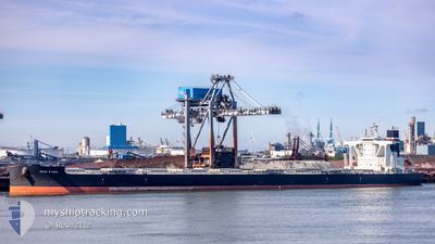
NORD STEEL
Cargo
Current Trip
| Time Travelled | 35 days |
|---|---|
| Remaining Time | --- |
| Distance Travelled | 5428.41 nm |
| Remaining Distance | --- |
| AVG Speed | 8.3 Knots |
| MAX Speed | 14.6 Knots |
| AVG Wind | 13 knots |
| MAX Wind | 27 knots |
| MIN Temp | 11.3°C / 52.34°F |
| MAX Temp | 34.4°C / 93.92°F |
| Draught | 15 m |
| Position Received | 3 d ago |
Current Position
| Longitude | -80.64337° |
|---|---|
| Latitude | 23.48141° |
| Status | Under way using engine |
| Speed | 10.3 Knots |
| Course | 100.9° |
| Area | North Atlantic Ocean |
| Station | T-AIS |
| Position Received | 3 d ago |
Info
Information
The current position of NORD STEEL is in North Atlantic Ocean with coordinates 23.48141° / -80.64337° as reported on 2024-06-13 06:52 by AIS to our vessel tracker app. The vessel's current speed is 10.3 Knots and is heading at the port of SINGAPORE. The estimated time of arrival as calculated by MyShipTracking vessel tracking app is 2024-07-31 13:00 LT
The vessel NORD STEEL (IMO: 9966233, MMSI: 219610000) is a Cargo It's sailing under the flag of [DK] Denmark.
In this page you can find informations about the vessels current position, last detected port calls, and current voyage information. If the vessels is not in coverage by AIS you will find the latest position.
The current position of NORD STEEL is detected by our AIS receivers and we are not responsible for the reliability of the data. The last position was recorded while the vessel was in Coverage by the Ais receivers of our vessel tracking app.
The current draught of NORD STEEL as reported by AIS is 15 meters
Weather
| Temperature | 27.6°C / 81.68°F |
|---|---|
| Wind Speed | 7 knots |
| Direction | 34° NE |
| Pressure | 1013.5 hPa |
| Humidity | 80 % |
| Cloud Coverage | 100 % |
Featured Company
Most Visited Ports (Last year)
| Port | Arrivals | |
|---|---|---|
| 1 |
Last Trips
| Origin | Departure | Destination | Arrival | Distance |
|---|
Events
| Time | Event | Details | Position / Dest | Info |
|---|---|---|---|---|
| 2024-06-13 06:52 | OUT of Coverage |
23.48141 / -80.64337
North Atlantic Ocean
|
Speed: 10.3 kn Course: 100.9° |
|
| 2024-06-13 06:43 | IN Coverage |
23.48598 / -80.66935
North Atlantic Ocean
|
Speed: 10.2 kn Course: 99.7° |
|
| 2024-06-13 05:28 | OUT of Coverage |
23.50518 / -80.90055
North Atlantic Ocean
|
Speed: 10.1 kn Course: 93.5° |
|
| 2024-06-13 04:03 | Draught Changed | 15 13.6 |
23.52376 / -81.16841
SINGAPORE
|
Speed: 10.8 kn Course: 95.9° |
| 2024-06-13 04:03 | Destination Changed | SINGAPORE NEW ORLEANS |
23.52376 / -81.16841
SINGAPORE
|
Speed: 10.8 kn Course: 95.9° |
| 2024-06-13 04:03 | ETA Changed | 2024/07/31 13:00 2024/06/05 05:01 |
23.52376 / -81.16841
SINGAPORE
|
Speed: 10.8 kn Course: 95.9° |
| 2024-06-13 02:48 | Detected in Sea | Cuban part of the North Atlantic Ocean |
23.54605 / -81.42262
North Atlantic Ocean
|
Speed: 11.6 kn Course: 95.5° |
| 2024-06-13 02:48 | IN Coverage |
23.54605 / -81.42262
North Atlantic Ocean
|
Speed: 11.6 kn Course: 95.5° |
|
| 2024-06-10 18:18 | OUT of Coverage |
29.52008 / -89.72064
Gulf of Mexico
|
Speed: 14.5 kn Course: 119.9° |
|
| 2024-06-10 17:28 | IN Coverage |
29.61094 / -89.88482
Gulf of Mexico
|
Speed: 5.3 kn Course: 116.1° |