
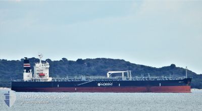
NORD JOY
Tanker
Current Trip
US LA
| Time Travelled | 10 days |
|---|---|
| Remaining Time | --- |
| Distance Travelled | 3103.51 nm |
| Remaining Distance | --- |
| AVG Speed | 12.3 Knots |
| MAX Speed | 16.9 Knots |
| AVG Wind | 13.1 knots |
| MAX Wind | 30 knots |
| MIN Temp | 3.5°C / 38.3°F |
| MAX Temp | 16.6°C / 61.88°F |
| Draught | 11 m |
| Position Received | 8 d ago |
Current Position
| Longitude | 141.78995° |
|---|---|
| Latitude | 41.62566° |
| Status | Under way using engine |
| Speed | 13.1 Knots |
| Course | 81.5° |
| Area | North Pacific Ocean |
| Station | T-AIS |
| Position Received | 8 d ago |
Info
Information
The current position of NORD JOY is in North Pacific Ocean with coordinates 41.62566° / 141.78995° as reported on 2024-04-17 21:27 by AIS to our vessel tracker app. The vessel's current speed is 13.1 Knots
The vessel NORD JOY (IMO: 9814179, MMSI: 374282000) is a Tanker It's sailing under the flag of [PA] Panama.
In this page you can find informations about the vessels current position, last detected port calls, and current voyage information. If the vessels is not in coverage by AIS you will find the latest position.
The current position of NORD JOY is detected by our AIS receivers and we are not responsible for the reliability of the data. The last position was recorded while the vessel was in Coverage by the Ais receivers of our vessel tracking app.
The current draught of NORD JOY as reported by AIS is 11 meters
Weather
| Temperature | 7.1°C / 44.78°F |
|---|---|
| Wind Speed | 16 knots |
| Direction | 322° NW |
| Pressure | 1022.8 hPa |
| Humidity | 68.7 % |
| Cloud Coverage | 100 % |
Featured Company
Last Port Calls
| Port | Arrival | Departure | Time In Port |
|---|---|---|---|
| 2024-04-13 22:12 | 2024-04-15 17:03 | 1 d | |
| 2024-04-02 00:06 | 2024-04-03 09:41 | 1 d | |
| 2024-03-22 14:57 | |||
| 2024-03-08 02:28 | 2024-03-10 22:59 | 2 d | |
| 2024-02-21 15:42 | 2024-02-22 13:36 | 21 h | |
| 2024-02-19 09:17 | 2024-02-21 14:49 | 2 d | |
| 2024-02-08 04:21 | 2024-02-10 05:38 | 2 d | |
| 2024-02-05 02:07 |
Most Visited Ports (Last year)
| Port | Arrivals | |
|---|---|---|
| 3 | ||
| 3 | ||
| 2 | ||
| 2 | ||
| 2 | ||
| 1 |
Last Trips
| Origin | Departure | Destination | Arrival | Distance | |
|---|---|---|---|---|---|
| 2024-04-03 17:41 | 2024-04-14 07:12 | 2630.29 nm | |||
| 2024-03-22 20:27 | 2024-04-02 08:06 | 2818.20 nm | |||
| 2024-02-22 21:36 | 2024-03-08 06:28 | 3584.63 nm | |||
| 2024-02-21 22:49 | 2024-02-21 23:42 | 3.93 nm | |||
| 2024-02-10 11:38 | 2024-02-19 17:17 | 1649.72 nm | |||
| 2024-02-05 07:37 | 2024-02-08 10:21 | 385.61 nm |
Events
| Time | Event | Details | Position / Dest | Info |
|---|---|---|---|---|
| 2024-04-17 21:35 | Status Changed | Default Under way using engine |
41.62808 / 141.83206
US LA
|
Speed: 13.1 kn Course: 81.5° |
| 2024-04-17 21:27 | OUT of Coverage |
41.62566 / 141.78995
North Pacific Ocean
US LA
|
Speed: 13.1 kn Course: 81.5° |
|
| 2024-04-17 19:53 | Change Sea Area | Japanese part of the North Pacific Ocean Japanese part of the Japan Sea |
41.63138 / 141.30181
North Pacific Ocean
US LA
|
Speed: 13.3 kn Course: 85.3° |
| 2024-04-17 16:17 | Status Changed | Under way using engine Default |
41.31491 / 140.23806
US LA
|
Speed: 15.8 kn Course: 56° |
| 2024-04-17 16:01 | Status Changed | Default Under way using engine |
41.27382 / 140.15860
US LA
|
Speed: 15 kn Course: 58.5° |
| 2024-04-17 15:42 | ETA Changed | 2024/05/01 22:00 2024/04/12 08:00 |
41.23268 / 140.07699
US LA
|
Speed: 14.2 kn Course: 55.2° |
| 2024-04-17 15:35 | Status Changed | Under way using engine Default |
41.21747 / 140.04710
US LA
|
Speed: 13.6 kn Course: 56° |
| 2024-04-17 15:30 | Status Changed | Default Under way using engine |
41.20686 / 140.02655
US LA
|
Speed: 13.5 kn Course: 54.1° |
| 2024-04-17 15:15 | Status Changed | Under way using engine Default |
41.17302 / 139.96301
US LA
|
Speed: 13.8 kn Course: 53° |
| 2024-04-17 15:00 | Detected in Sea | Japanese part of the Japan Sea |
41.13966 / 139.90380
Japan Sea
|
Speed: 13.8 kn Course: 54.5° |