

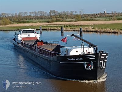
NOORDERKROON
Cargo

Current Trip
GRONINGEN
| Time Travelled | 16 h, 34 mins |
|---|---|
| Remaining Time | --- |
| Distance Travelled | 41.33 nm |
| Remaining Distance | --- |
| AVG Speed | 5.2 Knots |
| MAX Speed | 6.8 Knots |
| AVG Wind | 7.4 knots |
| MAX Wind | 9 knots |
| MIN Temp | 5.5°C / 41.9°F |
| MAX Temp | 10.3°C / 50.54°F |
| Draught | 0.3 m |
| Position Received | Now |
Current Position
| Longitude | --- |
|---|---|
| Latitude | --- |
| Status | Under way using engine |
| Speed | |
| Course | --- |
| Area | North Sea |
| Station | T-AIS |
| Position Received | Now |
Information
The current position of NOORDERKROON is in North Sea with coordinates 53.21769° / 6.48796° as reported on 2025-03-25 02:10 by AIS to our vessel tracker app. The vessel's current speed is 0 Knots
The vessel NOORDERKROON (MMSI: 244630297) is a Cargo It's sailing under the flag of [NL] Netherlands.
In this page you can find informations about the vessels current position, last detected port calls, and current voyage information. If the vessels is not in coverage by AIS you will find the latest position.
The current position of NOORDERKROON is detected by our AIS receivers and we are not responsible for the reliability of the data. The last position was recorded while the vessel was in Coverage by the Ais receivers of our vessel tracking app.
The current draught of NOORDERKROON as reported by AIS is 0.3 meters
Weather
| Temperature | 4.3°C / 39.74°F |
|---|---|
| Wind Speed | 5 knots |
| Direction | 263° W |
| Pressure | 1018.1 hPa |
| Humidity | 95.1 % |
| Cloud Coverage | 100 % |


Featured Company
Last Port Calls
| Port | Arrival | Departure | Time In Port |
|---|---|---|---|
| 2025-03-24 08:03 | 2025-03-24 10:36 | 2 h | |
| 2025-03-22 10:15 | 2025-03-24 06:18 | 1 d | |
| 2025-03-21 18:03 | 2025-03-21 19:11 | 1 h | |
| 2025-03-21 08:24 | 2025-03-21 09:44 | 1 h | |
| 2025-03-20 20:09 | 2025-03-20 21:15 | 1 h | |
| 2025-03-20 15:06 | 2025-03-20 17:42 | 2 h | |
| 2025-03-20 12:46 | 2025-03-20 13:25 | 39 m | |
| 2025-03-18 19:04 | 2025-03-19 07:10 | 12 h | |
| 2025-03-18 12:14 | 2025-03-18 13:04 | 50 m | |
| 2025-03-18 10:08 |
Last Trips
| Origin | Departure | Destination | Arrival | Distance | |
|---|---|---|---|---|---|
| 2025-03-24 06:18 | 2025-03-24 08:03 | 12.00 nm | |||
| 2025-03-21 19:11 | 2025-03-22 10:15 | 27.57 nm | |||
| 2025-03-21 09:44 | 2025-03-21 18:03 | 28.24 nm | |||
| 2025-03-20 21:15 | 2025-03-21 08:24 | 25.67 nm | |||
| 2025-03-20 17:42 | 2025-03-20 20:09 | 12.32 nm | |||
| 2025-03-20 13:25 | 2025-03-20 15:06 | 11.49 nm | |||
| 2025-03-19 07:10 | 2025-03-20 12:46 | 71.23 nm | |||
| 2025-03-18 13:04 | 2025-03-18 19:04 | 41.40 nm | |||
| 2025-03-18 10:08 | 2025-03-18 12:14 | 13.62 nm | |||
| 2025-03-17 07:43 | 2025-03-17 12:13 | 26.40 nm |
Events
| Time | Event | Details | Position / Dest | Info |
|---|---|---|---|---|
| 2025-03-24 17:36 | STOP Moving | 2.87 nm, West of GRONINGEN |
53.21773 / 6.48799
GRONINGEN
|
Speed: 0.1 kn Course: 511° |
| 2025-03-24 16:16 | Status Changed | Under way using engine Default |
53.25293 / 6.39050
GRONINGEN
|
Speed: 6.7 kn Course: 101° |
| 2025-03-24 16:14 | Status Changed | Default Under way using engine |
53.25276 / 6.38352
GRONINGEN
|
Speed: 6.6 kn Course: 87.1° |
| 2025-03-24 16:01 | Status Changed | Under way using engine Default |
53.25229 / 6.34395
GRONINGEN
|
Speed: 6.6 kn Course: 80° |
| 2025-03-24 15:57 | Status Changed | Default Under way using engine |
53.25115 / 6.33223
GRONINGEN
|
Speed: 6.3 kn Course: 80° |
| 2025-03-24 15:52 | START Moving | 2.67 nm, West of BRILTIL |
53.24960 / 6.31715
GRONINGEN
|
Speed: 6.3 kn Course: 80° |
| 2025-03-24 15:41 | STOP Moving | 2.92 nm, West of BRILTIL |
53.24881 / 6.31022
GRONINGEN
|
Speed: Course: 511° |
| 2025-03-24 14:39 | Status Changed | Under way using engine Default |
53.22358 / 6.15667
GRONINGEN
|
Speed: 6.2 kn Course: 79° |
| 2025-03-24 14:38 | Status Changed | Default Under way using engine |
53.22282 / 6.15197
GRONINGEN
|
Speed: 6.2 kn Course: 80.8° |
| 2025-03-24 14:27 | IN Coverage |
53.22087 / 6.12282
North Sea
|
Speed: 6.3 kn Course: 87.4° |