
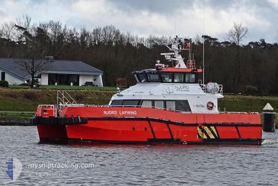
NJORD LAPWING
High speed craft
Current Trip
| Trip Time | 34 days |
|---|---|
| Trip Distance | 301.60 nm |
| AVG Speed | 12.7 Knots |
| MAX Speed | 12.7 Knots |
| Draught | 1.4 m |
| AVG Wind | 13.6 knots |
| MAX Wind | 24.5 knots |
| MIN Temp | 3.8°C / 38.84°F |
| MAX Temp | 11.9°C / 53.42°F |
| Position Received | 2 m ago |
Current Position
| Longitude | --- |
|---|---|
| Latitude | --- |
| Status | Moored |
| Speed | |
| Course | 41° |
| Area | North Sea |
| Station | T-AIS |
| Position Received | 2 m ago |
Info
Information
The current position of NJORD LAPWING is in North Sea with coordinates 53.32426° / 6.92239° as reported on 2025-12-12 23:04 by AIS to our vessel tracker app. The vessel's current speed is 0 Knots and is currently inside the port of DELFZIJL.
The vessel NJORD LAPWING (IMO: 8355944, MMSI: 235095776) is a High speed craft It's sailing under the flag of [GB] United Kingdom.
In this page you can find informations about the vessels current position, last detected port calls, and current voyage information. If the vessels is not in coverage by AIS you will find the latest position.
The current position of NJORD LAPWING is detected by our AIS receivers and we are not responsible for the reliability of the data. The last position was recorded while the vessel was in Coverage by the Ais receivers of our vessel tracking app.
The current draught of NJORD LAPWING as reported by AIS is 1.4 meters
Weather
| Temperature | 8°C / 46.4°F |
|---|---|
| Wind Speed | 7 knots |
| Direction | 202° SSW |
| Pressure | 1023 hPa |
| Humidity | 96.1 % |
| Cloud Coverage | 100 % |
Featured Company
Last Port Calls
| Port | Arrival | Departure | Time In Port |
|---|---|---|---|
| 2025-12-08 14:49 | |||
| 2025-10-31 17:39 | 2025-11-03 15:22 | 2 d | |
| 2025-10-31 07:27 | |||
| 2025-10-22 18:07 | 2025-10-23 07:30 | 13 h | |
| 2025-10-20 10:31 | 2025-10-21 07:53 | 21 h | |
| 2025-10-19 17:12 | 2025-10-20 08:04 | 14 h | |
| 2025-10-15 18:00 | 2025-10-16 07:53 | 13 h | |
| 2025-10-15 07:50 | |||
| 2025-10-13 18:24 | 2025-10-14 08:37 | 14 h | |
| 2025-10-12 18:03 | 2025-10-13 07:59 | 13 h |
Last Trips
| Origin | Departure | Destination | Arrival | Distance | |
|---|---|---|---|---|---|
| 2025-11-03 15:22 | 2025-12-08 14:49 | 301.60 nm | |||
| 2025-10-31 07:27 | 2025-10-31 17:39 | 60.40 nm | |||
| 2025-10-21 07:53 | 2025-10-22 18:07 | 150.78 nm | |||
| 2025-10-20 08:04 | 2025-10-20 10:31 | 36.20 nm | |||
| 2025-10-16 07:53 | 2025-10-19 17:12 | 266.32 nm | |||
| 2025-10-15 07:50 | 2025-10-15 18:00 | 57.46 nm | |||
| 2025-10-13 07:59 | 2025-10-13 18:24 | 52.99 nm | |||
| 2025-10-12 07:49 | 2025-10-12 18:03 | 58.80 nm |
Events
| Time | Event | Details | Position / Dest | Info |
|---|---|---|---|---|
| 2025-12-11 07:27 | IN Coverage |
53.32350 / 6.92132
North Sea
[NL] DELFZIJL
|
Speed: Course: 183.2° |
|
| 2025-12-11 06:27 | OUT of Coverage |
53.32348 / 6.92133
North Sea
[NL] DELFZIJL
|
Speed: Course: 306.5° |
|
| 2025-12-11 06:09 | IN Coverage |
53.32351 / 6.92133
North Sea
[NL] DELFZIJL
|
Speed: Course: 183.2° |
|
| 2025-12-11 04:21 | OUT of Coverage |
53.32348 / 6.92133
North Sea
[NL] DELFZIJL
|
Speed: Course: 241.1° |
|
| 2025-12-11 04:00 | IN Coverage |
53.32343 / 6.92136
North Sea
[NL] DELFZIJL
|
Speed: Course: 265.1° |
|
| 2025-12-11 02:45 | OUT of Coverage |
53.32349 / 6.92131
North Sea
[NL] DELFZIJL
|
Speed: Course: 9.7° |
|
| 2025-12-11 00:12 | IN Coverage |
53.32349 / 6.92133
North Sea
[NL] DELFZIJL
|
Speed: Course: 183.2° |
|
| 2025-12-10 22:51 | OUT of Coverage |
53.32355 / 6.92132
North Sea
[NL] DELFZIJL
|
Speed: Course: 183.2° |
|
| 2025-12-10 19:00 | IN Coverage |
53.32352 / 6.92129
North Sea
[NL] DELFZIJL
|
Speed: Course: 267.1° |
|
| 2025-12-10 17:58 | OUT of Coverage |
53.32350 / 6.92129
North Sea
[NL] DELFZIJL
|
Speed: Course: 71.7° |