

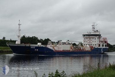
NIKE
Oil/Chemical Tanker

Current Trip
| Time Travelled | 3 days |
|---|---|
| Remaining Time | --- |
| Distance Travelled | 484.39 nm |
| Remaining Distance | --- |
| AVG Speed | 11 Knots |
| MAX Speed | 14 Knots |
| AVG Wind | 14.8 knots |
| MAX Wind | 24 knots |
| MIN Temp | -2.3°C / 27.86°F |
| MAX Temp | 5.5°C / 41.9°F |
| Draught | 5.4 m |
| Position Received | 4 m ago |
Current Position
| Longitude | --- |
|---|---|
| Latitude | --- |
| Status | At anchor |
| Speed | 0.1 Knots |
| Course | 50° |
| Area | Kattegat |
| Station | T-AIS |
| Position Received | 4 m ago |
Information
The current position of NIKE is in Kattegat with coordinates 57.60167° / 11.67881° as reported on 2025-02-15 18:31 by AIS to our vessel tracker app. The vessel's current speed is 0.1 Knots
The vessel NIKE (IMO: 9431032, MMSI: 249803000) is a Oil/Chemical Tanker that was built in 2009 ( 16 years old ). It's sailing under the flag of [MT] Malta.
In this page you can find informations about the vessels current position, last detected port calls, and current voyage information. If the vessels is not in coverage by AIS you will find the latest position.
The current position of NIKE is detected by our AIS receivers and we are not responsible for the reliability of the data. The last position was recorded while the vessel was in Coverage by the Ais receivers of our vessel tracking app.
The current draught of NIKE as reported by AIS is 5.4 meters
Weather
| Temperature | -2.3°C / 27.86°F |
|---|---|
| Wind Speed | 19 knots |
| Direction | 45° NE |
| Pressure | 1026.9 hPa |
| Humidity | 63.1 % |
| Cloud Coverage | 64 % |


Featured Company
Last Port Calls
| Port | Arrival | Departure | Time In Port |
|---|---|---|---|
| 2025-02-10 12:29 | 2025-02-11 21:21 | 1 d | |
| 2025-02-05 20:15 | 2025-02-07 02:00 | 1 d | |
| 2025-02-03 12:14 | 2025-02-03 15:15 | 3 h | |
| 2025-02-02 03:20 | 2025-02-03 10:43 | 1 d | |
| 2025-01-31 08:45 | 2025-01-31 09:28 | 43 m | |
| 2025-01-28 22:16 | 2025-01-29 22:24 | 1 d | |
| 2025-01-24 17:22 | 2025-01-25 19:58 | 1 d | |
| 2025-01-21 03:52 | 2025-01-21 22:25 | 18 h | |
| 2025-01-16 20:43 | 2025-01-18 08:04 | 1 d | |
| 2025-01-13 11:35 | 2025-01-15 10:06 | 1 d |
Most Visited Ports (Last year)
| Port | Arrivals | |
|---|---|---|
| 8 | ||
| 8 | ||
| 7 | ||
| 7 | ||
| 4 | ||
| 4 |
Last Trips
| Origin | Departure | Destination | Arrival | Distance | |
|---|---|---|---|---|---|
| 2025-02-07 03:00 | 2025-02-10 13:29 | 599.74 nm | |||
| 2025-02-03 16:15 | 2025-02-05 21:15 | 592.69 nm | |||
| 2025-02-03 11:43 | 2025-02-03 13:14 | 17.24 nm | |||
| 2025-01-31 10:28 | 2025-02-02 04:20 | 395.97 nm | |||
| 2025-01-29 23:24 | 2025-01-31 09:45 | 361.31 nm | |||
| 2025-01-25 20:58 | 2025-01-28 23:16 | 691.98 nm | |||
| 2025-01-21 23:25 | 2025-01-24 18:22 | 661.54 nm | |||
| 2025-01-18 09:04 | 2025-01-21 04:52 | 561.78 nm | |||
| 2025-01-15 11:06 | 2025-01-16 21:43 | 376.59 nm | |||
| 2025-01-12 23:56 | 2025-01-13 12:35 | 87.24 nm |
Events
| Time | Event | Details | Position / Dest | Info |
|---|---|---|---|---|
| 2025-02-14 09:30 | Status Changed | At anchor Default |
57.60308 / 11.67927
SE GOT
|
Speed: Course: 128° |
| 2025-02-14 09:27 | Status Changed | Default At anchor |
57.60304 / 11.67918
SE GOT
|
Speed: Course: 125° |
| 2025-02-14 02:18 | Status Changed | At anchor Default |
57.60213 / 11.67854
SE GOT
|
Speed: 0.1 kn Course: 71° |
| 2025-02-14 02:15 | Status Changed | Default At anchor |
57.60209 / 11.67865
SE GOT
|
Speed: 0.1 kn Course: 63° |
| 2025-02-13 17:15 | Status Changed | At anchor Under way using engine |
57.60238 / 11.68073
SE GOT
|
Speed: 1 kn Course: 50° |
| 2025-02-13 17:12 | STOP Moving | 3.06 nm, West of SANDVIK |
57.60285 / 11.68123
SE GOT
|
Speed: 0.3 kn Course: 49° |
| 2025-02-13 15:19 | Change Sea Area | Swedish part of the Kattegat Danish part of the Kattegat |
57.68518 / 11.18170
Kattegat
SE GOT
|
Speed: 10.7 kn Course: 116.1° |
| 2025-02-13 14:16 | Change Sea Area | Danish part of the Kattegat Danish part of the Skaggerak |
57.78284 / 10.88267
Kattegat
SE GOT
|
Speed: 11 kn Course: 135° |
| 2025-02-13 05:52 | Change Sea Area | Danish part of the Skaggerak Danish part of the North Sea |
57.19188 / 8.49447
Skaggerak
SE GOT
|
Speed: 11.1 kn Course: 57.6° |
| 2025-02-13 01:37 | ETA Changed | 2025/02/13 19:00 2025/02/13 11:00 |
56.59440 / 7.48618
SE GOT
|
Speed: 11.8 kn Course: 28.8° |