
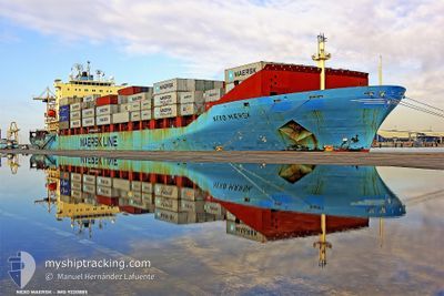
NEXOE MAERSK
Container Ship
Current Trip
| Time Travelled | 2 days |
|---|---|
| Remaining Time | 2 days |
| Distance Travelled | 856.36 nm |
| Remaining Distance | 961.89 nm |
| AVG Speed | 13.9 Knots |
| MAX Speed | 16.3 Knots |
| AVG Wind | 7 knots |
| MAX Wind | 14.7 knots |
| MIN Temp | 12.2°C / 53.96°F |
| MAX Temp | 19.4°C / 66.92°F |
| Draught | 10.2 m |
| Position Received | Now |
Current Position
| Longitude | 11.94786° |
|---|---|
| Latitude | 37.05873° |
| Status | Under way using engine |
| Speed | 13.6 Knots |
| Course | 111.9° |
| Area | Mediterranean Sea - Eastern Basin |
| Station | T-AIS |
| Position Received | Now |
Info
Information
The current position of NEXOE MAERSK is in Mediterranean Sea - Eastern Basin with coordinates 37.05873° / 11.94786° as reported on 2024-05-14 14:19 by AIS to our vessel tracker app. The vessel's current speed is 13.6 Knots and is heading at the port of ALEXANDRIA. The estimated time of arrival as calculated by MyShipTracking vessel tracking app is 2024-05-17 12:09 LT
The vessel NEXOE MAERSK (IMO: 9220885, MMSI: 477642400) is a Container Ship that was built in 2001 ( 23 years old ). It's sailing under the flag of [HK] Hong Kong.
In this page you can find informations about the vessels current position, last detected port calls, and current voyage information. If the vessels is not in coverage by AIS you will find the latest position.
The current position of NEXOE MAERSK is detected by our AIS receivers and we are not responsible for the reliability of the data. The last position was recorded while the vessel was in Coverage by the Ais receivers of our vessel tracking app.
The current draught of NEXOE MAERSK as reported by AIS is 10.2 meters
Weather
| Temperature | 19°C / 66.2°F |
|---|---|
| Wind Speed | 12 knots |
| Direction | 137° SE |
| Pressure | 1007.1 hPa |
| Humidity | 88.7 % |
| Cloud Coverage | 81 % |
Featured Company
Last Port Calls
| Port | Arrival | Departure | Time In Port |
|---|---|---|---|
| 2024-05-11 11:20 | 2024-05-12 01:17 | 13 h | |
| 2024-05-07 21:44 | 2024-05-09 14:59 | 1 d | |
| 2024-05-05 10:28 | 2024-05-06 03:46 | 17 h | |
| 2024-05-04 05:51 | 2024-05-04 18:49 | 12 h | |
| 2024-05-02 18:32 | 2024-05-03 17:12 | 22 h | |
| 2024-04-30 16:20 | 2024-04-30 23:04 | 6 h | |
| 2024-04-26 01:18 | |||
| 2024-04-25 20:06 | |||
| 2024-04-23 20:41 | 2024-04-24 23:32 | 1 d | |
| 2024-04-21 13:51 | 2024-04-22 18:33 | 1 d |
Last Trips
| Origin | Departure | Destination | Arrival | Distance | |
|---|---|---|---|---|---|
| 2024-05-09 15:59 | 2024-05-11 13:20 | 278.57 nm | |||
| 2024-05-06 05:46 | 2024-05-07 22:44 | 619.98 nm | |||
| 2024-05-04 20:49 | 2024-05-05 12:28 | 164.13 nm | |||
| 2024-05-03 19:12 | 2024-05-04 07:51 | 190.48 nm | |||
| 2024-05-01 01:04 | 2024-05-02 20:32 | 282.09 nm | |||
| 2024-04-25 02:32 | 2024-04-25 23:06 | 258.17 nm | |||
| 2024-04-22 20:33 | 2024-04-23 23:41 | 453.69 nm | |||
| 2024-04-17 04:33 | 2024-04-21 15:51 | 1805.80 nm | |||
| 2024-04-11 19:48 | 2024-04-16 02:05 | 548.46 nm | |||
| 2024-04-10 15:39 | 2024-04-11 01:26 | 163.72 nm |
Events
| Time | Event | Details | Position / Dest | Info |
|---|---|---|---|---|
| 2024-05-14 12:14 | Detected in Sea | Tunisian part of the Mediterranean Sea - Eastern Basin |
37.26612 / 11.41023
Mediterranean Sea - Eastern Basin
ESALR>EGALY
|
Speed: 13.7 kn Course: 116.5° |
| 2024-05-14 06:35 | Status Changed | Under way using engine Default |
37.57082 / 9.83364
ESALR>EGALY
|
Speed: 13.9 kn Course: 98° |
| 2024-05-14 06:31 | Status Changed | Default Under way using engine |
37.57307 / 9.81387
ESALR>EGALY
|
Speed: 13.9 kn Course: 98.1° |
| 2024-05-14 06:26 | Status Changed | Under way using engine Default |
37.57530 / 9.79357
ESALR>EGALY
|
Speed: 14 kn Course: 76° |
| 2024-05-14 06:05 | Status Changed | Default Under way using engine |
37.55669 / 9.69290
ESALR>EGALY
|
Speed: 14 kn Course: 75.4° |
| 2024-05-14 05:46 | Change Sea Area | Tunisian part of the Mediterranean Sea - Western Basin Algerian part of the Mediterranean Sea - Western Basin |
37.53795 / 9.60288
Mediterranean Sea - Western Basin
ESALR>EGALY
|
Speed: 13.9 kn Course: 75.3° |
| 2024-05-14 05:46 | IN Coverage |
37.53795 / 9.60288
Mediterranean Sea - Western Basin
ESALR>EGALY
|
Speed: 13.9 kn Course: 75.3° |
|
| 2024-05-14 05:45 | Status Changed | Under way using engine Default |
37.53647 / 9.59582
ESALR>EGALY
|
Speed: 13.7 kn Course: 77° |
| 2024-05-12 21:19 | Status Changed | Default Under way using engine |
36.71496 / .28665
ESALR>EGALY
|
Speed: 14.1 kn Course: 81.1° |
| 2024-05-12 21:13 | OUT of Coverage |
36.71075 / .25534
Mediterranean Sea - Western Basin
ESALR>EGALY
|
Speed: 14.1 kn Course: 81.1° |