
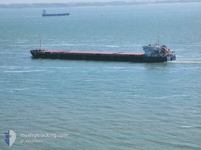
NEVA-LEADER 2
General Cargo
Current Trip
| Trip Time | 35 days |
|---|---|
| Trip Distance | 2612.21 nm |
| AVG Speed | 8 Knots |
| MAX Speed | 12.5 Knots |
| Draught | 4 m |
| AVG Wind | 9 knots |
| MAX Wind | 36 knots |
| MIN Temp | -2.9°C / 26.78°F |
| MAX Temp | 18.2°C / 64.76°F |
| Position Received | 4 d ago |
Current Position
| Longitude | --- |
|---|---|
| Latitude | --- |
| Status | Under way using engine |
| Speed | 8.7 Knots |
| Course | 48.4° |
| Area | Mediterranean Sea - Eastern Basin |
| Station | T-AIS |
| Position Received | 4 d ago |
Info
Information
The current position of NEVA-LEADER 2 is in Mediterranean Sea - Eastern Basin with coordinates 36.50652° / 35.85316° as reported on 2025-02-21 10:13 by AIS to our vessel tracker app. The vessel's current speed is 8.7 Knots and is currently inside the port of ISKENDERUN.
The vessel NEVA-LEADER 2 (IMO: 9598828, MMSI: 273350280) is a General Cargo that was built in 2012 ( 13 years old ). It's sailing under the flag of [RU] Russia.
In this page you can find informations about the vessels current position, last detected port calls, and current voyage information. If the vessels is not in coverage by AIS you will find the latest position.
The current position of NEVA-LEADER 2 is detected by our AIS receivers and we are not responsible for the reliability of the data. The last position was recorded while the vessel was in Coverage by the Ais receivers of our vessel tracking app.
The current draught of NEVA-LEADER 2 as reported by AIS is 4 meters
Weather
| Temperature | 4.5°C / 40.1°F |
|---|---|
| Wind Speed | 4 knots |
| Direction | 290° WNW |
| Pressure | 1025.6 hPa |
| Humidity | 42.1 % |
| Cloud Coverage | 100 % |
Featured Company
Last Port Calls
| Port | Arrival | Departure | Time In Port |
|---|---|---|---|
| 2025-02-24 04:17 | |||
| 2025-01-16 03:57 | 2025-01-19 09:16 | 3 d | |
| 2024-12-18 06:45 | 2024-12-19 20:51 | 1 d |
Events
| Time | Event | Details | Position / Dest | Info |
|---|---|---|---|---|
| 2025-02-24 05:01 | STOP Moving |
36.78303 / 36.19942
[TR] ISKENDERUN
|
Speed: Course: 74° |
|
| 2025-02-24 04:17 | PORT ARRIVAL |
|
36.78125 / 36.18224
[TR] ISKENDERUN
|
Speed: 4.4 kn Course: 68° |
| 2025-02-24 02:17 | START Moving | 2.01 nm, West of ISKENDERUN |
36.60631 / 36.13394
TRISK
|
Speed: 5 kn Course: 3° |
| 2025-02-21 12:25 | STOP Moving | 1.93 nm, West of ISKENDERUN |
36.60199 / 36.13676
TRISK
|
Speed: 0.2 kn Course: 340° |
| 2025-02-21 10:29 | Status Changed | Default Under way using engine |
36.53297 / 35.88985
TRISK
|
Speed: 8.7 kn Course: 48.4° |
| 2025-02-21 10:13 | OUT of Coverage |
36.50652 / 35.85316
Mediterranean Sea - Eastern Basin
TRISK
|
Speed: 8.7 kn Course: 48.4° |
|
| 2025-02-21 09:19 | ETA Changed | 2025/02/21 16:00 2025/02/21 12:00 |
36.42329 / 35.72988
TRISK
|
Speed: 8.5 kn Course: 48.5° |
| 2025-02-21 09:12 | Draught Changed | 4 3.9 |
36.41300 / 35.71515
TRISK
|
Speed: 8.4 kn Course: 49.9° |
| 2025-02-21 05:48 | Status Changed | Under way using engine Default |
36.30525 / 35.23103
TRISK
|
Speed: 6.6 kn Course: 77° |
| 2025-02-21 05:40 | Status Changed | Default Under way using engine |
36.30254 / 35.21492
TRISK
|
Speed: 6.5 kn Course: 76.9° |