
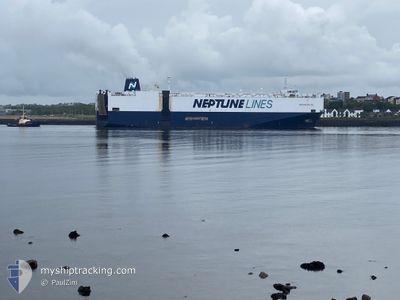
NEPTUNE HELLAS
Vehicles Carrier
Current Trip
| Time Travelled | 15 days |
|---|---|
| Remaining Time | 4 days |
| Distance Travelled | 5641.32 nm |
| Remaining Distance | 1182.70 nm |
| AVG Speed | 14.8 Knots |
| MAX Speed | 18.2 Knots |
| AVG Wind | 13.8 knots |
| MAX Wind | 33.2 knots |
| MIN Temp | 11°C / 51.8°F |
| MAX Temp | 27.7°C / 81.86°F |
| Draught | 8.6 m |
| Position Received | 4 h, 29 m ago |
Current Position
| Longitude | --- |
|---|---|
| Latitude | --- |
| Status | Under way using engine |
| Speed | 10.5 Knots |
| Course | 356° |
| Area | North Atlantic Ocean |
| Station | T-AIS |
| Position Received | 4 h, 29 m ago |
Info
Information
The current position of NEPTUNE HELLAS is in North Atlantic Ocean with coordinates 39.26697° / -9.85810° as reported on 2026-01-05 06:48 by AIS to our vessel tracker app. The vessel's current speed is 10.5 Knots and is heading at the port of EMDEN. The estimated time of arrival as calculated by MyShipTracking vessel tracking app is 2026-01-10 05:46 LT
The vessel NEPTUNE HELLAS (IMO: 9440148, MMSI: 256575000) is a Vehicles Carrier that was built in 2009 ( 17 years old ). It's sailing under the flag of [MT] Malta.
In this page you can find informations about the vessels current position, last detected port calls, and current voyage information. If the vessels is not in coverage by AIS you will find the latest position.
The current position of NEPTUNE HELLAS is detected by our AIS receivers and we are not responsible for the reliability of the data. The last position was recorded while the vessel was in Coverage by the Ais receivers of our vessel tracking app.
The current draught of NEPTUNE HELLAS as reported by AIS is 8.6 meters
Weather
| Temperature | 11.3°C / 52.34°F |
|---|---|
| Wind Speed | 31 knots |
| Direction | 12° NNE |
| Pressure | 1017 hPa |
| Humidity | 58 % |
| Cloud Coverage | 32 % |
Featured Company
Last Trips
| Origin | Departure | Destination | Arrival | Distance | |
|---|---|---|---|---|---|
| 2025-12-07 15:22 | 2025-12-19 07:13 | 4446.27 nm | |||
| 2025-11-27 21:14 | 2025-12-06 07:38 | 1068.53 nm | |||
| 2025-11-21 16:48 | 2025-11-27 05:33 | 199.73 nm | |||
| 2025-11-13 21:41 | 2025-11-21 03:53 | 975.42 nm | |||
| 2025-10-30 23:52 | 2025-11-09 23:41 | 972.25 nm |
Events
| Time | Event | Details | Position / Dest | Info |
|---|---|---|---|---|
| 2026-01-05 06:55 | Status Changed | Default Under way using engine |
39.28501 / -9.85995
DEEME
|
Speed: 10.5 kn Course: 356° |
| 2026-01-05 06:48 | OUT of Coverage |
39.26697 / -9.85810
North Atlantic Ocean
DEEME
|
Speed: 10.5 kn Course: 356° |
|
| 2026-01-05 05:48 | Status Changed | Under way using engine Default |
39.09875 / -9.84747
DEEME
|
Speed: 10.2 kn Course: 359° |
| 2026-01-05 05:47 | Status Changed | Default Under way using engine |
39.09382 / -9.84749
DEEME
|
Speed: 9.9 kn Course: 358.6° |
| 2026-01-05 01:51 | ETA Changed | 2026/01/08 23:30 2026/01/08 10:00 |
38.35671 / -9.85094
DEEME
|
Speed: 12.7 kn Course: 2.1° |
| 2026-01-05 01:28 | Status Changed | Under way using engine Default |
38.28013 / -9.85779
DEEME
|
Speed: 12.3 kn Course: 6° |
| 2026-01-05 01:25 | Status Changed | Default Under way using engine |
38.26866 / -9.85916
DEEME
|
Speed: 12.1 kn Course: 6.1° |
| 2026-01-05 01:04 | Status Changed | Under way using engine Default |
38.19641 / -9.86649
DEEME
|
Speed: 13.7 kn Course: 4° |
| 2026-01-05 01:03 | Status Changed | Default Under way using engine |
38.19088 / -9.86690
DEEME
|
Speed: 13.7 kn Course: 4.9° |
| 2026-01-05 01:02 | Status Changed | Under way using engine Default |
38.18702 / -9.86733
DEEME
|
Speed: 13.6 kn Course: 4° |