
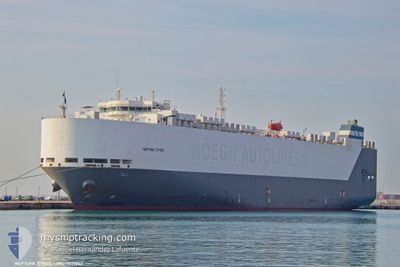
NEPTUNE ETHOS
Vehicles Carrier
Current Trip
| Time Travelled | 4 days |
|---|---|
| Remaining Time | 3 h, 50 mins |
| Distance Travelled | 533.15 nm |
| Remaining Distance | 35.93 nm |
| AVG Speed | 5.7 Knots |
| MAX Speed | 11.3 Knots |
| AVG Wind | 5.5 knots |
| MAX Wind | 15 knots |
| MIN Temp | 11.4°C / 52.52°F |
| MAX Temp | 14.7°C / 58.46°F |
| Draught | 7.6 m |
| Position Received | 1 m ago |
Current Position
| Longitude | --- |
|---|---|
| Latitude | --- |
| Status | Under way using engine |
| Speed | 3.5 Knots |
| Course | 176° |
| Area | Balearic Sea |
| Station | T-AIS |
| Position Received | 1 m ago |
Info
Information
The current position of NEPTUNE ETHOS is in Balearic Sea with coordinates 40.76062° / 2.72579° as reported on 2025-01-02 16:20 by AIS to our vessel tracker app. The vessel's current speed is 3.5 Knots and is heading at the port of BARCELONA. The estimated time of arrival as calculated by MyShipTracking vessel tracking app is 2025-01-02 20:11 LT
The vessel NEPTUNE ETHOS (IMO: 9431862, MMSI: 241816000) is a Vehicles Carrier that was built in 2011 ( 14 years old ). It's sailing under the flag of [GR] Greece.
In this page you can find informations about the vessels current position, last detected port calls, and current voyage information. If the vessels is not in coverage by AIS you will find the latest position.
The current position of NEPTUNE ETHOS is detected by our AIS receivers and we are not responsible for the reliability of the data. The last position was recorded while the vessel was in Coverage by the Ais receivers of our vessel tracking app.
The current draught of NEPTUNE ETHOS as reported by AIS is 7.6 meters
Weather
| Temperature | 14.1°C / 57.38°F |
|---|---|
| Wind Speed | 14 knots |
| Direction | 254° WSW |
| Pressure | 1023.4 hPa |
| Humidity | 67.7 % |
| Cloud Coverage | 23 % |
Featured Company
Last Port Calls
| Port | Arrival | Departure | Time In Port |
|---|---|---|---|
| 2024-12-25 05:48 | 2024-12-28 22:45 | 3 d | |
| 2024-12-23 19:18 | 2024-12-24 15:00 | 19 h | |
| 2024-12-19 15:15 | 2024-12-21 03:58 | 1 d | |
| 2024-12-18 05:40 | 2024-12-18 18:16 | 12 h | |
| 2024-12-11 16:16 | 2024-12-12 07:44 | 15 h | |
| 2024-12-09 19:36 | 2024-12-10 12:20 | 16 h | |
| 2024-12-04 05:45 | 2024-12-05 03:13 | 21 h | |
| 2024-11-30 07:03 | 2024-12-01 20:18 | 1 d | |
| 2024-11-28 06:24 | 2024-11-29 05:34 | 23 h | |
| 2024-11-27 09:32 | 2024-11-27 18:19 | 8 h |
Last Trips
| Origin | Departure | Destination | Arrival | Distance | |
|---|---|---|---|---|---|
| 2024-12-24 16:00 | 2024-12-25 06:48 | 137.37 nm | |||
| 2024-12-21 04:58 | 2024-12-23 20:18 | 917.53 nm | |||
| 2024-12-18 18:16 | 2024-12-19 16:15 | 319.10 nm | |||
| 2024-12-12 07:44 | 2024-12-18 05:40 | 1380.90 nm | |||
| 2024-12-10 12:20 | 2024-12-11 16:16 | 316.79 nm | |||
| 2024-12-05 03:13 | 2024-12-09 19:36 | 1469.60 nm | |||
| 2024-12-01 21:18 | 2024-12-04 05:45 | 824.11 nm | |||
| 2024-11-29 06:34 | 2024-11-30 08:03 | 390.53 nm | |||
| 2024-11-27 19:19 | 2024-11-28 07:24 | 97.15 nm | |||
| 2024-11-26 19:31 | 2024-11-27 10:32 | 203.19 nm |
Events
| Time | Event | Details | Position / Dest | Info |
|---|---|---|---|---|
| 2025-01-02 16:20 | Status Changed | Under way using engine Default |
40.76062 / 2.72579
ESBCN
|
Speed: 3.6 kn Course: 175° |
| 2025-01-02 14:40 | Status Changed | Default Under way using engine |
40.80761 / 2.60717
ESBCN
|
Speed: 3.1 kn Course: 238° |
| 2025-01-02 14:33 | OUT of Coverage |
40.81338 / 2.60394
Balearic Sea
ESBCN
|
Speed: 3.1 kn Course: 174.7° |
|
| 2025-01-02 14:12 | Status Changed | Under way using engine Default |
40.84934 / 2.59832
ESBCN
|
Speed: 6.5 kn Course: 177° |
| 2025-01-02 14:03 | Status Changed | Default Under way using engine |
40.86613 / 2.59603
ESBCN
|
Speed: 6.5 kn Course: 176.7° |
| 2025-01-02 07:11 | START Moving | 16.04 nm, South East of PREMIA DE MAR |
41.27711 / 2.58448
ESBCN
|
Speed: 3.1 kn Course: 286° |
| 2025-01-02 06:38 | ETA Changed | 2025/01/14 04:00 2025/12/30 12:00 |
41.27346 / 2.57049
ESBCN
|
Speed: 1.6 kn Course: 186° |
| 2025-01-02 03:08 | STOP Moving | 15.34 nm, South East of PREMIA DE MAR |
41.25525 / 2.50520
ESBCN
|
Speed: 0.3 kn Course: 201° |
| 2025-01-01 23:11 | START Moving | 13.85 nm, South East of PREMIA DE MAR |
41.30912 / 2.56035
ESBCN
|
Speed: 3.1 kn Course: 224° |
| 2025-01-01 23:07 | STOP Moving | 13.83 nm, South East of PREMIA DE MAR |
41.31056 / 2.56189
ESBCN
|
Speed: 0.3 kn Course: 201° |