
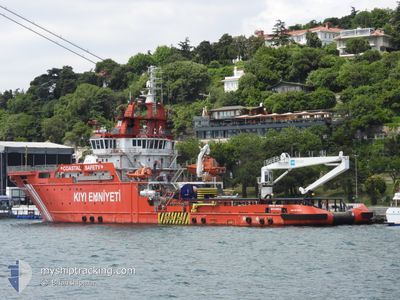
NENE HATUN
Search and Rescue vessel
Current Trip
| Time Travelled | 2 days |
|---|---|
| Remaining Time | --- |
| Distance Travelled | 324.52 nm |
| Remaining Distance | --- |
| AVG Speed | 6.3 Knots |
| MAX Speed | 10.6 Knots |
| AVG Wind | 4.5 knots |
| MAX Wind | 15.7 knots |
| MIN Temp | 5.1°C / 41.18°F |
| MAX Temp | 12.3°C / 54.14°F |
| Draught | 6.5 m |
| Position Received | 1 m ago |
Current Position
| Longitude | --- |
|---|---|
| Latitude | --- |
| Status | Under way using engine |
| Speed | 2.1 Knots |
| Course | 337° |
| Area | Sea of Marmara |
| Station | T-AIS |
| Position Received | 1 m ago |
Info
Information
The current position of NENE HATUN is in Sea of Marmara with coordinates 40.70530° / 29.16960° as reported on 2025-12-12 11:30 by AIS to our vessel tracker app. The vessel's current speed is 2.1 Knots
The vessel NENE HATUN (IMO: 9675004, MMSI: 271044031) is a Search and Rescue vessel It's sailing under the flag of [TR] Turkey.
In this page you can find informations about the vessels current position, last detected port calls, and current voyage information. If the vessels is not in coverage by AIS you will find the latest position.
The current position of NENE HATUN is detected by our AIS receivers and we are not responsible for the reliability of the data. The last position was recorded while the vessel was in Coverage by the Ais receivers of our vessel tracking app.
The current draught of NENE HATUN as reported by AIS is 6.5 meters
Weather
| Temperature | 11.6°C / 52.88°F |
|---|---|
| Wind Speed | 2 knots |
| Direction | 30° NNE |
| Pressure | 1020.5 hPa |
| Humidity | 62.3 % |
| Cloud Coverage | 75 % |
Featured Company
Events
| Time | Event | Details | Position / Dest | Info |
|---|---|---|---|---|
| 2025-12-12 11:27 | START Moving | 5.55 nm, North West of YALOVA |
40.70716 / 29.16908
YALOVA
|
Speed: 3.1 kn Course: 346° |
| 2025-12-12 04:28 | STOP Moving | 7.96 nm, West of YALOVA |
40.70426 / 29.10999
YALOVA
|
Speed: 0.3 kn Course: 271° |
| 2025-12-10 21:38 | Destination Changed | YALOVA CANAKKALE |
40.71557 / 27.81569
YALOVA
|
Speed: 5.8 kn Course: 78.8° |
| 2025-12-10 21:38 | ETA Changed | 2025/12/11 11:00 2025/12/10 05:45 |
40.71557 / 27.81569
YALOVA
|
Speed: 5.8 kn Course: 78.8° |
| 2025-12-10 20:03 | IN Coverage |
40.69394 / 27.62438
Sea of Marmara
|
Speed: 5.4 kn Course: 69.9° |
|
| 2025-12-10 18:36 | OUT of Coverage |
40.64585 / 27.45371
Sea of Marmara
|
Speed: 5.9 kn Course: 65° |
|
| 2025-12-10 18:36 | IN Coverage |
40.64585 / 27.45371
Sea of Marmara
|
Speed: 5.9 kn Course: 65° |
|
| 2025-12-10 10:51 | OUT of Coverage |
40.29728 / 26.58558
Sea of Marmara
|
Speed: 5.4 kn Course: 44.1° |
|
| 2025-12-10 03:07 | IN Coverage |
40.31085 / 26.58489
Sea of Marmara
CANAKKALE
|
Speed: 9 kn Course: 229.1° |
|
| 2025-12-09 20:59 | OUT of Coverage |
40.75649 / 27.62062
Sea of Marmara
CANAKKALE
|
Speed: 10 kn Course: 244.2° |