
NARA
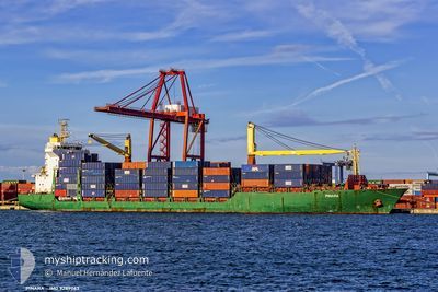
Container Ship
Current Trip
| Time Travelled | 8 days |
|---|---|
| Remaining Time | 3 days |
| Distance Travelled | 2752.89 nm |
| Remaining Distance | 1214.07 nm |
| AVG Speed | 14 Knots |
| MAX Speed | 18.8 Knots |
| AVG Wind | 8.4 knots |
| MAX Wind | 15.6 knots |
| MIN Temp | 25.8°C / 78.44°F |
| MAX Temp | 31°C / 87.8°F |
| Draught | 11.2 m |
| Position Received | 3 d ago |
Current Position
| Longitude | 103.45477° |
|---|---|
| Latitude | 1.22437° |
| Status | Under way using engine |
| Speed | 16.6 Knots |
| Course | 285.5° |
| Area | Malacca Strait |
| Station | T-AIS |
| Position Received | 3 d ago |
Info
Information
The current position of NARA is in Malacca Strait with coordinates 1.22437° / 103.45477° as reported on 2024-05-10 15:47 by AIS to our vessel tracker app. The vessel's current speed is 16.6 Knots and is heading at the port of NHAVA SHEVA. The estimated time of arrival as calculated by MyShipTracking vessel tracking app is 2024-05-16 23:07 LT
The vessel NARA (IMO: 9289063, MMSI: 271051022) is a Container Ship that was built in 2004 ( 20 years old ). It's sailing under the flag of [TR] Turkey.
In this page you can find informations about the vessels current position, last detected port calls, and current voyage information. If the vessels is not in coverage by AIS you will find the latest position.
The current position of NARA is detected by our AIS receivers and we are not responsible for the reliability of the data. The last position was recorded while the vessel was in Coverage by the Ais receivers of our vessel tracking app.
The current draught of NARA as reported by AIS is 11.2 meters
Weather
| Temperature | 29.5°C / 85.1°F |
|---|---|
| Wind Speed | 6 knots |
| Direction | 182° S |
| Pressure | 1007.3 hPa |
| Humidity | 72.2 % |
| Cloud Coverage | 55 % |
Featured Company
Last Port Calls
| Port | Arrival | Departure | Time In Port |
|---|---|---|---|
| 2024-05-05 07:00 | 2024-05-05 12:56 | 5 h | |
| 2024-04-30 05:10 | 2024-04-30 16:08 | 10 h | |
| 2024-04-26 19:28 | 2024-04-27 12:00 | 16 h | |
| 2024-04-12 07:42 | 2024-04-12 17:58 | 10 h | |
| 2024-04-10 19:43 | 2024-04-11 03:10 | 7 h | |
| 2024-04-01 02:29 | 2024-04-01 11:13 | 8 h | |
| 2024-03-28 23:58 | 2024-03-29 19:56 | 19 h | |
| 2024-03-27 18:34 | 2024-03-28 18:40 | 1 d | |
| 2024-03-25 03:24 | 2024-03-26 21:41 | 1 d | |
| 2024-03-23 12:18 | 2024-03-24 09:26 | 21 h |
Most Visited Ports (Last year)
| Port | Arrivals | |
|---|---|---|
| 27 | ||
| 27 | ||
| 26 | ||
| 3 | ||
| 3 | ||
| 2 |
Last Trips
| Origin | Departure | Destination | Arrival | Distance | |
|---|---|---|---|---|---|
| 2024-05-01 00:08 | 2024-05-05 15:00 | 1126.34 nm | |||
| 2024-04-27 20:00 | 2024-04-30 13:10 | 455.95 nm | |||
| 2024-04-12 23:28 | 2024-04-27 03:28 | 5016.66 nm | |||
| 2024-04-11 08:40 | 2024-04-12 13:12 | 427.84 nm | |||
| 2024-03-29 22:56 | 2024-04-11 01:13 | 3872.47 nm | |||
| 2024-03-29 22:56 | 2024-04-01 04:29 | 796.76 nm | |||
| 2024-03-28 21:40 | 2024-03-29 02:58 | 44.28 nm | |||
| 2024-03-27 00:41 | 2024-03-27 21:34 | 62.01 nm | |||
| 2024-03-24 12:26 | 2024-03-25 06:24 | 271.48 nm | |||
| 2024-03-13 05:33 | 2024-03-23 15:18 | 3451.88 nm |
Events
| Time | Event | Details | Position / Dest | Info |
|---|---|---|---|---|
| 2024-05-10 15:52 | Status Changed | Default Under way using engine |
1.23325 / 103.43222
INNSA
|
Speed: 16.6 kn Course: 285.5° |
| 2024-05-10 15:47 | OUT of Coverage |
1.22437 / 103.45477
Malacca Strait
INNSA
|
Speed: 16.6 kn Course: 285.5° |
|
| 2024-05-10 15:46 | Change Sea Area | Malaysian part of the Malacca Strait Malaysian part of the Singapore Strait |
1.22267 / 103.46092
Malacca Strait
INNSA
|
Speed: 16.2 kn Course: 285° |
| 2024-05-10 15:39 | Status Changed | Under way using engine Default |
1.21222 / 103.49199
INNSA
|
Speed: 16.8 kn Course: 291° |
| 2024-05-10 15:37 | Status Changed | Default Under way using engine |
1.20869 / 103.50115
INNSA
|
Speed: 16.7 kn Course: 287.9° |
| 2024-05-10 15:20 | Change Sea Area | Malaysian part of the Singapore Strait Indonesian part of the Singapore Strait |
1.18879 / 103.57602
Singapore Strait
INNSA
|
Speed: 16.7 kn Course: 275.1° |
| 2024-05-10 15:11 | Draught Changed | 11.2 10.9 |
1.18338 / 103.61715
INNSA
|
Speed: 16.7 kn Course: 278.7° |
| 2024-05-10 15:11 | ETA Changed | 2024/05/17 02:30 2024/05/17 23:00 |
1.18338 / 103.61715
INNSA
|
Speed: 16.7 kn Course: 278.7° |
| 2024-05-10 15:04 | ETA Changed | 2024/05/17 23:00 2024/05/09 23:00 |
1.17846 / 103.64785
INNSA
|
Speed: 16.1 kn Course: 279.7° |
| 2024-05-10 14:59 | Change Sea Area | Indonesian part of the Singapore Strait Singaporean part of the Singapore Strait |
1.17432 / 103.67073
Singapore Strait
|
Speed: 15.3 kn Course: 279.8° |