

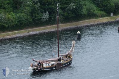
NAJADE
Sailing

Current Trip
NO-IDEA
| Time Travelled | 15 h, 29 mins |
|---|---|
| Remaining Time | --- |
| Distance Travelled | 4.56 nm |
| Remaining Distance | --- |
| AVG Speed | 4.4 Knots |
| MAX Speed | 4.6 Knots |
| AVG Wind | 11 knots |
| MAX Wind | 16 knots |
| MIN Temp | 11.1°C / 51.98°F |
| MAX Temp | 13.1°C / 55.58°F |
| Draught | 1.2 m |
| Position Received | 8 m ago |
Current Position
| Longitude | --- |
|---|---|
| Latitude | --- |
| Status | At anchor |
| Speed | |
| Course | --- |
| Area | North Sea |
| Station | T-AIS |
| Position Received | 8 m ago |
Information
The current position of NAJADE is in North Sea with coordinates 53.44443° / 6.18635° as reported on 2025-04-13 01:31 by AIS to our vessel tracker app. The vessel's current speed is 0 Knots
The vessel NAJADE (MMSI: 245925000) is a Sailing It's sailing under the flag of [NL] Netherlands.
In this page you can find informations about the vessels current position, last detected port calls, and current voyage information. If the vessels is not in coverage by AIS you will find the latest position.
The current position of NAJADE is detected by our AIS receivers and we are not responsible for the reliability of the data. The last position was recorded while the vessel was in Coverage by the Ais receivers of our vessel tracking app.
The current draught of NAJADE as reported by AIS is 1.2 meters
Weather
| Temperature | 10.8°C / 51.44°F |
|---|---|
| Wind Speed | 14 knots |
| Direction | 149° SSE |
| Pressure | 999.9 hPa |
| Humidity | 79.9 % |
| Cloud Coverage | 37 % |


Featured Company
Last Port Calls
| Port | Arrival | Departure | Time In Port |
|---|---|---|---|
| 2025-04-12 11:29 | 2025-04-12 12:10 | 41 m | |
| 2025-03-17 17:28 | 2025-04-11 20:34 | 25 d | |
| 2025-03-15 11:29 |
Most Visited Ports (Last year)
| Port | Arrivals | |
|---|---|---|
| 35 | ||
| 27 | ||
| 11 | ||
| 9 | ||
| 9 | ||
| 7 |
Last Trips
| Origin | Departure | Destination | Arrival | Distance | |
|---|---|---|---|---|---|
| 2025-04-11 20:34 | 2025-04-12 11:29 | 8.02 nm | |||
| 2025-03-15 11:29 | 2025-03-17 17:28 | 30.90 nm |
Events
| Time | Event | Details | Position / Dest | Info |
|---|---|---|---|---|
| 2025-04-12 19:36 | Status Changed | At anchor Under way sailing |
53.44432 / 6.18688
NO-IDEA
|
Speed: Course: 511° |
| 2025-04-12 18:12 | IN Coverage |
53.44252 / 6.18973
North Sea
|
Speed: Course: 511° |
|
| 2025-04-12 11:37 | OUT of Coverage |
53.43888 / 6.15364
North Sea
|
Speed: 1.6 kn Course: 21° |
|
| 2025-04-12 10:10 | PORT DEPARTURE |
|
53.41390 / 6.20047
NO-IDEA
|
Speed: 2 kn Course: 511° |
| 2025-04-12 10:03 | START Moving |
53.40949 / 6.19938
[NL] LAUWERSOOG
|
Speed: 3.4 kn Course: 339° |
|
| 2025-04-12 09:29 | STOP Moving |
53.40821 / 6.20420
[NL] LAUWERSOOG
|
Speed: Course: 511° |
|
| 2025-04-12 09:29 | PORT ARRIVAL |
|
53.40821 / 6.20420
[NL] LAUWERSOOG
|
Speed: 2.4 kn Course: 511° |
| 2025-04-12 08:26 | START Moving | 0.78 nm, South East of OOSTMAHORN |
53.36843 / 6.17911
NO-IDEA
|
Speed: 3.1 kn Course: 351° |
| 2025-04-12 07:09 | Status Changed | Under way sailing Under way using engine |
53.34625 / 6.22908
NO-IDEA
|
Speed: 0.4 kn Course: 511° |
| 2025-04-11 19:27 | STOP Moving | 2.4 nm, West of ZOUTKAMP |
53.34326 / 6.23271
NO-IDEA
|
Speed: 0.3 kn Course: 511° |