

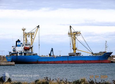
NAFKRATIS
General Cargo

Current Trip
| Trip Time | 16 h, 0 mins |
|---|---|
| Trip Distance | 127.91 nm |
| AVG Speed | 6.5 Knots |
| MAX Speed | 11.3 Knots |
| Draught | 4.5 m |
| AVG Wind | 22.1 knots |
| MAX Wind | 26.8 knots |
| MIN Temp | -9.1°C / 15.62°F |
| MAX Temp | 5.1°C / 41.18°F |
| Position Received | 1 d ago |
Current Position
| Longitude | --- |
|---|---|
| Latitude | --- |
| Status | Under way using engine |
| Speed | 5.8 Knots |
| Course | 327.8° |
| Area | Black Sea |
| Station | T-AIS |
| Position Received | 1 d ago |
Information
The current position of NAFKRATIS is in Black Sea with coordinates 41.49644° / 29.13675° as reported on 2025-02-19 15:21 by AIS to our vessel tracker app. The vessel's current speed is 5.8 Knots and is currently inside the port of BURGAS.
The vessel NAFKRATIS (IMO: 9235945, MMSI: 314768000) is a General Cargo that was built in 2000 ( 25 years old ). It's sailing under the flag of [BB] Barbados.
In this page you can find informations about the vessels current position, last detected port calls, and current voyage information. If the vessels is not in coverage by AIS you will find the latest position.
The current position of NAFKRATIS is detected by our AIS receivers and we are not responsible for the reliability of the data. The last position was recorded while the vessel was in Coverage by the Ais receivers of our vessel tracking app.
The current draught of NAFKRATIS as reported by AIS is 4.5 meters
Weather
| Temperature | -6.3°C / 20.66°F |
|---|---|
| Wind Speed | 6 knots |
| Direction | 349° N |
| Pressure | 1037.2 hPa |
| Humidity | 81.8 % |
| Cloud Coverage | 5 % |


Featured Company
Last Port Calls
| Port | Arrival | Departure | Time In Port |
|---|---|---|---|
| 2025-02-20 04:09 | |||
| 2025-02-19 10:22 | 2025-02-19 12:09 | 1 h | |
| 2025-02-17 03:28 | 2025-02-17 03:31 | 3 m | |
| 2025-02-10 07:54 | 2025-02-12 14:15 | 2 d | |
| 2025-01-29 04:24 | 2025-02-08 05:56 | 10 d | |
| 2025-01-21 13:53 | 2025-01-25 06:33 | 3 d | |
| 2025-01-14 13:24 | 2025-01-18 10:17 | 3 d | |
| 2025-01-06 07:14 | 2025-01-09 12:57 | 3 d | |
| 2024-12-18 16:54 | 2024-12-23 17:28 | 5 d | |
| 2024-12-10 12:03 | 2024-12-14 05:53 | 3 d |
Last Trips
| Origin | Departure | Destination | Arrival | Distance | |
|---|---|---|---|---|---|
| 2025-02-19 15:09 | 2025-02-20 06:09 | 127.91 nm | |||
| 2025-02-17 06:31 | 2025-02-19 13:22 | 188.78 nm | |||
| 2025-02-12 17:15 | 2025-02-17 06:28 | 113.91 nm | |||
| 2025-02-08 07:56 | 2025-02-10 10:54 | 211.39 nm | |||
| 2025-01-25 07:33 | 2025-01-29 06:24 | 980.66 nm | |||
| 2025-01-18 12:17 | 2025-01-21 14:53 | 835.21 nm | |||
| 2025-01-09 14:57 | 2025-01-14 15:24 | 406.08 nm | |||
| 2024-12-23 19:28 | 2025-01-06 09:14 | 1147.21 nm | |||
| 2024-12-14 07:53 | 2024-12-18 18:54 | 795.32 nm | |||
| 2024-12-06 16:24 | 2024-12-10 14:03 | 770.40 nm |
Events
| Time | Event | Details | Position / Dest | Info |
|---|---|---|---|---|
| 2025-02-20 05:01 | STOP Moving |
42.48632 / 27.45420
[BG] BURGAS
|
Speed: Course: 37° |
|
| 2025-02-20 04:09 | PORT ARRIVAL |
|
42.47711 / 27.50565
[BG] BURGAS
|
Speed: 5.2 kn Course: 260° |
| 2025-02-19 15:24 | Status Changed | Default Under way using engine |
41.50095 / 29.13164
ISTANBUL
|
Speed: 5.8 kn Course: 327.8° |
| 2025-02-19 15:21 | OUT of Coverage |
41.49644 / 29.13675
Black Sea
ISTANBUL
|
Speed: 5.8 kn Course: 327.8° |
|
| 2025-02-19 14:40 | Status Changed | Under way using engine Default |
41.45482 / 29.15647
ISTANBUL
|
Speed: 5.9 kn Course: 359° |
| 2025-02-19 14:31 | Status Changed | Default Under way using engine |
41.44110 / 29.15681
ISTANBUL
|
Speed: 5.8 kn Course: 341.7° |
| 2025-02-19 13:47 | Status Changed | Under way using engine Default |
41.36889 / 29.17472
ISTANBUL
|
Speed: 5.1 kn Course: 338° |
| 2025-02-19 13:39 | Status Changed | Default Under way using engine |
41.35577 / 29.17883
ISTANBUL
|
Speed: 5.6 kn Course: 342.1° |
| 2025-02-19 12:29 | Change Sea Area | Turkish part of the Black Sea Turkish part of the Sea of Marmara |
41.23410 / 29.14611
Black Sea
ISTANBUL
|
Speed: 7.6 kn Course: 31° |
| 2025-02-19 12:09 | PORT DEPARTURE |
|
41.20401 / 29.11662
ISTANBUL
|
Speed: 7.7 kn Course: 40° |